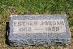
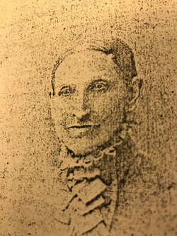
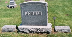
Hester Keister Jordan
| Birth | : | 1812 Pendleton County, West Virginia, USA |
| Death | : | 1898 Scranton, Greene County, Iowa, USA |
| Burial | : | Corner Cemetery, Bridgewater, Aroostook County, USA |
| Coordinate | : | 46.4558990, -67.8530960 |
| Plot | : | Lot 104 |
| Description | : | Hester Keister daughter of George William Keister and Susannah Peck was born 1810 in Pendleton County. She Married Jeremiah Jordan on Oct 31, 1840. She is buried in Kendrick Twp. Cemetery, (also known as the Dillavou Cemetery), near Scranton in Greene County, Iowa. ∼Esther (Hester) Keister Jordan married Jeremiah W. Jordan on October 31, 1840 in Pendleton County, West Virginia (Virginia at the time). She was the daughter of George William Keister and Gusannah Peck. Children were: Sarah Elizabeth, Martin Van Buren, William Keister and Victoria. |
frequently asked questions (FAQ):
-
Where is Hester Keister Jordan's memorial?
Hester Keister Jordan's memorial is located at: Corner Cemetery, Bridgewater, Aroostook County, USA.
-
When did Hester Keister Jordan death?
Hester Keister Jordan death on 1898 in Scranton, Greene County, Iowa, USA
-
Where are the coordinates of the Hester Keister Jordan's memorial?
Latitude: 46.4558990
Longitude: -67.8530960
Family Members:
Parent
Siblings
Children
Flowers:
Nearby Cemetories:
1. Corner Cemetery
Bridgewater, Aroostook County, USA
Coordinate: 46.4558990, -67.8530960
2. Bridgewater Mennonite Church Cemetery
Bridgewater, Aroostook County, USA
Coordinate: 46.4512841, -67.8446239
3. Sanborn Cemetery
Blaine, Aroostook County, USA
Coordinate: 46.4797600, -67.8532000
4. Boundary Cemetery
Bridgewater, Aroostook County, USA
Coordinate: 46.4508171, -67.7971878
5. Tapley Cemetery
Blaine, Aroostook County, USA
Coordinate: 46.4944920, -67.8681870
6. Smith Cemetery
Bridgewater, Aroostook County, USA
Coordinate: 46.4118800, -67.8420870
7. East Blaine Cemetery
Blaine, Aroostook County, USA
Coordinate: 46.4953800, -67.8143500
8. Royalton Cemetery
Wicklow, Carleton County, Canada
Coordinate: 46.4820030, -67.7707210
9. Snow Cemetery
Mars Hill, Aroostook County, USA
Coordinate: 46.5172480, -67.8843660
10. Tracey Mills United Baptist Cemetery
Tracey Mills, Carleton County, Canada
Coordinate: 46.4406586, -67.7464600
11. Kings Grove Cemetery
Mars Hill, Aroostook County, USA
Coordinate: 46.5325012, -67.8557968
12. Lower Knoxford Cemetery
Knoxford, Carleton County, Canada
Coordinate: 46.4906400, -67.7368900
13. Upper Knoxford Cemetery
Upper Knoxford, Carleton County, Canada
Coordinate: 46.5205700, -67.7492700
14. St. Paul's United Church Cemetery
Centreville, Carleton County, Canada
Coordinate: 46.4331605, -67.7121574
15. St. James Anglican Church Cemetery
Centreville, Carleton County, Canada
Coordinate: 46.4331400, -67.7119700
16. United Baptist Church Cemetery
Centreville, Carleton County, Canada
Coordinate: 46.4323100, -67.7075500
17. Good Corner Cemetery
Good Corner, Carleton County, Canada
Coordinate: 46.3864400, -67.7408800
18. Pierce Cemetery
Mars Hill, Aroostook County, USA
Coordinate: 46.5602989, -67.8692017
19. Carvell Cemetery
Carvell, Carleton County, Canada
Coordinate: 46.3613000, -67.7698700
20. Jewell Cemetery
Monticello, Aroostook County, USA
Coordinate: 46.3422280, -67.8425290
21. Greenfield Anglican Cemetery
Greenfield, Carleton County, Canada
Coordinate: 46.4900710, -67.6862390
22. Summerfield Cemetery
Wicklow, Carleton County, Canada
Coordinate: 46.5249990, -67.7083540
23. Marshall Cemetery
Westfield, Aroostook County, USA
Coordinate: 46.5635986, -67.9464035
24. Pioneer Methodist Cemetery
Carleton County, Canada
Coordinate: 46.3815804, -67.6998596


