
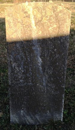
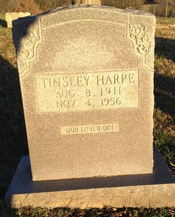
Hillary Tilmon “Tilly” Harpe
| Birth | : | 16 Sep 1851 Overton County, Tennessee, USA |
| Death | : | 16 Dec 1923 Clay County, Tennessee, USA |
| Burial | : | McColgan Cemetery, Clay County, USA |
| Coordinate | : | 36.5163994, -85.5560989 |
| Description | : | Tilly Harpe, in addition to farming fulltime, also captained logging river "boats". The timber industry was been a major business in the Clay County area since before 1800. Tilly and his sons frequently moved logs from Clay county to Nashville along the Cumberland river. Early life in Jackson/Overton/Clay Counties was based on farming and river transport via the Cumberland River. For many years, before modern day roads, the Cumberland River was the major form of transport in the Upper Cumberland's, making the ports of Butlers Landing, Bennett Ferry and Celina major distribution hubs. Tilly Harpe's farm was near Butler's Landing in... Read More |
frequently asked questions (FAQ):
-
Where is Hillary Tilmon “Tilly” Harpe's memorial?
Hillary Tilmon “Tilly” Harpe's memorial is located at: McColgan Cemetery, Clay County, USA.
-
When did Hillary Tilmon “Tilly” Harpe death?
Hillary Tilmon “Tilly” Harpe death on 16 Dec 1923 in Clay County, Tennessee, USA
-
Where are the coordinates of the Hillary Tilmon “Tilly” Harpe's memorial?
Latitude: 36.5163994
Longitude: -85.5560989
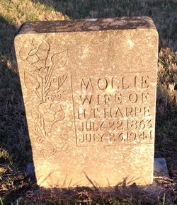
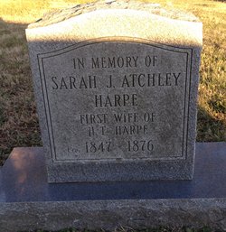
Family Members:
Parent
Spouse
Siblings
Children
Flowers:


Nearby Cemetories:
1. McColgan Cemetery
Clay County, USA
Coordinate: 36.5163994, -85.5560989
2. Lester Brown Family Cemetery
Arcott, Clay County, USA
Coordinate: 36.5205700, -85.5547530
3. Mabry Cemetery
Clay County, USA
Coordinate: 36.5139008, -85.5464020
4. Archibald Plumlee Cemetery
Pine Hill, Clay County, USA
Coordinate: 36.5203018, -85.5682983
5. Roberts Cemetery
Celina, Clay County, USA
Coordinate: 36.5066986, -85.5727997
6. Hamilton Cemetery
Clay County, USA
Coordinate: 36.5181007, -85.5338974
7. Kirk Cemetery
Clay County, USA
Coordinate: 36.4960670, -85.5661650
8. Butlers Landing Cemetery
Celina, Clay County, USA
Coordinate: 36.4941300, -85.5600410
9. Doc Hall Cemetery
Clay County, USA
Coordinate: 36.4995390, -85.5369270
10. Hall Cemetery
Clay County, USA
Coordinate: 36.4994011, -85.5366974
11. John Hamilton Cemetery
Butlers Landing, Clay County, USA
Coordinate: 36.4916010, -85.5489080
12. Dalton Cemetery
Arcott, Clay County, USA
Coordinate: 36.5429540, -85.5546170
13. Emberton Cemetery
Celina, Clay County, USA
Coordinate: 36.4862150, -85.5237040
14. John Fowler Cemetery
Butlers Landing, Clay County, USA
Coordinate: 36.4910900, -85.5972590
15. McDonald Cemetery
Baptist Ridge, Clay County, USA
Coordinate: 36.4855995, -85.5119019
16. High Cedar Cemetery
Clay County, USA
Coordinate: 36.4827710, -85.5974970
17. M R Cemetery
Baptist Ridge, Clay County, USA
Coordinate: 36.4769100, -85.5196770
18. Rich-Lynn Family Cemetery
Butlers Landing, Clay County, USA
Coordinate: 36.4794140, -85.5987380
19. Amos Kirkpatrick-Tinsley Cemetery
Jackson County, USA
Coordinate: 36.4715080, -85.5867230
20. Varney Andrews Cemetery
Celina, Clay County, USA
Coordinate: 36.5604650, -85.5209530
21. Green Cemetery
Celina, Clay County, USA
Coordinate: 36.5496418, -85.5024450
22. Plumlee Cemetery
Celina, Clay County, USA
Coordinate: 36.5694280, -85.5282830
23. Goolsby Cemetery
Clay County, USA
Coordinate: 36.4603640, -85.5368040
24. Walker Reecer Cemetery
Celina, Clay County, USA
Coordinate: 36.5746290, -85.5480270