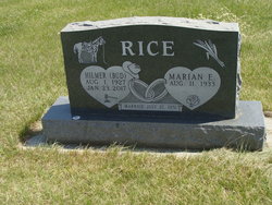
Hilmer Theodore “Bud” Rice
| Birth | : | 1 Aug 1927 North Dakota, USA |
| Death | : | 23 Jan 2017 Stanley, Mountrail County, North Dakota, USA |
| Burial | : | Norman Lutheran Cemetery, White Earth, Mountrail County, USA |
| Coordinate | : | 48.4879417, -102.8506165 |
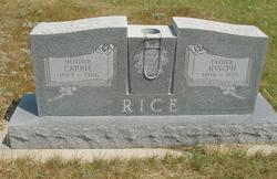
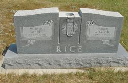
| Description | : | Hilmer “Bud” T. Rice August 1, 1927 – January 23, 2017 Hilmer “Bud” Theodore Rice, 89, passed away peacefully on January 23rd, 2017 at the Mountrail County Bethel Home in Stanley, ND. He was born August 1st, 1927 to Joseph & Carrie (Gramstad) Rice on his grandmother’s homestead northeast of Tioga. When Bud was one year old, his family moved to another farmstead three miles away where he spent the remainder of his childhood. Bud attended Loomis School for his first four years of grade school. He then attended Hulberg School where he would drive a horse and buggy to... Read More |
frequently asked questions (FAQ):
-
Where is Hilmer Theodore “Bud” Rice's memorial?
Hilmer Theodore “Bud” Rice's memorial is located at: Norman Lutheran Cemetery, White Earth, Mountrail County, USA.
-
When did Hilmer Theodore “Bud” Rice death?
Hilmer Theodore “Bud” Rice death on 23 Jan 2017 in Stanley, Mountrail County, North Dakota, USA
-
Where are the coordinates of the Hilmer Theodore “Bud” Rice's memorial?
Latitude: 48.4879417
Longitude: -102.8506165
Family Members:
Parent
Spouse
Siblings
Flowers:
Nearby Cemetories:
1. Norman Lutheran Cemetery
White Earth, Mountrail County, USA
Coordinate: 48.4879417, -102.8506165
2. Beauty Valley Cemetery
Mountrail County, USA
Coordinate: 48.5024986, -102.8488998
3. Lindahl Lutheran Cemetery
McGregor, Williams County, USA
Coordinate: 48.5226550, -102.9286890
4. Bakken Cemetery
Tioga, Williams County, USA
Coordinate: 48.4160995, -102.9216995
5. Bethel Cemetery
Battleview, Burke County, USA
Coordinate: 48.5746994, -102.7797012
6. Eastside Cemetery
Tioga, Williams County, USA
Coordinate: 48.3939018, -102.9235992
7. Saint Olaf Cemetery
Temple, Williams County, USA
Coordinate: 48.5069008, -103.0160980
8. Zion Lutheran Cemetery
Tioga, Williams County, USA
Coordinate: 48.3911018, -102.9411011
9. United Cemetery
Tioga, Williams County, USA
Coordinate: 48.3885994, -102.9396973
10. Minton Cemetery
Williams County, USA
Coordinate: 48.3867760, -102.9412060
11. Saint Francis Catholic Cemetery
White Earth, Mountrail County, USA
Coordinate: 48.3724213, -102.7795181
12. White Earth Cemetery
White Earth, Mountrail County, USA
Coordinate: 48.3718987, -102.7639008
13. Sharon Cemetery
McGregor, Williams County, USA
Coordinate: 48.6039009, -102.9400024
14. Bethel Cemetery
Lunds Valley, Mountrail County, USA
Coordinate: 48.5458512, -102.6671137
15. Bethel Cemetery
Powers Lake, Burke County, USA
Coordinate: 48.5466995, -102.6675034
16. Saint Marys Cemetery
McGregor, Williams County, USA
Coordinate: 48.6178017, -102.9282990
17. Zion Lutheran Cemetery
McGregor, Williams County, USA
Coordinate: 48.6185989, -102.9285965
18. Old Bethel Cemetery
Burke County, USA
Coordinate: 48.6310997, -102.8007965
19. Grong Cemetery
Hamlet, Williams County, USA
Coordinate: 48.5966700, -103.0164400
20. Temple Cemetery
Temple, Williams County, USA
Coordinate: 48.3871994, -103.0475006
21. Scandia Cemetery
Battleview, Burke County, USA
Coordinate: 48.6618580, -102.8655650
22. Saint James Cemetery
Powers Lake, Burke County, USA
Coordinate: 48.5821991, -102.6241989
23. Bethel Lutheran Cemetery
Mountrail County, USA
Coordinate: 48.5458760, -102.5811050
24. Stordahl Cemetery
Hamlet, Williams County, USA
Coordinate: 48.5614014, -103.1231003

