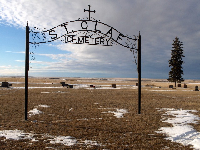
| Memorials | : | 6 |
| Location | : | Temple, Williams County, USA |
| Coordinate | : | 48.5069008, -103.0160980 |
| Description | : | Township 158 - Range 96 - Section 13 of South Meadow Township Located 8 miles North and 2 miles East of Temple, North Dakota In 1916 Olaf Samdahl gave 2 acres of land for a church and cemetery. |
frequently asked questions (FAQ):
-
Where is Saint Olaf Cemetery?
Saint Olaf Cemetery is located at Temple, Williams County ,North Dakota , 58852USA.
-
Saint Olaf Cemetery cemetery's updated grave count on graveviews.com?
6 memorials
-
Where are the coordinates of the Saint Olaf Cemetery?
Latitude: 48.5069008
Longitude: -103.0160980
Nearby Cemetories:
1. Lindahl Lutheran Cemetery
McGregor, Williams County, USA
Coordinate: 48.5226550, -102.9286890
2. Stordahl Cemetery
Hamlet, Williams County, USA
Coordinate: 48.5614014, -103.1231003
3. Grong Cemetery
Hamlet, Williams County, USA
Coordinate: 48.5966700, -103.0164400
4. Sharon Cemetery
McGregor, Williams County, USA
Coordinate: 48.6039009, -102.9400024
5. Bakken Cemetery
Tioga, Williams County, USA
Coordinate: 48.4160995, -102.9216995
6. Beauty Valley Cemetery
Mountrail County, USA
Coordinate: 48.5024986, -102.8488998
7. Norman Lutheran Cemetery
White Earth, Mountrail County, USA
Coordinate: 48.4879417, -102.8506165
8. Saint Paul Lutheran Cemetery
Wildrose, Williams County, USA
Coordinate: 48.5321999, -103.1857986
9. Temple Cemetery
Temple, Williams County, USA
Coordinate: 48.3871994, -103.0475006
10. Saint Marys Cemetery
McGregor, Williams County, USA
Coordinate: 48.6178017, -102.9282990
11. Zion Lutheran Cemetery
McGregor, Williams County, USA
Coordinate: 48.6185989, -102.9285965
12. Zion Lutheran Cemetery
Tioga, Williams County, USA
Coordinate: 48.3911018, -102.9411011
13. Eastside Cemetery
Tioga, Williams County, USA
Coordinate: 48.3939018, -102.9235992
14. United Cemetery
Tioga, Williams County, USA
Coordinate: 48.3885994, -102.9396973
15. Minton Cemetery
Williams County, USA
Coordinate: 48.3867760, -102.9412060
16. Trinity Cemetery
Hayland Township, Divide County, USA
Coordinate: 48.6399994, -103.0582962
17. Rainbow Valley Lutheran Cemetery
Wildrose, Williams County, USA
Coordinate: 48.4802361, -103.2330551
18. Bethel Cemetery
Wildrose, Williams County, USA
Coordinate: 48.5682983, -103.2324982
19. Bethel Cemetery
Battleview, Burke County, USA
Coordinate: 48.5746994, -102.7797012
20. Grace Cemetery
Wildrose, Williams County, USA
Coordinate: 48.6327500, -103.1927100
21. Emmanual Lutheran German Cemetery
Ray, Williams County, USA
Coordinate: 48.3278008, -103.0580978
22. Scandia Cemetery
Battleview, Burke County, USA
Coordinate: 48.6618580, -102.8655650
23. Old Bethel Cemetery
Burke County, USA
Coordinate: 48.6310997, -102.8007965
24. Saint Michaels Cemetery
Ray, Williams County, USA
Coordinate: 48.3483009, -103.1781006

