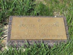
Holger Johnson
| Birth | : | 30 Dec 1892 Beresford, Union County, South Dakota, USA |
| Death | : | 17 May 1972 Sioux Falls, Minnehaha County, South Dakota, USA |
| Burial | : | Sankta Birgittas griftegård, Borås, Borås kommun, Sweden |
| Coordinate | : | 57.7142538, 12.9332699 |
| Inscription | : | "South Dakota Pvt US Army World War I" |
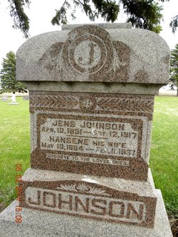
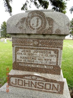
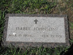
| Description | : | Holger was a veteran of World War I. In 1920, he married Isabel Latendresse. They farmed near the communities of Beresford, SD and Hartford, SD before moving to Sioux Falls, SD in 1947. Holger was survived by his wife; a son; four grandchildren; one great-grandchild; and a brother, Dewey of Beresford, SD. According to his obituary, Holger was originally buried at the Hartford Cemetery before his burial at St. John Cemetery near Beresford, SD. Note: Parental link information was obtained from Amie Dwelle. |
frequently asked questions (FAQ):
-
Where is Holger Johnson's memorial?
Holger Johnson's memorial is located at: Sankta Birgittas griftegård, Borås, Borås kommun, Sweden.
-
When did Holger Johnson death?
Holger Johnson death on 17 May 1972 in Sioux Falls, Minnehaha County, South Dakota, USA
-
Where are the coordinates of the Holger Johnson's memorial?
Latitude: 57.7142538
Longitude: 12.9332699
Family Members:
Parent
Spouse
Siblings
Children
Flowers:
Nearby Cemetories:
1. Sankta Birgittas griftegård
Borås, Borås kommun, Sweden
Coordinate: 57.7142538, 12.9332699
2. Sankt Ansgars griftegård
Borås, Borås kommun, Sweden
Coordinate: 57.7182057, 12.9351487
3. Caroli kyrkogård
Borås kommun, Sweden
Coordinate: 57.7219569, 12.9391612
4. Sankt Sigfrids griftegård
Borås, Borås kommun, Sweden
Coordinate: 57.7049706, 12.9184835
5. Brämhults kyrkogård
Borås, Borås kommun, Sweden
Coordinate: 57.7356940, 13.0276110
6. Sandhults kyrkogård
Borås, Borås kommun, Sweden
Coordinate: 57.7696917, 12.8221206
7. Toarp nya kyrkogård
Dalsjofors, Borås kommun, Sweden
Coordinate: 57.7360900, 13.1036900
8. Toarp Church Cemetery
Dalsjofors, Borås kommun, Sweden
Coordinate: 57.7377500, 13.1068330
9. Fristad Church Cemetery
Borås, Borås kommun, Sweden
Coordinate: 57.8181000, 13.0091000
10. Ljushults Kyrkogård
Borås, Borås kommun, Sweden
Coordinate: 57.6174795, 13.0432013
11. Rångedala kyrkogård
Rangedala, Borås kommun, Sweden
Coordinate: 57.7904470, 13.1219796
12. Äspered kyrkogård
Aspered, Borås kommun, Sweden
Coordinate: 57.7551211, 13.1835097
13. Vänga Kyrkogården
Fristad, Borås kommun, Sweden
Coordinate: 57.8588920, 12.9315350
14. Dannike kyrkogård
Dannike, Borås kommun, Sweden
Coordinate: 57.6833902, 13.2280893
15. Fritsla gamla kyrkogård
Fritsla, Marks kommun, Sweden
Coordinate: 57.5574232, 12.7928255
16. Skephult kyrkogård
Skepphult, Marks kommun, Sweden
Coordinate: 57.5361110, 12.8811110
17. Tvärred kyrkogård
Ulricehamn, Ulricehamns kommun, Sweden
Coordinate: 57.7258320, 13.3139710
18. Bollebygd Cemetery
Bollebygd, Bollebygds kommun, Sweden
Coordinate: 57.6666679, 12.5500002
19. Finnekumla kyrkogård
Finnekumla, Borås kommun, Sweden
Coordinate: 57.6562600, 13.3456100
20. Svenska Kyrkan
Svenljunga, Svenljunga kommun, Sweden
Coordinate: 57.4951300, 13.1159100
21. Orby Kyrkogard
Örby, Marks kommun, Sweden
Coordinate: 57.4818140, 12.7005510
22. Ornunga gamla kyrkogård
Ornunga, Vårgårda kommun, Sweden
Coordinate: 57.9795830, 12.9132220
23. Od Church Cemetery
Od, Herrljunga kommun, Sweden
Coordinate: 57.9432060, 13.1874130
24. Kapellkyrkogården Ulricehamn
Ulricehamn, Ulricehamns kommun, Sweden
Coordinate: 57.8045724, 13.4054033

