| Birth | : | 6 Mar 1827 Johnson County, Kentucky, USA |
| Death | : | 13 Dec 1910 Prescott, Adams County, Iowa, USA |
| Burial | : | Mickle Memorial Cemetery, Gravenhurst, Muskoka District Municipality, Canada |
| Coordinate | : | 44.9300353, -79.3749970 |
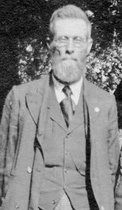
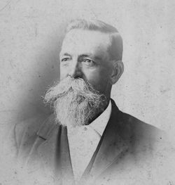
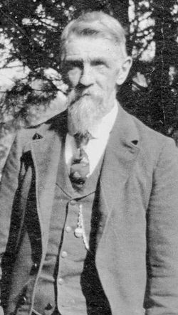
| Description | : | On the 13th day of December, 1910, Hon Edmund Burson Homan, an aged pioneer settle of Adams County, passed peacefully and calmly from this life to the Christian haven of eternal rest, prepared for the upright in this life. He was born in Kentucky on the 6th day of March 1827, and at the time of his death was 88 years, 9 months, and 7 days old. In the same year of his birth he was carried by his parents to a farm in Putnam County, Indiana. He was the son of March and Nancy Homan. His mother Nancy Homan... Read More |
frequently asked questions (FAQ):
-
Where is Hon Edmund Burson Homan's memorial?
Hon Edmund Burson Homan's memorial is located at: Mickle Memorial Cemetery, Gravenhurst, Muskoka District Municipality, Canada.
-
When did Hon Edmund Burson Homan death?
Hon Edmund Burson Homan death on 13 Dec 1910 in Prescott, Adams County, Iowa, USA
-
Where are the coordinates of the Hon Edmund Burson Homan's memorial?
Latitude: 44.9300353
Longitude: -79.3749970
Family Members:
Parent
Spouse
Siblings
Children
Flowers:
Nearby Cemetories:
1. Mickle Memorial Cemetery
Gravenhurst, Muskoka District Municipality, Canada
Coordinate: 44.9300353, -79.3749970
2. Lakeview Cemetery
Gravenhurst, Muskoka District Municipality, Canada
Coordinate: 44.9269700, -79.3793500
3. St. James Anglican Church & Cemetery
Gravenhurst, Muskoka District Municipality, Canada
Coordinate: 44.9124710, -79.3707220
4. North Reay Cemetery
Muskoka Falls, Muskoka District Municipality, Canada
Coordinate: 44.9812830, -79.3133120
5. Pioneer Lutheran Cemetery
Gravenhurst, Muskoka District Municipality, Canada
Coordinate: 44.8518360, -79.3844670
6. Free Methodist Church Cemetery
Gravenhurst, Muskoka District Municipality, Canada
Coordinate: 44.8832400, -79.4648200
7. Muskoka Falls Cemetery
Muskoka Falls, Muskoka District Municipality, Canada
Coordinate: 44.9966700, -79.3047200
8. Pioneer Lutheran Cemetery
Kilworthy, Muskoka District Municipality, Canada
Coordinate: 44.8429380, -79.3546770
9. Church of Our Lady Anglican Cemetery
Gravenhurst, Muskoka District Municipality, Canada
Coordinate: 44.9080550, -79.5013880
10. Symington Cemetery
Severn Bridge, Muskoka District Municipality, Canada
Coordinate: 44.8451900, -79.3178600
11. Annie Williams Memorial Cemetery
Bracebridge, Muskoka District Municipality, Canada
Coordinate: 45.0308780, -79.3215520
12. Bracebridge United Cemetery
Bracebridge, Muskoka District Municipality, Canada
Coordinate: 45.0307700, -79.3195500
13. Germania Lutheran Church and Cemetery
Germania, Muskoka District Municipality, Canada
Coordinate: 44.9553300, -79.2202400
14. Torrance Union Cemetery
Torrance, Muskoka District Municipality, Canada
Coordinate: 44.9501100, -79.5496400
15. Bethel Cemetery
Kilworthy, Muskoka District Municipality, Canada
Coordinate: 44.8082700, -79.3262200
16. Saint Thomas Cemetery
Bracebridge, Muskoka District Municipality, Canada
Coordinate: 45.0535300, -79.3260300
17. Society of St. John the Evangelist Cemetery
Bracebridge, Muskoka District Municipality, Canada
Coordinate: 45.0495350, -79.3044500
18. Ziska Cemetery
Ziska, Muskoka District Municipality, Canada
Coordinate: 45.0599000, -79.3812500
19. Saint Joseph's Roman Catholic Cemetery
Bracebridge, Muskoka District Municipality, Canada
Coordinate: 45.0607900, -79.3325300
20. Bracebridge Municipal Cemetery
Bracebridge, Muskoka District Municipality, Canada
Coordinate: 45.0636400, -79.3334130
21. Matthiasville Cemetery
Matthiasville, Muskoka District Municipality, Canada
Coordinate: 44.9933800, -79.1998200
22. Saint Paul's Anglican Churchyard Cemetery
Uffington, Muskoka District Municipality, Canada
Coordinate: 44.9830440, -79.1857840
23. Nicholson Cemetery
Bracebridge, Muskoka District Municipality, Canada
Coordinate: 45.0577420, -79.2808090
24. Barkway Cemetery
Barkway, Muskoka District Municipality, Canada
Coordinate: 44.8996000, -79.1754000


