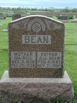
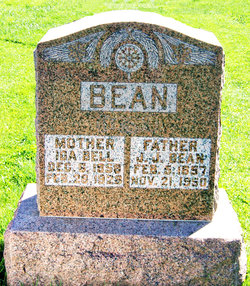
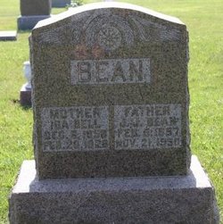
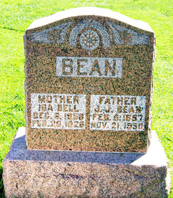
Ida Belle Willett Bean
| Birth | : | 6 Dec 1858 Hillsboro, Highland County, Ohio, USA |
| Death | : | 28 Feb 1928 Des Moines, Polk County, Iowa, USA |
| Burial | : | Red Lake Cemetery, Red Lake, Kenora District, Canada |
| Coordinate | : | 51.0209930, -93.8000000 |
| Description | : | BEAN, IDA BELL WILLETT] Clarinda Herald (Clarinda, Iowa), Thursday, March 9, 1928, p. 9 Mrs. Julius Bean Ida Bell Willet was born in Hillsboro, Ohio, Highland County, Dec. 6, 1857 and died at her home in Des Moines, Ia. Feb. 27, 1928 age 69 years, 2 months and 22 days. She was married at Nodaway, Iowa, Adams Co., in August 1878 to Julius Bean. They moved to Taylor Co. in 1884, living in that vicinity till 1919, then moving to Des Moines, Ia. To this union were born seven children all of whom are living: Bert of Detroit, Mich.; Myrtle... Read More |
frequently asked questions (FAQ):
-
Where is Ida Belle Willett Bean's memorial?
Ida Belle Willett Bean's memorial is located at: Red Lake Cemetery, Red Lake, Kenora District, Canada.
-
When did Ida Belle Willett Bean death?
Ida Belle Willett Bean death on 28 Feb 1928 in Des Moines, Polk County, Iowa, USA
-
Where are the coordinates of the Ida Belle Willett Bean's memorial?
Latitude: 51.0209930
Longitude: -93.8000000
Family Members:
Parent
Spouse
Children
Flowers:
Nearby Cemetories:
1. Red Lake Cemetery
Red Lake, Kenora District, Canada
Coordinate: 51.0209930, -93.8000000
2. Woodland Cemetery
Balmertown, Kenora District, Canada
Coordinate: 51.0711200, -93.7570900
3. Post Narrows Burying Ground
Red Lake, Kenora District, Canada
Coordinate: 50.9500348, -93.6032140
4. Gold Pines Burying Ground
Ear Falls, Kenora District, Canada
Coordinate: 50.6408620, -93.3123336
5. Ear Falls Municipal Cemetery
Ear Falls, Kenora District, Canada
Coordinate: 50.6151080, -93.1993280
6. McIntosh Cemetery
McIntosh, Kenora District, Canada
Coordinate: 49.9813175, -93.5870514
7. McIntosh First Nation Residential School Cemetery
McIntosh, Kenora District, Canada
Coordinate: 49.9794440, -93.6108330
8. Quibell Cemetery
Quibell, Kenora District, Canada
Coordinate: 49.9594491, -93.4252027
9. Rice Lake Miners Cemetery
Lac du Bonnet, Eastern Manitoba Census Division, Canada
Coordinate: 50.8489080, -95.5382330
10. Vermilion Bay Catholic Cemetery
Vermilion Bay, Kenora District, Canada
Coordinate: 49.8782390, -93.4265730
11. Eagle River Cemetery
Eagle River, Kenora District, Canada
Coordinate: 49.7920670, -93.2036170
12. Minnitaki Cemetery
Minnitaki, Kenora District, Canada
Coordinate: 49.8157393, -93.0846587
13. Lake Of The Woods Cemetery
Kenora, Kenora District, Canada
Coordinate: 49.7764700, -94.4798500
14. Oxdrift Cemetery
Oxdrift, Kenora District, Canada
Coordinate: 49.8148000, -92.9632200
15. Dryden Cemetery
Dryden, Kenora District, Canada
Coordinate: 49.7993900, -92.8460600
16. Bird River Cemetery
Bird River, Eastern Manitoba Census Division, Canada
Coordinate: 50.4039770, -95.7400990
17. Sacred Heart Cemetery
Sioux Lookout, Kenora District, Canada
Coordinate: 50.1029400, -91.9313600
18. Northway Cemetery
Sioux Lookout, Kenora District, Canada
Coordinate: 50.1028800, -91.9289400
19. Wendigo Lettonia Cemetery
Wendigo Beach, Eastern Manitoba Census Division, Canada
Coordinate: 50.3485300, -95.9261600
20. Wabigoon Cemetery
Wabigoon, Kenora District, Canada
Coordinate: 49.7266200, -92.5850100
21. Lee River Cemetery
Lee River, Eastern Manitoba Census Division, Canada
Coordinate: 50.2525500, -95.9204800
22. Notre Dame du Laus Cemetery
Powerview, Eastern Manitoba Census Division, Canada
Coordinate: 50.5817090, -96.1599420
23. Saint Georges Roman Catholic Church Cemetery
Saint-Georges, Eastern Manitoba Census Division, Canada
Coordinate: 50.5387670, -96.1543330
24. St. George's Anglican Cemetery
Dinorwic, Kenora District, Canada
Coordinate: 49.6919800, -92.4943600

