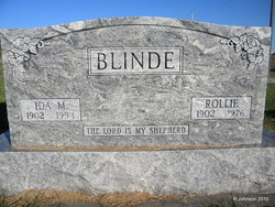
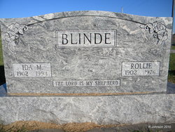
Ida Marie Teten Blinde
| Birth | : | 15 Apr 1902 Auburn, Nemaha County, Nebraska, USA |
| Death | : | 25 Sep 1994 Nebraska, USA |
| Burial | : | Macedonia Baptist Church Cemetery, Falls of Rough, Breckinridge County, USA |
| Coordinate | : | 37.6200000, -86.5803000 |
| Description | : | Daughter of Jacob Matthais Teten and Antje "Anna" Mareke Williams. She was married to Rollie August Frederich Blinde on Feb. 5, 1925, at Council Bluffs, Iowa. They had 2 daughters, Maxine Christina and Yvonne Elnore. Services were at St. Matthew Lutheran Church in Johnson, Nebraska. Interment was in the church cemetery. |
frequently asked questions (FAQ):
-
Where is Ida Marie Teten Blinde's memorial?
Ida Marie Teten Blinde's memorial is located at: Macedonia Baptist Church Cemetery, Falls of Rough, Breckinridge County, USA.
-
When did Ida Marie Teten Blinde death?
Ida Marie Teten Blinde death on 25 Sep 1994 in Nebraska, USA
-
Where are the coordinates of the Ida Marie Teten Blinde's memorial?
Latitude: 37.6200000
Longitude: -86.5803000
Family Members:
Parent
Spouse
Siblings
Children
Flowers:
Nearby Cemetories:
1. Macedonia Baptist Church Cemetery
Falls of Rough, Breckinridge County, USA
Coordinate: 37.6200000, -86.5803000
2. Meador Askins Family Cemetery
Falls of Rough, Breckinridge County, USA
Coordinate: 37.6072960, -86.5935090
3. Clay Cooper Cemetery
Glen Dean, Breckinridge County, USA
Coordinate: 37.6425100, -86.5647130
4. Summers Dean Family Cemetery
Hardinsburg, Breckinridge County, USA
Coordinate: 37.6416054, -86.6086090
5. Howard Cemetery #2
Glen Dean, Breckinridge County, USA
Coordinate: 37.6558580, -86.5866550
6. Goshen Baptist Church Cemetery
Glen Dean, Breckinridge County, USA
Coordinate: 37.6493500, -86.5427800
7. Black Lick Baptist Church Cemetery
Falls of Rough, Breckinridge County, USA
Coordinate: 37.6647600, -86.5876800
8. Robertson Cemetery
Glen Dean, Breckinridge County, USA
Coordinate: 37.6677380, -86.5937930
9. Dunk and Raily Powell Family Cemetery
Glen Dean, Breckinridge County, USA
Coordinate: 37.6519900, -86.5321400
10. Edward Smith Burial Ground
Fordsville, Ohio County, USA
Coordinate: 37.5960930, -86.6431300
11. Eskridge Cemetery
Leitchfield, Grayson County, USA
Coordinate: 37.6153000, -86.5080000
12. Hopewell Cemetery
Fordsville, Ohio County, USA
Coordinate: 37.6545710, -86.6412520
13. Allen Cemetery
Grayson County, USA
Coordinate: 37.5741400, -86.5316300
14. Grant Owen Cemetery
Glen Dean, Breckinridge County, USA
Coordinate: 37.6500360, -86.5142440
15. Lone Star Cemetery
Falls of Rough, Grayson County, USA
Coordinate: 37.5929000, -86.5053000
16. Beatty Cemetery
Hancock County, USA
Coordinate: 37.6739006, -86.6342010
17. James Matthews Graveyard
Ohio County, USA
Coordinate: 37.5700000, -86.6425000
18. Grant Cemetery
Ohio County, USA
Coordinate: 37.5699997, -86.6425018
19. Payton Cemetery
Grayson County, USA
Coordinate: 37.5497017, -86.5599976
20. Smith Cemetery
Grayson County, USA
Coordinate: 37.5477982, -86.5674973
21. Blain Family Cemetery
Short Creek, Grayson County, USA
Coordinate: 37.5731000, -86.5098000
22. Clark Cemetery
Axtel, Breckinridge County, USA
Coordinate: 37.6291880, -86.4867780
23. Sand Knob Cemetery
Axtel, Breckinridge County, USA
Coordinate: 37.6410500, -86.4878000
24. Porter Cemetery
Grayson County, USA
Coordinate: 37.5391998, -86.5761032


