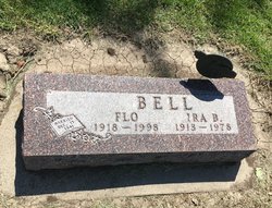
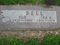
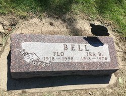
Ira Bozart Bell
| Birth | : | 6 Mar 1913 |
| Death | : | 15 Dec 1978 |
| Burial | : | St Laurence Churchyard, South Hinksey, Vale of White Horse District, England |
| Coordinate | : | 51.7319218, -1.2635270 |
| Plot | : | Buried in original section #206 |
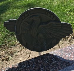
| Description | : | Last Rites HeldFor Ira B. Bell: Ira Bozarth Bell was born to Daisy May Bozarth and Xavier Alcibatus Bell on March 6, 1913 at Civil Bend, Mo., and spent his youth in his parent's home. He was united in marriage to Flo Huntsman on Dec. 13,1941, at Rock Port, Mo. There was born to this union Robert Eugene of Fort Collins, Colo., and Donald Dean of Peoria, Ill. Ira spent three years overseas during World War II as a Sergeantin the 753rd Railroad Shop Battalion,Army of the United States. He attained the skill of Rifle Sharpshooter on Sept. 11,1942. He served... Read More |
frequently asked questions (FAQ):
-
Where is Ira Bozart Bell's memorial?
Ira Bozart Bell's memorial is located at: St Laurence Churchyard, South Hinksey, Vale of White Horse District, England.
-
When did Ira Bozart Bell death?
Ira Bozart Bell death on 15 Dec 1978 in
-
Where are the coordinates of the Ira Bozart Bell's memorial?
Latitude: 51.7319218
Longitude: -1.2635270
Family Members:
Spouse
Flowers:
Nearby Cemetories:
1. St Laurence Churchyard
South Hinksey, Vale of White Horse District, England
Coordinate: 51.7319218, -1.2635270
2. St Matthews Church
Oxford, City of Oxford, England
Coordinate: 51.7442200, -1.2585480
3. St Mary the Virgin Churchyard
Iffley, City of Oxford, England
Coordinate: 51.7273590, -1.2381680
4. Osney Cathedral
Oxford, City of Oxford, England
Coordinate: 51.7497220, -1.2700000
5. St Ebbe Churchyard
Oxford, City of Oxford, England
Coordinate: 51.7504200, -1.2596030
6. Greyfriars
Oxford, City of Oxford, England
Coordinate: 51.7437920, -1.2401460
7. Christ Church Cathedral
Oxford, City of Oxford, England
Coordinate: 51.7500620, -1.2547160
8. Osney Cemetery
Oxford, City of Oxford, England
Coordinate: 51.7505310, -1.2703040
9. St. Lawrence's Churchyard
North Hinksey, Vale of White Horse District, England
Coordinate: 51.7457590, -1.2848020
10. Saint Thomas the Martyr Churchyard
Oxford, City of Oxford, England
Coordinate: 51.7512222, -1.2679445
11. St Martin's Church, Carfax (Defunct)
Oxford, City of Oxford, England
Coordinate: 51.7513500, -1.2581700
12. Corpus Christi College Chapel
Oxford, City of Oxford, England
Coordinate: 51.7507010, -1.2534236
13. Saint Peter le Bailey Churchyard
Oxford, City of Oxford, England
Coordinate: 51.7516980, -1.2600300
14. St Thomas the Martyr
Oxford, City of Oxford, England
Coordinate: 51.7518100, -1.2683430
15. Oxford Castle and Prison Cemetery
Oxford, City of Oxford, England
Coordinate: 51.7521453, -1.2631165
16. Merton College chapel
Oxford, City of Oxford, England
Coordinate: 51.7510500, -1.2526620
17. Oriel College Ante-Chapel
Oxford, City of Oxford, England
Coordinate: 51.7512420, -1.2531940
18. University Church of St Mary the Virgin
Oxford, City of Oxford, England
Coordinate: 51.7523990, -1.2556000
19. All Saints Churchyard
Oxford, City of Oxford, England
Coordinate: 51.7525000, -1.2555560
20. St Frideswide Churchyard
Oxford, City of Oxford, England
Coordinate: 51.7521560, -1.2748350
21. University College Chapel
Oxford, City of Oxford, England
Coordinate: 51.7522100, -1.2521700
22. St. Michael at the North Gate Church
Oxford, City of Oxford, England
Coordinate: 51.7537210, -1.2583950
23. Jesus College Chapel
Oxford, City of Oxford, England
Coordinate: 51.7536130, -1.2566180
24. Exeter College Chapel
Oxford, City of Oxford, England
Coordinate: 51.7539460, -1.2561170

