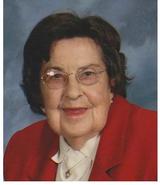
| Birth | : | 30 Sep 1935 Randolph County, North Carolina, USA |
| Death | : | 16 Aug 2005 High Point, Guilford County, North Carolina, USA |
| Burial | : | Estep Cemetery, Ameagle, Raleigh County, USA |
| Coordinate | : | 37.9509660, -81.4222430 |
| Description | : | Husband of Geraldine Andrews Farlow Married May 4,1960 SOPHIA- (V)Isaac Raphael Farlow, 69, passed Aug. 16th at High Point Regional Hospital. Funeral service will be held 5:30 p.m. Aug. 19th at Marlboro Friends Meeting; Pastor John Sides and Dr. Bob Medford officiating. Interment will follow in the meeting house Born Sept. 30, 1935, s/o late Lewis Lee and Blanche Ward Farlow. On May 4, 1960, he married the former Geraldine "Gerry" Andrews who survives of the home. In addition to his parents, he was preceded in death by a brother, Dennis E. Farlow. Also surviving are three sons, Terry... Read More |
frequently asked questions (FAQ):
-
Where is Isaac Raphael “Ray” Farlow's memorial?
Isaac Raphael “Ray” Farlow's memorial is located at: Estep Cemetery, Ameagle, Raleigh County, USA.
-
When did Isaac Raphael “Ray” Farlow death?
Isaac Raphael “Ray” Farlow death on 16 Aug 2005 in High Point, Guilford County, North Carolina, USA
-
Where are the coordinates of the Isaac Raphael “Ray” Farlow's memorial?
Latitude: 37.9509660
Longitude: -81.4222430
Family Members:
Parent
Spouse
Siblings
Flowers:
Nearby Cemetories:
1. Estep Cemetery
Ameagle, Raleigh County, USA
Coordinate: 37.9509660, -81.4222430
2. Union Cemetery
Dorothy, Raleigh County, USA
Coordinate: 37.9549000, -81.4449200
3. Perry Cemetery
Ameagle, Raleigh County, USA
Coordinate: 37.9441670, -81.3990000
4. Hodge Cemetery
Raleigh County, USA
Coordinate: 37.9439011, -81.3989029
5. Hill Cemetery
Dorothy, Raleigh County, USA
Coordinate: 37.9589005, -81.4582977
6. Stanley Cemetery
Dorothy, Raleigh County, USA
Coordinate: 37.9747009, -81.4488983
7. Notomine Cemetery
Cabin Creek, Kanawha County, USA
Coordinate: 37.9840540, -81.4315220
8. Moles Cemetery
Artie, Raleigh County, USA
Coordinate: 37.9297700, -81.3598700
9. Artie Cemetery
Raleigh County, USA
Coordinate: 37.9376500, -81.3554300
10. High Coal Black Cemetery
Garrison, Boone County, USA
Coordinate: 37.9946510, -81.4775900
11. Perry Cemetery
Decota, Kanawha County, USA
Coordinate: 38.0155983, -81.4150009
12. Toney Fork Cemetery
Clear Creek, Raleigh County, USA
Coordinate: 37.9162210, -81.3448290
13. Dunbar Cemetery
Clear Creek, Raleigh County, USA
Coordinate: 37.9067001, -81.3522034
14. Carbon Cemetery
Carbon, Kanawha County, USA
Coordinate: 38.0209520, -81.4037110
15. Workmans Creek Cemetery
Clear Creek, Raleigh County, USA
Coordinate: 37.9002800, -81.3483505
16. Brock Cemetery
Clear Creek, Raleigh County, USA
Coordinate: 37.9002800, -81.3483500
17. Jarrell Cemetery
Raleigh County, USA
Coordinate: 37.8863983, -81.4772034
18. Taylor Cemetery
Clear Creek, Raleigh County, USA
Coordinate: 37.8875008, -81.3644028
19. Jarrell Cemetery
Raleigh County, USA
Coordinate: 37.8697014, -81.4364014
20. Perry Jarrell Family Cemetery
Dry Creek, Raleigh County, USA
Coordinate: 37.8687500, -81.4412500
21. Pettry Cemetery
Dry Creek, Raleigh County, USA
Coordinate: 37.8683014, -81.4503021
22. Cooper Cemetery
Dry Creek, Raleigh County, USA
Coordinate: 37.8679640, -81.4570490
23. Barrett Cemetery
Dry Creek, Raleigh County, USA
Coordinate: 37.8630400, -81.4641700
24. Daniel Family Cemetery
Dry Creek, Raleigh County, USA
Coordinate: 37.8625300, -81.4643300


