
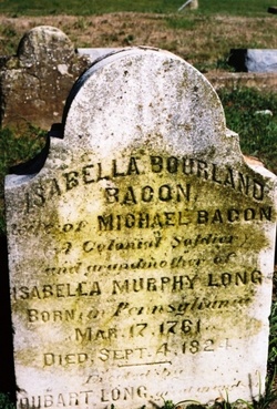
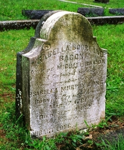
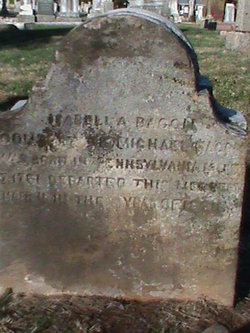
Isabella Bourland Bacon
| Birth | : | 17 Mar 1761 Pennsylvania, USA |
| Death | : | 4 Sep 1824 Farmington, St. Francois County, Missouri, USA |
| Burial | : | Taruheru Cemetery, Gisborne, Gisborne District, New Zealand |
| Coordinate | : | -38.6428900, 177.9802300 |
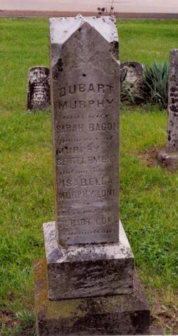
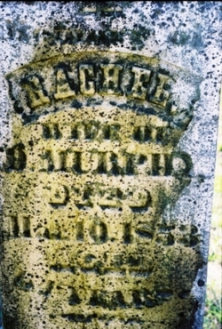
| Description | : | Isabella (nee Bourland) Bacon was the wife of Michael Bacon, a Colonial Soldier of the American Revolutionary War and according to Ancestry.com entry on him, he died in Hawkins County, Tennessee on 23 August of 1807, 540 miles away from Farmington, Missouri on modern roads. Could her husband actually be laid to rest in this Masonic Cemetery? No listing of him in the actual cemetery records. Isabella was the daughter of John Bourland and Catherine (nee Randolph) Bourland of Northern Ireland who supposedly immigrated to Virginia about 1761. (Yes, the same year she was born but maybe the year before) One web-site... Read More |
frequently asked questions (FAQ):
-
Where is Isabella Bourland Bacon's memorial?
Isabella Bourland Bacon's memorial is located at: Taruheru Cemetery, Gisborne, Gisborne District, New Zealand.
-
When did Isabella Bourland Bacon death?
Isabella Bourland Bacon death on 4 Sep 1824 in Farmington, St. Francois County, Missouri, USA
-
Where are the coordinates of the Isabella Bourland Bacon's memorial?
Latitude: -38.6428900
Longitude: 177.9802300
Family Members:
Spouse
Children


Nearby Cemetories:
1. Taruheru Cemetery
Gisborne, Gisborne District, New Zealand
Coordinate: -38.6428900, 177.9802300
2. Makaraka Cemetery
Gisborne, Gisborne District, New Zealand
Coordinate: -38.6482600, 177.9803200
3. Waerenga a hika Urupā
Gisborne, Gisborne District, New Zealand
Coordinate: -38.5954100, 177.9263500
4. Opou Tuarakena Cemetery
Manutuke, Gisborne District, New Zealand
Coordinate: -38.6744759, 177.9095277
5. Opou Station Cemetery
Manutuke, Gisborne District, New Zealand
Coordinate: -38.6779310, 177.9084450
6. Paramanihi Waihirere Cemetery
Gisborne, Gisborne District, New Zealand
Coordinate: -38.5791250, 177.9488450
7. Manutuke Churchyard Urupā
Manutuke, Gisborne District, New Zealand
Coordinate: -38.6815360, 177.9080180
8. Patutahi Cemetery
Gisborne, Gisborne District, New Zealand
Coordinate: -38.6199300, 177.8955600
9. Manutuke Whakato Urupā
Manutuke, Gisborne District, New Zealand
Coordinate: -38.6843390, 177.9073690
10. Wainui
Gisborne District, New Zealand
Coordinate: -38.6950000, 178.0707400
11. Ormond Cemetery
Ormond, Gisborne District, New Zealand
Coordinate: -38.5526480, 177.9279330
12. Pouawa Urupā
Whangara, Gisborne District, New Zealand
Coordinate: -38.6085500, 178.1825900
13. Whangara Urupā
Whangara, Gisborne District, New Zealand
Coordinate: -38.5716800, 178.2310400
14. Tapuae o te Rangi Urupā
Whatatutu, Gisborne District, New Zealand
Coordinate: -38.3791200, 177.8134180
15. Kohimarama Urupā
Tolaga Bay, Gisborne District, New Zealand
Coordinate: -38.3791770, 178.3007610
16. Nuhaka North Cemetery
Morere, Wairoa District, New Zealand
Coordinate: -38.9797100, 177.7944300
17. Tolaga Bay Cemetery
Tolaga Bay, Gisborne District, New Zealand
Coordinate: -38.3643370, 178.3045240
18. Tolaga Bay Urupā
Tolaga Bay, Gisborne District, New Zealand
Coordinate: -38.3629400, 178.3050080
19. Rakauroa Cemetery
Matawai, Gisborne District, New Zealand
Coordinate: -38.4358900, 177.5711400
20. Okuri Marea Urupa
Tolaga Bay, Gisborne District, New Zealand
Coordinate: -38.3055250, 178.2704340
21. Arataiha Urupā
Nuhaka, Wairoa District, New Zealand
Coordinate: -39.0201020, 177.7361770
22. Opoutama Cemetery
Mahia, Wairoa District, New Zealand
Coordinate: -39.0550780, 177.8405420
23. Manawarakau Urupā
Nuhaka, Wairoa District, New Zealand
Coordinate: -39.0371870, 177.7262650
24. Kaiuku Marae Urupā
Mahia, Wairoa District, New Zealand
Coordinate: -39.0823112, 177.9086516