
| Birth | : | 22 Dec 1858 Edgar County, Illinois, USA |
| Death | : | 13 Aug 1940 Alliance, Box Butte County, Nebraska, USA |
| Burial | : | St. Michael's Churchyard, Monkton Combe, Bath and North East Somerset Unitary Authority, England |
| Coordinate | : | 51.3559540, -2.3285700 |
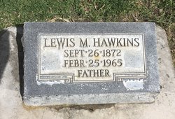
| Description | : | OBITUARY FROM PIONEER GRIP: ( August ? 1940) Death came at the age of 81 years early Sunday morning to Jacob Clarence Hawkins, a veteran farmer of Box Butte County, at the home at 216 Toluca Ave. Funeral services were held this afternoon from the Alliance Christian church with Rev. Burton Davies officiating, followed by burial at the Hagaman Cemetery 15 miles southwest of Alliance. Mr. Hawkins is survived by his wife, with whom he celebrated his 61st wedding anniversary about nine months ago. He had been in failing health for the past two... Read More |
frequently asked questions (FAQ):
-
Where is Jacob Clarence Hawkins's memorial?
Jacob Clarence Hawkins's memorial is located at: St. Michael's Churchyard, Monkton Combe, Bath and North East Somerset Unitary Authority, England.
-
When did Jacob Clarence Hawkins death?
Jacob Clarence Hawkins death on 13 Aug 1940 in Alliance, Box Butte County, Nebraska, USA
-
Where are the coordinates of the Jacob Clarence Hawkins's memorial?
Latitude: 51.3559540
Longitude: -2.3285700
Family Members:
Parent
Spouse

Siblings
Children
Flowers:


Nearby Cemetories:
1. St. Michael's Churchyard
Monkton Combe, Bath and North East Somerset Unitary Authority, England
Coordinate: 51.3559540, -2.3285700
2. Union Chapel
Combe Down, Bath and North East Somerset Unitary Authority, England
Coordinate: 51.3594751, -2.3443662
3. Prior Park College
Bath, Bath and North East Somerset Unitary Authority, England
Coordinate: 51.3645990, -2.3442400
4. Jewish Burial Ground
Combe Down, Bath and North East Somerset Unitary Authority, England
Coordinate: 51.3599170, -2.3534670
5. Midford Burial Ground
Bath, Bath and North East Somerset Unitary Authority, England
Coordinate: 51.3394360, -2.3391424
6. St John the Evangelist Cemetery
Bath, Bath and North East Somerset Unitary Authority, England
Coordinate: 51.3696700, -2.3487400
7. Bath Abbey Cemetery
Widcombe, Bath and North East Somerset Unitary Authority, England
Coordinate: 51.3712850, -2.3483060
8. St Thomas à Becket's Church
Widcombe, Bath and North East Somerset Unitary Authority, England
Coordinate: 51.3734250, -2.3465560
9. Unitarian Chapel Burial Ground
Widcombe, Bath and North East Somerset Unitary Authority, England
Coordinate: 51.3704650, -2.3539270
10. St. Mary The Virgin Churchyard
Bathwick, Bath and North East Somerset Unitary Authority, England
Coordinate: 51.3759930, -2.3411930
11. Smallcombe Vale Cemetery
Bathwick, Bath and North East Somerset Unitary Authority, England
Coordinate: 51.3757400, -2.3429400
12. Freshford Cemetery
Freshford, Bath and North East Somerset Unitary Authority, England
Coordinate: 51.3379620, -2.3082970
13. Saint Peters Churchyard
Freshford, Bath and North East Somerset Unitary Authority, England
Coordinate: 51.3400570, -2.3033340
14. Quaker Burial Ground
Widcombe, Bath and North East Somerset Unitary Authority, England
Coordinate: 51.3744350, -2.3498460
15. St. James' Churchyard
South Stoke, Bath and North East Somerset Unitary Authority, England
Coordinate: 51.3497220, -2.3652780
16. St. Mary's Churchyard
Claverton, Bath and North East Somerset Unitary Authority, England
Coordinate: 51.3757560, -2.3061500
17. Claverton Cemetery
Bath, Bath and North East Somerset Unitary Authority, England
Coordinate: 51.3758190, -2.3060720
18. Abbey & St James' Graveyard for the Poor
Widcombe, Bath and North East Somerset Unitary Authority, England
Coordinate: 51.3753550, -2.3545640
19. Old Baptist Burial Ground
Walcot, Bath and North East Somerset Unitary Authority, England
Coordinate: 51.3755070, -2.3544360
20. Baptist Burial Ground
Widcombe, Bath and North East Somerset Unitary Authority, England
Coordinate: 51.3764216, -2.3556947
21. Bath Union Workhouse Graveyard
Bath, Bath and North East Somerset Unitary Authority, England
Coordinate: 51.3584160, -2.3711140
22. Saint Mark's Churchyard
Widcombe, Bath and North East Somerset Unitary Authority, England
Coordinate: 51.3766660, -2.3588010
23. St Mary Magdalen Chapel
Widcombe, Bath and North East Somerset Unitary Authority, England
Coordinate: 51.3760486, -2.3643405
24. Old Orchard Street Catholic Burial Vault
Bath, Bath and North East Somerset Unitary Authority, England
Coordinate: 51.3800370, -2.3579910