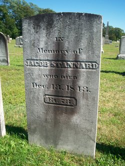
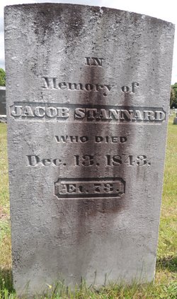
Jacob Stannard
| Birth | : | 13 Mar 1771 Saybrook Manor, Middlesex County, Connecticut, USA |
| Death | : | 13 Dec 1843 USA |
| Burial | : | Fern Hill Cemetery, Menlo, Pacific County, USA |
| Coordinate | : | 46.6338997, -123.6585999 |
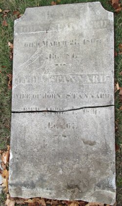
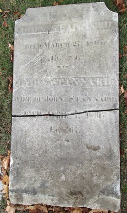
| Description | : | 73 yrs. Married Jerusha Kelsey (1773-1830) on 9 Aug 1797 at Saybrook. |
frequently asked questions (FAQ):
-
Where is Jacob Stannard's memorial?
Jacob Stannard's memorial is located at: Fern Hill Cemetery, Menlo, Pacific County, USA.
-
When did Jacob Stannard death?
Jacob Stannard death on 13 Dec 1843 in USA
-
Where are the coordinates of the Jacob Stannard's memorial?
Latitude: 46.6338997
Longitude: -123.6585999
Family Members:
Parent
Spouse
Siblings
Children
Flowers:
Nearby Cemetories:
1. Fern Hill Cemetery
Menlo, Pacific County, USA
Coordinate: 46.6338997, -123.6585999
2. Giesy Family Cemetery
Menlo, Pacific County, USA
Coordinate: 46.6446780, -123.6625170
3. Odd Fellows Cemetery
South Bend, Pacific County, USA
Coordinate: 46.6647130, -123.7541360
4. Riddell Street Cemetery
Raymond, Pacific County, USA
Coordinate: 46.6945200, -123.7358600
5. F O E 1631 Cemetery
Raymond, Pacific County, USA
Coordinate: 46.7006000, -123.7319000
6. Washington Cemetery
Raymond, Pacific County, USA
Coordinate: 46.7005997, -123.7319031
7. Maple Hill Cemetery
Lebam, Pacific County, USA
Coordinate: 46.5653150, -123.5671480
8. Fir Grove Cemetery
Lebam, Pacific County, USA
Coordinate: 46.5604910, -123.5548970
9. Holy Family Catholic Cemetery
Frances, Pacific County, USA
Coordinate: 46.5403270, -123.5000130
10. Campbell Family Cemetery
Frances, Pacific County, USA
Coordinate: 46.5346950, -123.4939790
11. North River Cemetery
Brooklyn, Pacific County, USA
Coordinate: 46.7750090, -123.4877010
12. Wilsonville Cemetery
Pacific County, USA
Coordinate: 46.6379710, -123.9387740
13. Bay Center Cemetery
Bay Center, Pacific County, USA
Coordinate: 46.5986490, -123.9355650
14. Vesta Cemetery
Vesta, Grays Harbor County, USA
Coordinate: 46.8301850, -123.5900460
15. Bay Center Pioneer Cemetery
Bay Center, Pacific County, USA
Coordinate: 46.6298850, -123.9538870
16. Saint Joseph Cemetery
Pe Ell, Lewis County, USA
Coordinate: 46.5732590, -123.3012070
17. Saint Josephs Catholic Cemetery
Pe Ell, Lewis County, USA
Coordinate: 46.5648880, -123.3031070
18. Forest Lawn Cemetery
Pe Ell, Lewis County, USA
Coordinate: 46.5649190, -123.3008280
19. Shoalwater Bay Indian Tribal Cemetery
Pacific County, USA
Coordinate: 46.7217040, -124.0152920
20. Dryad Cemetery
Dryad, Lewis County, USA
Coordinate: 46.6467667, -123.2665329
21. Oysterville Cemetery
Oysterville, Pacific County, USA
Coordinate: 46.5478670, -124.0337350
22. Salmon Creek Cemetery
Deep River, Wahkiakum County, USA
Coordinate: 46.3634000, -123.7164000
23. Deep River Cemetery
Deep River, Wahkiakum County, USA
Coordinate: 46.3587910, -123.6849890
24. Salmon Creek Cemetery Old
Wahkiakum County, USA
Coordinate: 46.3578630, -123.7178340

