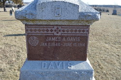
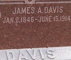
James Alexander Davis
| Birth | : | 6 Jan 1846 Liberty, Clay County, Missouri, USA |
| Death | : | 15 Jun 1914 Birmingham, Jackson County, Kansas, USA |
| Burial | : | Woodlawn Cemetery, Grand Rapids, Kent County, USA |
| Coordinate | : | 42.9160995, -85.6303024 |
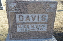
| Description | : | James Alexander Davis was born at Liberty, Clay county, Mo, 6 Jan 1846. He moved to Lansing, Ks in 1854, then in 1857, he came to Jackson county and settled on a farm 3 miles south of Holton in 1894. He moved to Birmingham in 1897. He is survived by Mother, sisters, Alice, who has always made her hone with him and sisters, Mrs Hale and Mrs Larkingburg. He died at Birningham of a heart ailment and services were at at New Harmony church. info per Holton Recorder, June 18, 1914 |
frequently asked questions (FAQ):
-
Where is James Alexander Davis's memorial?
James Alexander Davis's memorial is located at: Woodlawn Cemetery, Grand Rapids, Kent County, USA.
-
When did James Alexander Davis death?
James Alexander Davis death on 15 Jun 1914 in Birmingham, Jackson County, Kansas, USA
-
Where are the coordinates of the James Alexander Davis's memorial?
Latitude: 42.9160995
Longitude: -85.6303024
Family Members:
Parent
Siblings
Flowers:
Nearby Cemetories:
1. Woodlawn Cemetery
Grand Rapids, Kent County, USA
Coordinate: 42.9160995, -85.6303024
2. Oak Grove Cemetery
Grand Rapids, Kent County, USA
Coordinate: 42.9136009, -85.6314011
3. Garfield Park Cemetery
Grand Rapids, Kent County, USA
Coordinate: 42.9221992, -85.6307983
4. Maple Grove Cemetery
Kentwood, Kent County, USA
Coordinate: 42.9033300, -85.6203400
5. Rest Lawn Memorial Park
Grand Rapids, Kent County, USA
Coordinate: 42.9007988, -85.6438980
6. Grace Episcopal Church Columbarium
Grand Rapids, Kent County, USA
Coordinate: 42.9413390, -85.6242730
7. Oakhill Cemetery
Grand Rapids, Kent County, USA
Coordinate: 42.9411011, -85.6517029
8. Saint Andrews Catholic Cemetery
Grand Rapids, Kent County, USA
Coordinate: 42.9463997, -85.6567001
9. Resurrection Cemetery
Wyoming, Kent County, USA
Coordinate: 42.8905983, -85.6819000
10. Pine Hill Cemetery
Kentwood, Kent County, USA
Coordinate: 42.8675003, -85.6363983
11. Fulton Street Cemetery
Grand Rapids, Kent County, USA
Coordinate: 42.9639200, -85.6486400
12. Central Reformed Church Crypt
Grand Rapids, Kent County, USA
Coordinate: 42.9634410, -85.6563430
13. Westminster Presbyterian Church Columbarium
Grand Rapids, Kent County, USA
Coordinate: 42.9619070, -85.6646760
14. First United Methodist Church Columbarium
Grand Rapids, Kent County, USA
Coordinate: 42.9634200, -85.6633300
15. Martin Cemetery
Grand Rapids, Kent County, USA
Coordinate: 42.9458008, -85.5607986
16. Graceland Memorial Park and Mausoleum
Grand Rapids, Kent County, USA
Coordinate: 42.9481010, -85.5618973
17. Gerald R Ford Museum
Grand Rapids, Kent County, USA
Coordinate: 42.9668140, -85.6771000
18. Chapel Hill Memorial Gardens
Cascade Township, Kent County, USA
Coordinate: 42.9089012, -85.5464020
19. Holy Trinity Columbarium
Wyoming, Kent County, USA
Coordinate: 42.8669010, -85.6847490
20. Teeple Cemetery (Defunct)
Cascade Township, Kent County, USA
Coordinate: 42.9134300, -85.5357790
21. Frederik Meijer Gardens and Sculpture Park
Grand Rapids, Kent County, USA
Coordinate: 42.9794880, -85.5897510
22. Blain Cemetery
Cutlerville, Kent County, USA
Coordinate: 42.8414001, -85.6335983
23. Fairplains Cemetery
Grand Rapids, Kent County, USA
Coordinate: 43.0005989, -85.6421967
24. Dutton Cemetery
Dutton, Kent County, USA
Coordinate: 42.8366670, -85.5841670

