

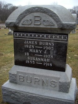
James Burns
| Birth | : | 10 Nov 1828 Mifflin County, Pennsylvania, USA |
| Death | : | 1 Sep 1905 Monticello, White County, Indiana, USA |
| Burial | : | Oakwood Cemetery, Osawatomie, Miami County, USA |
| Coordinate | : | 38.5024300, -94.9510300 |
| Plot | : | sec. 2, row 26 |
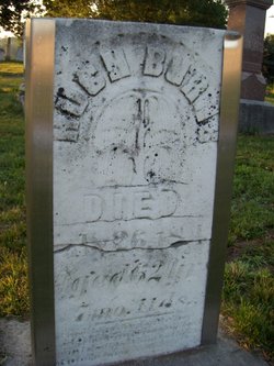
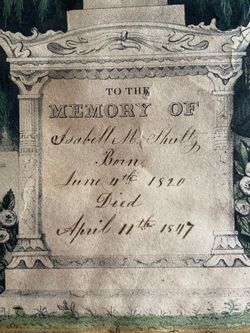
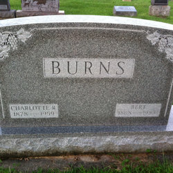
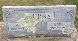
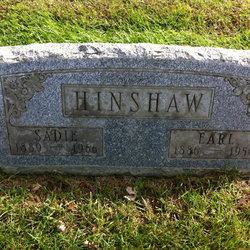
| Description | : | His parents were Hugh and Elizabeth (Turner) Burns. He was one of the first settlers of White County arriving in 1835. He owned Edge Hill Farm, two miles south of Monticello. In 1865, he married Mary Jane. They had three sons: Samuel, Edward, and Bert. After the death of his first wife, he married Susan Ferry and they had four children: Mae, Pearl, Earl, and Sadie. He was Union County road superintendent. Source of info: The Old Monticello Cemetery, by W.C. Madden & Janet Ollman Dold |
frequently asked questions (FAQ):
-
Where is James Burns's memorial?
James Burns's memorial is located at: Oakwood Cemetery, Osawatomie, Miami County, USA.
-
When did James Burns death?
James Burns death on 1 Sep 1905 in Monticello, White County, Indiana, USA
-
Where are the coordinates of the James Burns's memorial?
Latitude: 38.5024300
Longitude: -94.9510300
Family Members:
Parent
Spouse

Siblings

Children
Flowers:


Nearby Cemetories:
1. Oakwood Cemetery
Osawatomie, Miami County, USA
Coordinate: 38.5024300, -94.9510300
2. Brown Cemetery
Osawatomie, Miami County, USA
Coordinate: 38.4980300, -94.9566500
3. Elmdale Cemetery
Osawatomie, Miami County, USA
Coordinate: 38.5017014, -94.9381027
4. Osawatomie State Hospital Burial Ground
Osawatomie, Miami County, USA
Coordinate: 38.5128600, -94.9326300
5. Indianapolis Cemetery
Osawatomie, Miami County, USA
Coordinate: 38.5046997, -94.9931030
6. Osawatomie Cemetery
Osawatomie, Miami County, USA
Coordinate: 38.5355988, -94.9377975
7. Miami Memorial Gardens
Paola, Miami County, USA
Coordinate: 38.5337100, -94.9221400
8. Crescent Hill Cemetery
Osawatomie, Miami County, USA
Coordinate: 38.4513700, -94.9705800
9. Mount Nebo Family Cemetery
Osawatomie Township, Miami County, USA
Coordinate: 38.4540400, -94.9208400
10. Whiteford Cemetery
Osawatomie, Miami County, USA
Coordinate: 38.4618988, -94.8992004
11. Spring Grove Quaker Cemetery
Miami County, USA
Coordinate: 38.4409600, -95.0185100
12. Green Valley Cemetery
Miami County, USA
Coordinate: 38.4700012, -95.0472031
13. Paola Cemetery
Paola, Miami County, USA
Coordinate: 38.5704000, -94.8873000
14. Beagle Cemetery
Beagle, Miami County, USA
Coordinate: 38.4178300, -94.9493400
15. Mannen Cemetery
Stanton, Miami County, USA
Coordinate: 38.5731010, -95.0113983
16. Debrick Cemetery
Miami County, USA
Coordinate: 38.4757996, -94.8432999
17. Ursuline Cemetery
Paola, Miami County, USA
Coordinate: 38.5678500, -94.8676400
18. Stanton Cemetery
Stanton, Miami County, USA
Coordinate: 38.5426000, -95.0596100
19. Lockhart Cemetery
Beagle, Miami County, USA
Coordinate: 38.4112400, -94.9828500
20. Miami County Poor Farm Cemetery
Paola, Miami County, USA
Coordinate: 38.5943420, -94.9193018
21. Shively Cemetery
Rantoul, Franklin County, USA
Coordinate: 38.5159500, -95.0747400
22. Holy Cross Cemetery
Paola, Miami County, USA
Coordinate: 38.5628014, -94.8482971
23. Chandler Family Cemetery
Beagle, Miami County, USA
Coordinate: 38.4057600, -94.9951200
24. Mound Creek Cemetery
Beagle, Miami County, USA
Coordinate: 38.3958015, -94.9760971