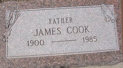
James Cook
| Birth | : | 19 Dec 1900 Saint Francis, Cheyenne County, Kansas, USA |
| Death | : | 4 Jul 1985 Saint Francis, Cheyenne County, Kansas, USA |
| Burial | : | Mina Chapel Cemetery, Green Township, Gallia County, USA |
| Coordinate | : | 38.7724991, -82.2380981 |
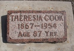
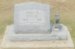
| Description | : | James Cook began his life on the Cook homestead on Dec. 19, 1900 and died on July 4th in the Cheyenne County Hospital. Jim ws the eighth child of a large family of 12 children of John and Theresia Ittner Cook. In 1925 he married Viola R. Heinrich. He was a member of the Christian Church of St. Francis. Jim's life was spent entirely in Cheyenne County. He played short stop on the Cook Brothers Baseball Team. Jim preferred to live alone and lived as a farmer on a small acreage north of St. Francis. Jim... Read More |
frequently asked questions (FAQ):
-
Where is James Cook's memorial?
James Cook's memorial is located at: Mina Chapel Cemetery, Green Township, Gallia County, USA.
-
When did James Cook death?
James Cook death on 4 Jul 1985 in Saint Francis, Cheyenne County, Kansas, USA
-
Where are the coordinates of the James Cook's memorial?
Latitude: 38.7724991
Longitude: -82.2380981
Family Members:
Parent
Spouse
Siblings
Children
Flowers:
Nearby Cemetories:
1. Mina Chapel Cemetery
Green Township, Gallia County, USA
Coordinate: 38.7724991, -82.2380981
2. King Cemetery
Green Township, Gallia County, USA
Coordinate: 38.7740190, -82.2594810
3. Ohio Valley Memory Gardens
Green Township, Gallia County, USA
Coordinate: 38.7915900, -82.2412800
4. Northup Cemetery
Green Township, Gallia County, USA
Coordinate: 38.7742004, -82.2742004
5. Harrington Cemetery
Clay Township, Gallia County, USA
Coordinate: 38.7441670, -82.2383080
6. Brucker Cemetery
Clay Township, Gallia County, USA
Coordinate: 38.7576100, -82.2059900
7. Mound Hill Cemetery
Gallipolis, Gallia County, USA
Coordinate: 38.8003500, -82.2219900
8. Beale Cemetery
Gallipolis Ferry, Mason County, USA
Coordinate: 38.7782070, -82.1979340
9. Clendenin-Steenbergen Cemetery
Gallipolis Ferry, Mason County, USA
Coordinate: 38.7824810, -82.1983420
10. Lewis Cemetery
Gallipolis Ferry, Mason County, USA
Coordinate: 38.7826600, -82.1978400
11. Jordan Baptist Cemetery
Gallipolis Ferry, Mason County, USA
Coordinate: 38.7738991, -82.1958008
12. Coffman Cemetery
Clay Township, Gallia County, USA
Coordinate: 38.7519493, -82.2007675
13. Centenary Cemetery
Centenary, Gallia County, USA
Coordinate: 38.8041992, -82.2675018
14. Ouster Cemetery
Green Township, Gallia County, USA
Coordinate: 38.7825012, -82.2900009
15. Loucks Cemetery
Harrison Township, Gallia County, USA
Coordinate: 38.7294006, -82.2546997
16. Saint Peters Episcopal Church Columbarium
Gallipolis, Gallia County, USA
Coordinate: 38.8098970, -82.2015540
17. Earwood Cemetery
Clay Township, Gallia County, USA
Coordinate: 38.7249730, -82.2365370
18. Cottrell Cemetery
Clay Township, Gallia County, USA
Coordinate: 38.7252998, -82.2219009
19. Pine Street Cemetery
Gallipolis, Gallia County, USA
Coordinate: 38.8171997, -82.1992035
20. Saint Nicholas Cemetery
Clay Township, Gallia County, USA
Coordinate: 38.7180200, -82.2367900
21. Bruce Chapel Cemetery
Mason County, USA
Coordinate: 38.7453003, -82.1772003
22. Pine Street Colored Cemetery
Gallipolis, Gallia County, USA
Coordinate: 38.8185700, -82.1999800
23. Macedonia Cemetery
Harrison Township, Gallia County, USA
Coordinate: 38.7310982, -82.2893982
24. Asbury Cemetery
Green Township, Gallia County, USA
Coordinate: 38.7675800, -82.3120950

