
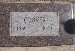
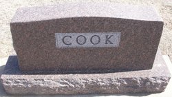
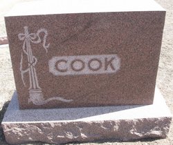
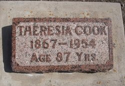
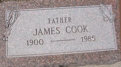
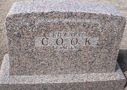
Grover Cleveland Cook
| Birth | : | 10 Oct 1889 Cheyenne County, Kansas, USA |
| Death | : | 1 Aug 1976 Saint Francis, Cheyenne County, Kansas, USA |
| Burial | : | Vernon Grove Cemetery, Milford, Worcester County, USA |
| Coordinate | : | 42.1292000, -71.5124969 |
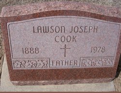
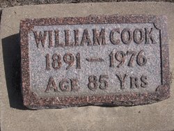
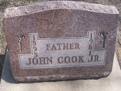
| Description | : | Grover Cook was born October 10, 1889 in Cheyenne County Kansas, the second son of John and Teresia Cook, and he died August 1, 1976, at the Good Samaritan Village after a lengthy illness. He attended local school, and on Oct. 3, 1917 he left for the Army training at Camp Funston and Fort Sill with Co. E of the 110th Ammunition Train. He served overseas in France in world War I and was discharged May 5, 1919. On April 15, 1922 he was married to Emma Harrington. Grover and Emma lived on their farm southwest of... Read More |
frequently asked questions (FAQ):
-
Where is Grover Cleveland Cook's memorial?
Grover Cleveland Cook's memorial is located at: Vernon Grove Cemetery, Milford, Worcester County, USA.
-
When did Grover Cleveland Cook death?
Grover Cleveland Cook death on 1 Aug 1976 in Saint Francis, Cheyenne County, Kansas, USA
-
Where are the coordinates of the Grover Cleveland Cook's memorial?
Latitude: 42.1292000
Longitude: -71.5124969
Family Members:
Parent
Spouse

Siblings
Children


Flowers:


Nearby Cemetories:
1. Vernon Grove Cemetery
Milford, Worcester County, USA
Coordinate: 42.1292000, -71.5124969
2. South Hopedale Cemetery
Hopedale, Worcester County, USA
Coordinate: 42.1114000, -71.5139000
3. Hopedale Village Cemetery
Hopedale, Worcester County, USA
Coordinate: 42.1268997, -71.5432968
4. Saint Mary's Cemetery
Milford, Worcester County, USA
Coordinate: 42.1542015, -71.5083008
5. Sacred Heart Cemetery
Milford, Worcester County, USA
Coordinate: 42.1500015, -71.4916992
6. Bicknell Cemetery
Mendon, Worcester County, USA
Coordinate: 42.1012320, -71.5111090
7. Depot Street Cemetery
Bellingham, Norfolk County, USA
Coordinate: 42.1046900, -71.4934610
8. Gaskill Cemetery
Mendon, Worcester County, USA
Coordinate: 42.1061700, -71.5395600
9. Pine Grove Cemetery
Milford, Worcester County, USA
Coordinate: 42.1610985, -71.5096970
10. Quaker-Friends Cemetery
Mendon, Worcester County, USA
Coordinate: 42.1044600, -71.5468700
11. George Cemetery
Mendon, Worcester County, USA
Coordinate: 42.1046982, -71.5475006
12. Old Cemetery
Mendon, Worcester County, USA
Coordinate: 42.1037483, -71.5493164
13. North Purchase Cemetery
Milford, Worcester County, USA
Coordinate: 42.1666985, -71.5239029
14. Oak Hill Cemetery
Bellingham, Norfolk County, USA
Coordinate: 42.1162700, -71.4602500
15. Freeman Cemetery
Mendon, Worcester County, USA
Coordinate: 42.1058320, -71.5580760
16. Swan Dale Cemetery
Mendon, Worcester County, USA
Coordinate: 42.0903015, -71.5306015
17. North Bellingham Cemetery
Bellingham, Norfolk County, USA
Coordinate: 42.1172300, -71.4592090
18. Locust Hill Cemetery
Mendon, Worcester County, USA
Coordinate: 42.1197014, -71.5671997
19. Braggville Cemetery
Holliston, Middlesex County, USA
Coordinate: 42.1654500, -71.4752300
20. South Cemetery
Holliston, Middlesex County, USA
Coordinate: 42.1734900, -71.4701800
21. Center Cemetery
Bellingham, Norfolk County, USA
Coordinate: 42.0842000, -71.4707600
22. Union Cemetery
Bellingham, Norfolk County, USA
Coordinate: 42.0839800, -71.4703100
23. Union Freeman Cemetery
Mendon, Worcester County, USA
Coordinate: 42.0835300, -71.5626800
24. Wood Cemetery
Mendon, Worcester County, USA
Coordinate: 42.1017100, -71.5846000