

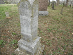
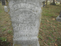
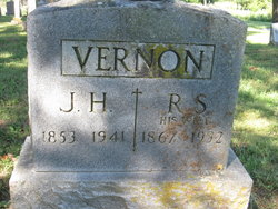
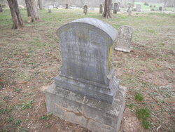
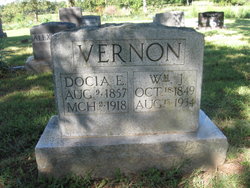
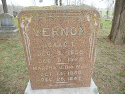
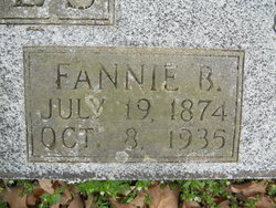
James Harvey Vernon
| Birth | : | 13 Jun 1853 Eldon, Miller County, Missouri, USA |
| Death | : | 2 May 1941 Eldon, Miller County, Missouri, USA |
| Burial | : | North Sidney Cemetery, Sidney, Montcalm County, USA |
| Coordinate | : | 43.2658600, -85.1533500 |
| Description | : | Unknown Newspaper, May 1941 James Harvey Vernon was born June 13, 1853, and departed this life May 2. If he had lived 1 month and 8 days longer he would have been 88 years old. His parents, Wilburn and Sarah Vernon were among the early settlers of this community. Mr. Vernon's entire life was spent in Miller County. The last 56 years he had lived on the same farm, the old homestead where he has reared one of the largest families in the county, has been made dear to the whole countryside by his gracious hospitality and his friendly... Read More |
frequently asked questions (FAQ):
-
Where is James Harvey Vernon's memorial?
James Harvey Vernon's memorial is located at: North Sidney Cemetery, Sidney, Montcalm County, USA.
-
When did James Harvey Vernon death?
James Harvey Vernon death on 2 May 1941 in Eldon, Miller County, Missouri, USA
-
Where are the coordinates of the James Harvey Vernon's memorial?
Latitude: 43.2658600
Longitude: -85.1533500
Family Members:
Parent
Spouse
Siblings

Children

Flowers:

I found your diaries and the information contained in them was unbelieveable! Made my geneology work much easier! Thanks for writing the family history cousin! Rest in Peace!
Left by Anonymous on 21 Oct 2010

Left by Anonymous on 22 May 2012

Left by Anonymous on 04 Dec 2014

Left by Anonymous on 01 Nov 2017
Left by Anonymous on 09 Nov 2017

I'm so happy that I have a great family. The story is impressive. my GG-Grandfather.
Left by Anonymous on 18 Nov 2019

Left by Anonymous on 21 Dec 2021


Nearby Cemetories:
1. Sidney Township Cemetery
Sidney, Montcalm County, USA
Coordinate: 43.2503100, -85.1369600
2. South Sidney Cemetery
Sidney, Montcalm County, USA
Coordinate: 43.2208050, -85.1826570
3. Forest Hill Cemetery
Stanton, Montcalm County, USA
Coordinate: 43.2910995, -85.0883026
4. Amish Greenville Church District Cemetery
Stanton, Montcalm County, USA
Coordinate: 43.3060570, -85.2311130
5. Potters Field
Greenville, Montcalm County, USA
Coordinate: 43.1922500, -85.1628000
6. Riverside Cemetery
Langston, Montcalm County, USA
Coordinate: 43.3136400, -85.2400300
7. East Montcalm Cemetery
Greenville, Montcalm County, USA
Coordinate: 43.2266998, -85.2510986
8. Sheridan Cemetery
Sheridan, Montcalm County, USA
Coordinate: 43.2061920, -85.0653030
9. Hillside Entrican Cemetery
Entrican, Montcalm County, USA
Coordinate: 43.3539009, -85.1446991
10. Evergreen Township Cemetery
Sheridan, Montcalm County, USA
Coordinate: 43.2200600, -85.0472300
11. Monroe Cemetery
Greenville, Montcalm County, USA
Coordinate: 43.2338982, -85.2716980
12. Bethania Cemetery
Gowen, Montcalm County, USA
Coordinate: 43.2333540, -85.2716950
13. Little Denmark Cemetery
Gowen, Montcalm County, USA
Coordinate: 43.2677994, -85.3013992
14. Fairplains Cemetery
Greenville, Montcalm County, USA
Coordinate: 43.1561400, -85.1722400
15. Saint Paul Episcopal Church Columbarium
Greenville, Montcalm County, USA
Coordinate: 43.1785420, -85.2517710
16. First Congregational Chapel Columbarium
Greenville, Montcalm County, USA
Coordinate: 43.1787370, -85.2527370
17. Palmer Cemetery
Day Township, Montcalm County, USA
Coordinate: 43.3588982, -85.0627975
18. First United Methodist Church Columbarium
Greenville, Montcalm County, USA
Coordinate: 43.1787690, -85.2550860
19. Saint Charles Catholic Cemetery
Greenville, Montcalm County, USA
Coordinate: 43.1889000, -85.2733002
20. McBride Cemetery
McBride, Montcalm County, USA
Coordinate: 43.3493996, -85.0382996
21. Wolverton Plains Cemetery
Greenville, Montcalm County, USA
Coordinate: 43.2094002, -85.3024979
22. Forest Home Cemetery
Greenville, Montcalm County, USA
Coordinate: 43.1638985, -85.2613983
23. Eureka Township Cemetery
Greenville, Montcalm County, USA
Coordinate: 43.1622500, -85.2603000
24. Evergreen Cemetery
Six Lakes, Montcalm County, USA
Coordinate: 43.4017000, -85.1353000