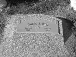
James Joseph Hurt
| Birth | : | 20 Aug 1901 Brainard, Butler County, Nebraska, USA |
| Death | : | 28 Apr 1965 Brainard, Butler County, Nebraska, USA |
| Burial | : | Union Cemetery, Mays Landing, Atlantic County, USA |
| Coordinate | : | 39.4373894, -74.7080536 |
frequently asked questions (FAQ):
-
Where is James Joseph Hurt's memorial?
James Joseph Hurt's memorial is located at: Union Cemetery, Mays Landing, Atlantic County, USA.
-
When did James Joseph Hurt death?
James Joseph Hurt death on 28 Apr 1965 in Brainard, Butler County, Nebraska, USA
-
Where are the coordinates of the James Joseph Hurt's memorial?
Latitude: 39.4373894
Longitude: -74.7080536
Family Members:
Parent
Spouse
Siblings
Children
Flowers:
Nearby Cemetories:
1. Union Cemetery
Mays Landing, Atlantic County, USA
Coordinate: 39.4373894, -74.7080536
2. Lincoln Memorial Park
Mays Landing, Atlantic County, USA
Coordinate: 39.4478493, -74.6872635
3. Westcott Free Burying Ground
Mays Landing, Atlantic County, USA
Coordinate: 39.4526215, -74.7281189
4. Holy Cross Cemetery and Chapel Mausoleum
Mays Landing, Atlantic County, USA
Coordinate: 39.4490395, -74.6839523
5. Presbyterian Cemetery
Mays Landing, Atlantic County, USA
Coordinate: 39.4539185, -74.7269821
6. Smith-Ireland Burying Ground
Estellville, Atlantic County, USA
Coordinate: 39.4151800, -74.7329640
7. Catawba Church and Burying Ground
Atlantic County, USA
Coordinate: 39.4082794, -74.7136078
8. Methodist Burying Ground
Estellville, Atlantic County, USA
Coordinate: 39.3978615, -74.7480164
9. Estellville Methodist Church Cemetery
Mays Landing, Atlantic County, USA
Coordinate: 39.3976900, -74.7477700
10. Carmantown Cemetery
Carmantown, Atlantic County, USA
Coordinate: 39.4483250, -74.6446000
11. Old Burying Ground
Estellville, Atlantic County, USA
Coordinate: 39.3959680, -74.7518810
12. Atlantic County Veterans Cemetery
Estell Manor, Atlantic County, USA
Coordinate: 39.3882790, -74.7386017
13. Steelmans Creek Burial Ground
Estell Manor, Atlantic County, USA
Coordinate: 39.3878517, -74.7388687
14. Asbury Methodist Episcopal Church Cemetery
English Creek, Atlantic County, USA
Coordinate: 39.3621483, -74.6706314
15. Laurel Memorial Park and Crematory
Egg Harbor Township, Atlantic County, USA
Coordinate: 39.4565887, -74.5941925
16. Old Weymouth Meeting House Cemetery
Weymouth, Atlantic County, USA
Coordinate: 39.5122070, -74.7802200
17. Bethlehem Evangelical Lutheran Cemetery
Dorothy, Atlantic County, USA
Coordinate: 39.4056396, -74.8247070
18. Palestine Bible Protestant Church Cemetery
Scullville, Atlantic County, USA
Coordinate: 39.3487091, -74.6608810
19. Saint Bernard Clairvaux Roman Catholic Cemetery
Dorothy, Atlantic County, USA
Coordinate: 39.4073067, -74.8260803
20. Saint Nicholas Roman Catholic Church Cemetery
Egg Harbor City, Atlantic County, USA
Coordinate: 39.5318222, -74.6367950
21. Estell Manor Community Church Cemetery
Estell Manor, Atlantic County, USA
Coordinate: 39.3763160, -74.8270490
22. Beth Kehillah Cemetery
Egg Harbor Township, Atlantic County, USA
Coordinate: 39.4091250, -74.5689580
23. Rodef Sholom Cemetery
Egg Harbor Township, Atlantic County, USA
Coordinate: 39.4080000, -74.5670500
24. Emeth Shalom Cemetery
Egg Harbor Township, Atlantic County, USA
Coordinate: 39.4067154, -74.5674896

