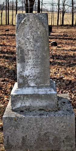
James Monroe Smith
| Birth | : | 15 Nov 1836 Indiana, USA |
| Death | : | 11 Feb 1873 Jolietville, Hamilton County, Indiana, USA |
| Burial | : | Beth Haven Baptist Church Cemetery, Berkeley County, USA |
| Coordinate | : | 39.4278800, -77.8983400 |
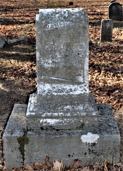
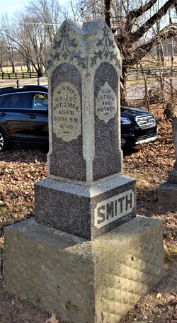
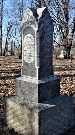
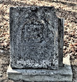
| Inscription | : | James M. Smith Died Feb. 11, 1873, Aged 36 Y. 2 M. 26 d. |
| Description | : | James Monroe Smith was a man of whom the relatives were especially proud. He was said to have been a very handsome man, and worthy of the honored nam, in character and ability. He married Sarah Ann Mower. They lived on a farm near Jolietville, Ind., until his death by accident. He had climbed into a tree to trim the top of it, when he fell to the ground and was killed. Source: Memorial Tribute to John Smith and Martha Pickens, by Grace Smith Pettijohn, 1912 |
frequently asked questions (FAQ):
-
Where is James Monroe Smith's memorial?
James Monroe Smith's memorial is located at: Beth Haven Baptist Church Cemetery, Berkeley County, USA.
-
When did James Monroe Smith death?
James Monroe Smith death on 11 Feb 1873 in Jolietville, Hamilton County, Indiana, USA
-
Where are the coordinates of the James Monroe Smith's memorial?
Latitude: 39.4278800
Longitude: -77.8983400
Family Members:
Parent
Spouse
Siblings
Children
Nearby Cemetories:
1. Beth Haven Baptist Church Cemetery
Berkeley County, USA
Coordinate: 39.4278800, -77.8983400
2. John Burns Cemetery
Baker Heights, Berkeley County, USA
Coordinate: 39.4137639, -77.8947583
3. Pleasant View Memory Gardens
Martinsburg, Berkeley County, USA
Coordinate: 39.4121000, -77.9163000
4. VanMetre Family Burial Ground
Berkeley County, USA
Coordinate: 39.4454600, -77.9268400
5. Smoketown Cemetery
Berkeley County, USA
Coordinate: 39.4575000, -77.9059000
6. VanMetre Cemetery
Baker Heights, Berkeley County, USA
Coordinate: 39.3962631, -77.9160690
7. White Rocks / Lemen Farm Cemetery
Kearneysville, Jefferson County, USA
Coordinate: 39.3940000, -77.8790000
8. White Rocks / Lemen Farm Cemetery
Kearneysville, Jefferson County, USA
Coordinate: 39.3940000, -77.8790000
9. Border Gibbons Cemetery
Kearneysville, Jefferson County, USA
Coordinate: 39.3908923, -77.8800182
10. Kearneysville Presbyterian Church Cemetery
Kearneysville, Jefferson County, USA
Coordinate: 39.3885155, -77.8876572
11. Mount Zion Baptist Church Cemetery
Martinsburg, Berkeley County, USA
Coordinate: 39.3889000, -77.9237700
12. Beth Jacob Cemetery
Martinsburg, Berkeley County, USA
Coordinate: 39.4580800, -77.9403700
13. Shepherd Family Cemetery
Douglas Grove, Berkeley County, USA
Coordinate: 39.4180940, -77.9543920
14. Douglass Grove Cemetery
Berkeley County, USA
Coordinate: 39.4182000, -77.9550500
15. Welsh Cemetery
Swan Pond, Berkeley County, USA
Coordinate: 39.4713730, -77.8813290
16. Rosedale Cemetery
Martinsburg, Berkeley County, USA
Coordinate: 39.4613991, -77.9403000
17. Sprinkle Cemetery
Greensburg, Berkeley County, USA
Coordinate: 39.4746400, -77.8933400
18. Saint Pauls Baptist Church Cemetery
Kearneysville, Jefferson County, USA
Coordinate: 39.3798904, -77.8862839
19. Hart-Lucas Cemetery
Kearneysville, Jefferson County, USA
Coordinate: 39.3783640, -77.8875400
20. Green Hill Cemetery
Martinsburg, Berkeley County, USA
Coordinate: 39.4538994, -77.9558029
21. Whitenah Family Burial Ground
Berkeley County, USA
Coordinate: 39.4547200, -77.9562990
22. Kearneysville Methodist Cemetery
Kearneysville, Jefferson County, USA
Coordinate: 39.3768294, -77.8817933
23. Glenburnie - Lafferty Graveyard
Shenandoah Junction, Jefferson County, USA
Coordinate: 39.3890610, -77.8461530
24. Adam Stephen Monument
Martinsburg, Berkeley County, USA
Coordinate: 39.4490400, -77.9663400

