
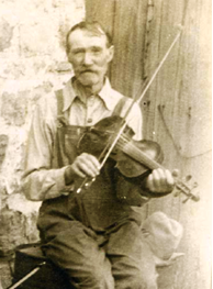
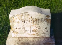


James William “JW” Moore
| Birth | : | 7 Feb 1867 Ellington, Reynolds County, Missouri, USA |
| Death | : | 26 Mar 1954 Farmington, St. Francois County, Missouri, USA |
| Burial | : | South Burying Ground, Boston, Suffolk County, USA |
| Coordinate | : | 42.3382600, -71.0741000 |
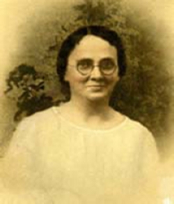
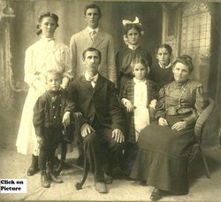
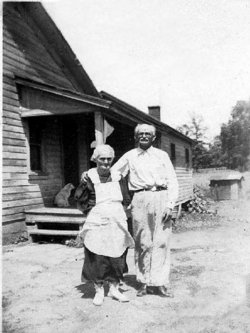
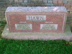
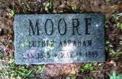
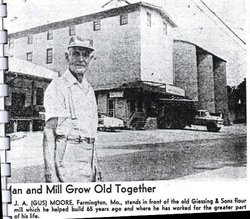
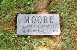
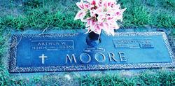
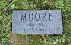
| Description | : | Buried at Parkview Cemetery in Farmington, MO: James was born in Ellington, Missouri on Feb. 7, 1867 to Alexander & Marguerite (nee Zolman) Moore (both are buried at the Zolman Cemetery, north of Farmington). JW (as known by the family) was an operating engineer in the lead mines, had owned a service station, and held numerous other postions. He lived most of his life in and around Flat River and Farmington, MO. JW had married twice in his lifetime. He first married Ophelia Lillian Bran on Feb. 22, 1891. Ophelia was the daughter of McArthur & Sarah Mecca (nee Zolman) Bran.... Read More |
frequently asked questions (FAQ):
-
Where is James William “JW” Moore's memorial?
James William “JW” Moore's memorial is located at: South Burying Ground, Boston, Suffolk County, USA.
-
When did James William “JW” Moore death?
James William “JW” Moore death on 26 Mar 1954 in Farmington, St. Francois County, Missouri, USA
-
Where are the coordinates of the James William “JW” Moore's memorial?
Latitude: 42.3382600
Longitude: -71.0741000
Family Members:
Parent

Spouse
Siblings
Children


Flowers:


Nearby Cemetories:
1. South Burying Ground
Boston, Suffolk County, USA
Coordinate: 42.3382600, -71.0741000
2. Cathedral of the Holy Cross Crypt
Boston, Suffolk County, USA
Coordinate: 42.3408200, -71.0697400
3. Eliot Burying Ground
Roxbury, Suffolk County, USA
Coordinate: 42.3318890, -71.0811970
4. Old South Church
Boston, Suffolk County, USA
Coordinate: 42.3500500, -71.0779000
5. Cocoanut Grove Fire Memorial
Boston, Suffolk County, USA
Coordinate: 42.3499600, -71.0681900
6. Warren Cemetery (Defunct)
Boston, Suffolk County, USA
Coordinate: 42.3269700, -71.0825500
7. Central Burying Ground
Boston, Suffolk County, USA
Coordinate: 42.3526300, -71.0659500
8. Saint Matthews Cemetery (Defunct)
South Boston, Suffolk County, USA
Coordinate: 42.3379940, -71.0497180
9. Saint Augustine Cemetery
South Boston, Suffolk County, USA
Coordinate: 42.3339900, -71.0491800
10. Saint Margaret's Convent Columbarium
Roxbury, Suffolk County, USA
Coordinate: 42.3260000, -71.0940700
11. Trinity Church Tombs (Defunct)
Boston, Suffolk County, USA
Coordinate: 42.3549300, -71.0597500
12. Granary Burying Ground
Boston, Suffolk County, USA
Coordinate: 42.3572400, -71.0613500
13. Warren Anatomical Museum
Boston, Suffolk County, USA
Coordinate: 42.3351300, -71.1036100
14. Dorchester North Burying Ground
Dorchester, Suffolk County, USA
Coordinate: 42.3170013, -71.0645828
15. Kings Chapel Burying Ground
Boston, Suffolk County, USA
Coordinate: 42.3583340, -71.0600370
16. Christ's Church
Brookline, Norfolk County, USA
Coordinate: 42.3421500, -71.1104200
17. Hawes Burying Ground
South Boston, Suffolk County, USA
Coordinate: 42.3340607, -71.0345078
18. Union Cemetery
South Boston, Suffolk County, USA
Coordinate: 42.3340440, -71.0344730
19. South Boston Farm Cemetery (Defunct)
South Boston, Suffolk County, USA
Coordinate: 42.3388510, -71.0326710
20. Copp's Hill Burying Ground
Boston, Suffolk County, USA
Coordinate: 42.3670100, -71.0560800
21. Christ Church Cemetery
Boston, Suffolk County, USA
Coordinate: 42.3664900, -71.0545200
22. Charlestown Revolutionary War Memorial
Charlestown, Suffolk County, USA
Coordinate: 42.3745800, -71.0601800
23. Phipps Street Burying Ground
Charlestown, Suffolk County, USA
Coordinate: 42.3766300, -71.0673000
24. Bunker Hill Monument
Charlestown, Suffolk County, USA
Coordinate: 42.3762360, -71.0607300