
| Birth | : | 22 Feb 1849 Winterset, Madison County, Iowa, USA |
| Death | : | 20 Jan 1934 Yakima, Yakima County, Washington, USA |
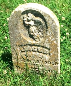
| Burial | : | St Peter Churchyard, Wymondham, Melton Borough, England |
| Coordinate | : | 52.7585970, -0.7395410 |
| Description | : | She was married to Ami Harader Nov-1-1865. They lived in Iowa until 1882 when moved to Mt. Vernon, S. Dakota where they lived until 1897 when they came to Chase Co., Kansas, and lived in Kans. until Mr. Harader died in 1929, when she went to her children in Washington state, where she died at the home of her daughter Mrs. W.A. Bell of Yakima, Washington. Mrs. Harader had been in poor health for several years. She united with the Methodist church when a young woman and remained a member until her death. Mrs. Harader was a... Read More |
frequently asked questions (FAQ):
-
Where is Jane Elizabeth Magness Harader's memorial?
Jane Elizabeth Magness Harader's memorial is located at: St Peter Churchyard, Wymondham, Melton Borough, England.
-
When did Jane Elizabeth Magness Harader death?
Jane Elizabeth Magness Harader death on 20 Jan 1934 in Yakima, Yakima County, Washington, USA
-
Where are the coordinates of the Jane Elizabeth Magness Harader's memorial?
Latitude: 52.7585970
Longitude: -0.7395410
Family Members:
Parent
Spouse

Children
Flowers:


Nearby Cemetories:
1. St Peter Churchyard
Wymondham, Melton Borough, England
Coordinate: 52.7585970, -0.7395410
2. Edmondthorpe Main Street Cemetery
Edmondthorpe, Melton Borough, England
Coordinate: 52.7491560, -0.7300030
3. Saint Michael and All Angels Churchyard
Edmondthorpe, Melton Borough, England
Coordinate: 52.7488800, -0.7301600
4. Holy Trinity Churchyard
Teigh, Rutland Unitary Authority, England
Coordinate: 52.7348560, -0.7207040
5. St Mary Churchyard
Garthorpe, Melton Borough, England
Coordinate: 52.7795740, -0.7685920
6. St Peter's Churchyard
Melton Mowbray, Melton Borough, England
Coordinate: 52.7720980, -0.7865420
7. St Andrew Churchyard
Coston, Melton Borough, England
Coordinate: 52.7905590, -0.7439280
8. St. Mary Magdalen Churchyard
Stapleford, Melton Borough, England
Coordinate: 52.7553000, -0.7987000
9. Saint Peter and Saint Paul's Churchyard
Market Overton, Rutland Unitary Authority, England
Coordinate: 52.7385000, -0.6893000
10. St Andrew Churchyard
Whissendine, Rutland Unitary Authority, England
Coordinate: 52.7200520, -0.7682370
11. St Mary's Churchyard
Freeby, Melton Borough, England
Coordinate: 52.7727300, -0.8099500
12. St Mary the Virgin Churchyard
Ashwell, Rutland Unitary Authority, England
Coordinate: 52.7144490, -0.7200580
13. St John the Baptist Churchyard
Buckminster, Melton Borough, England
Coordinate: 52.7981500, -0.6974900
14. St. Mary Churchyard
Wyfordby, Melton Borough, England
Coordinate: 52.7621940, -0.8257020
15. St Nicholas Churchyard
Thistleton, Rutland Unitary Authority, England
Coordinate: 52.7516900, -0.6483100
16. St Bartholomew's Churchyard
Sproxton, Melton Borough, England
Coordinate: 52.8150500, -0.7307100
17. Stonesby Saltby/Sproxton Road Cemetery
Sproxton, Melton Borough, England
Coordinate: 52.8143880, -0.7731270
18. St Peter's Churchyard
Stonesby, Melton Borough, England
Coordinate: 52.8140000, -0.7805100
19. St. Peter's Churchyard
Gunby, East Lindsey District, England
Coordinate: 52.7840600, -0.6483000
20. St Nicholas Churchyard
Gunby, South Kesteven District, England
Coordinate: 52.7838800, -0.6481500
21. St Peter Churchyard
Stainby, South Kesteven District, England
Coordinate: 52.7953390, -0.6587990
22. St. Nicholas Churchyard
Cottesmore, Rutland Unitary Authority, England
Coordinate: 52.7128800, -0.6655820
23. SS Peter and Paul Church
Langham, Rutland Unitary Authority, England
Coordinate: 52.6918700, -0.7529300
24. St Peter's Churchyard
Saltby, Melton Borough, England
Coordinate: 52.8298400, -0.7378900