Jay LeRoy Crom
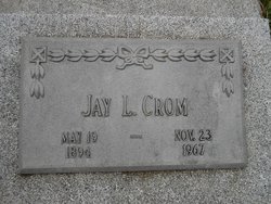
| Birth | : | 19 May 1894 Swanton, Saline County, Nebraska, USA |
| Death | : | 23 Nov 1967 Pawnee City, Pawnee County, Nebraska, USA |
| Burial | : | Holy Martyrs Catholic Cemetery, Bradford West Gwillimbury, Simcoe County, Canada |
| Coordinate | : | 44.1328600, -79.5989500 |
| Plot | : | West 211-5 |
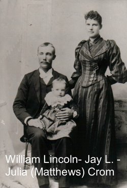
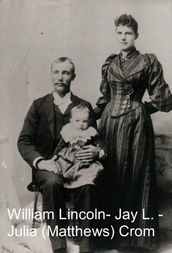
| Description | : | PAWNEE REPUBLICAN (Pawnee City, Nebraska)-Thursday, November 30, 1967- Page 4. JAY LEROY CROM Jay LeRoy Crom, the son of William Lincoln Crom and Julia Candace Mathews, was born at Swanton, Nebraska, May 19th, 1894. He departed this life at his home in Pawnee City, Nebraska, November 23, 1967, at the age of 73 years, 6 months and 4 days. He spent some of hes early childhood in Indiana while his father was preparing for the ministry in the United Brethren Church. The family returned to southeastern Nebraska where Jay graduated from DuBois High School in 1912. Later he attended... Read More |
frequently asked questions (FAQ):
-
Where is Jay LeRoy Crom's memorial?
Jay LeRoy Crom's memorial is located at: Holy Martyrs Catholic Cemetery, Bradford West Gwillimbury, Simcoe County, Canada.
-
When did Jay LeRoy Crom death?
Jay LeRoy Crom death on 23 Nov 1967 in Pawnee City, Pawnee County, Nebraska, USA
-
Where are the coordinates of the Jay LeRoy Crom's memorial?
Latitude: 44.1328600
Longitude: -79.5989500
Family Members:
Parent
Spouse
Children
Flowers:
Nearby Cemetories:
1. Holy Martyrs Catholic Cemetery
Bradford West Gwillimbury, Simcoe County, Canada
Coordinate: 44.1328600, -79.5989500
2. McGann's Cemetery
Bradford West Gwillimbury, Simcoe County, Canada
Coordinate: 44.1326800, -79.5985200
3. Mount Pleasant Cemetery
Bradford, Simcoe County, Canada
Coordinate: 44.1464700, -79.5725500
4. Christ Church Anglican Cemetery
Bradford, Simcoe County, Canada
Coordinate: 44.1036600, -79.6133400
5. Coulsons Hill Cemetery
Coulson's Hill, Simcoe County, Canada
Coordinate: 44.1630890, -79.5789740
6. Auld Kirk Cemetery
Bradford, Simcoe County, Canada
Coordinate: 44.0900900, -79.6155000
7. Presbyterian Church Cemetery
Scotch Settlement, Simcoe County, Canada
Coordinate: 44.0765720, -79.6174590
8. Newton Robinson United Church Cemetery
Newton Robinson, Simcoe County, Canada
Coordinate: 44.1262200, -79.6859700
9. Bond Head United Church Cemetery
Bond Head, Simcoe County, Canada
Coordinate: 44.0909615, -79.6683197
10. Law Cemetery
Bradford West Gwillimbury, Simcoe County, Canada
Coordinate: 44.1381530, -79.6904070
11. Zion Cemetery
Fennell, Simcoe County, Canada
Coordinate: 44.2063140, -79.5870850
12. Christ Church Anglican Heritage Cemetery
Holland Landing, York Regional Municipality, Canada
Coordinate: 44.0967400, -79.4893100
13. Saint John's Anglican Church Cemetery
Cookstown, Simcoe County, Canada
Coordinate: 44.1912010, -79.6975470
14. Clement's Cemetery
Innisfil, Simcoe County, Canada
Coordinate: 44.2278760, -79.5920290
15. Dunkerron United Church Cemetery
Dunkerron, Simcoe County, Canada
Coordinate: 44.0406580, -79.6630130
16. Dunkerron Quaker Cemetery
Dunkerron, Simcoe County, Canada
Coordinate: 44.0402650, -79.6648050
17. Ozman Cemetery
New Tecumseth, Simcoe County, Canada
Coordinate: 44.0689550, -79.7137260
18. Queensville Cemetery
Queensville, York Regional Municipality, Canada
Coordinate: 44.1454300, -79.4524800
19. Cookstown United Church Cemetery
Cookstown, Simcoe County, Canada
Coordinate: 44.2057100, -79.7062800
20. Selby Pioneer Cemetery
East Gwillimbury, York Regional Municipality, Canada
Coordinate: 44.1132400, -79.4443900
21. Bethesda Cemetery
Innisfil, Simcoe County, Canada
Coordinate: 44.2331310, -79.6738600
22. Penville Wesleyan Methodist Cemetery
Penville, Simcoe County, Canada
Coordinate: 44.0528160, -79.7119850
23. St. John's Anglican Church Cemetery
Penville, Simcoe County, Canada
Coordinate: 44.0661700, -79.7277300
24. Hicksite Friends Burying Ground
Newmarket, York Regional Municipality, Canada
Coordinate: 44.0545100, -79.4807000

