
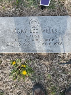
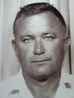
Jerry Lee Wells
| Birth | : | 15 Sep 1939 Natoma, Osborne County, Kansas, USA |
| Death | : | 6 Sep 1966 Independence, Jackson County, Missouri, USA |
| Burial | : | West Bath Cemetery, Bath, Grafton County, USA |
| Coordinate | : | 44.1750930, -71.9865080 |
| Description | : | United States Air Force Airman First Class served in South Vietnam. |
frequently asked questions (FAQ):
-
Where is Jerry Lee Wells's memorial?
Jerry Lee Wells's memorial is located at: West Bath Cemetery, Bath, Grafton County, USA.
-
When did Jerry Lee Wells death?
Jerry Lee Wells death on 6 Sep 1966 in Independence, Jackson County, Missouri, USA
-
Where are the coordinates of the Jerry Lee Wells's memorial?
Latitude: 44.1750930
Longitude: -71.9865080
Family Members:
Parent
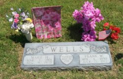
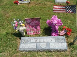
Siblings
Flowers:


Nearby Cemetories:
1. West Bath Cemetery
Bath, Grafton County, USA
Coordinate: 44.1750930, -71.9865080
2. Bath Village Cemetery
Bath, Grafton County, USA
Coordinate: 44.1693500, -71.9617800
3. Pettyboro District Cemetery
Pettyboro, Grafton County, USA
Coordinate: 44.2038310, -71.9620880
4. Carbee Cemetery
Bath, Grafton County, USA
Coordinate: 44.1724640, -72.0466980
5. Pine Grove Cemetery
Woodsville, Grafton County, USA
Coordinate: 44.1380997, -72.0188980
6. Saint Joseph Cemetery
Bath, Grafton County, USA
Coordinate: 44.1803017, -72.0524979
7. Upper Smith Road Cemetery
Bath, Grafton County, USA
Coordinate: 44.2202780, -72.0075000
8. Carbee District Cemetery
Bath, Grafton County, USA
Coordinate: 44.1881040, -72.0521310
9. Swiftwater Cemetery
Bath, Grafton County, USA
Coordinate: 44.1303400, -71.9574300
10. Bedel Cemetery
Bath, Grafton County, USA
Coordinate: 44.2075000, -72.0455560
11. Wells River Cemetery
Wells River, Orange County, USA
Coordinate: 44.1535988, -72.0547028
12. Grove Hill Cemetery
Lisbon, Grafton County, USA
Coordinate: 44.2108002, -71.9094009
13. Moulton Hill Cemetery
Lyman, Grafton County, USA
Coordinate: 44.2457400, -71.9862900
14. Manchester Family Cemetery
Ryegate, Caledonia County, USA
Coordinate: 44.2153625, -72.0713120
15. Landaff Center Cemetery
Landaff, Grafton County, USA
Coordinate: 44.1739860, -71.8847040
16. Boltonville Cemetery
Boltonville, Orange County, USA
Coordinate: 44.1575012, -72.0877991
17. Horse Meadow Cemetery
North Haverhill, Grafton County, USA
Coordinate: 44.1068880, -72.0405500
18. Old Scotch Cemetery
Ryegate, Caledonia County, USA
Coordinate: 44.1969000, -72.0928600
19. Horse Meadow Annex Cemetery
North Haverhill, Grafton County, USA
Coordinate: 44.1056820, -72.0408260
20. Parker Hill Cemetery
Lyman, Grafton County, USA
Coordinate: 44.2582400, -71.9458800
21. Monroe Village Cemetery
Monroe, Grafton County, USA
Coordinate: 44.2558400, -72.0427900
22. Blue Mountain Cemetery
Ryegate Corner, Caledonia County, USA
Coordinate: 44.2081000, -72.1058700
23. West Cemetery
Benton, Grafton County, USA
Coordinate: 44.1033700, -71.9014000
24. Salmon Hole Cemetery
Lisbon, Grafton County, USA
Coordinate: 44.2359600, -71.8848200