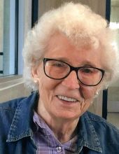
Jessie Lee Pryor Redd
| Birth | : | 6 Feb 1926 McCreary, Garrard County, Kentucky, USA |
| Death | : | 28 Mar 2022 La Junta, Otero County, Colorado, USA |
| Burial | : | Fort Lyon National Cemetery, Fort Lyon, Bent County, USA |
| Coordinate | : | 38.0847015, -103.1288986 |
| Plot | : | SECTION J ROW 13 SITE J |
| Description | : | Jessie Lee Redd, 96, was born February 6, 1926, in Borthella, Kentucky to N.A. & Callie (Ramsey) Pryor. She graduated from the 8th grade there. Jessie married Ralph Allen Bailey on July 24, 1943; he passed away in 1962. She married Bob Roberts in 1964; he passed away a few years later; she married the love of her life Robert Eldon Redd; he preceded her in death. Jessie was never afraid of hard work. Throughout her life Jessie worked as a waitress, cook, worked at the turkey factory and the pickle plant, picked cotton and bar tended. To... Read More |
frequently asked questions (FAQ):
-
Where is Jessie Lee Pryor Redd's memorial?
Jessie Lee Pryor Redd's memorial is located at: Fort Lyon National Cemetery, Fort Lyon, Bent County, USA.
-
When did Jessie Lee Pryor Redd death?
Jessie Lee Pryor Redd death on 28 Mar 2022 in La Junta, Otero County, Colorado, USA
-
Where are the coordinates of the Jessie Lee Pryor Redd's memorial?
Latitude: 38.0847015
Longitude: -103.1288986
Family Members:
Flowers:
Nearby Cemetories:
1. Fort Lyon National Cemetery
Fort Lyon, Bent County, USA
Coordinate: 38.0847015, -103.1288986
2. Fort Lyon Post Cemetery
Bent County, USA
Coordinate: 38.0427000, -103.0757000
3. Boggsville National Historic Site Grounds
Boggsville, Bent County, USA
Coordinate: 38.0425130, -103.2102730
4. Las Animas Cemetery
Las Animas, Bent County, USA
Coordinate: 38.0424995, -103.2174988
5. Union Valley Cemetery
Hasty, Bent County, USA
Coordinate: 38.0960999, -102.9574966
6. Indian Rock Cemetery
Bent County, USA
Coordinate: 37.9550018, -102.9630966
7. Home Cemetery
McClave, Bent County, USA
Coordinate: 38.1218987, -102.8497009
8. Bents Old Fort Cemetery
La Junta, Otero County, USA
Coordinate: 38.0416000, -103.4297000
9. Saint Paul’s Lutheran Cemetery
Otero County, USA
Coordinate: 38.0342000, -103.4542000
10. East Holbrook Mennonite Cemetery
Cheraw, Otero County, USA
Coordinate: 38.1101837, -103.4729767
11. Little Kansas Cemetery
Bent County, USA
Coordinate: 37.9399986, -102.8274994
12. Arlington Cemetery
Arlington, Kiowa County, USA
Coordinate: 38.3232994, -103.3597031
13. Hight Cemetery
Bent County, USA
Coordinate: 38.0264015, -102.7508011
14. Wiley Cemetery
Bent County, USA
Coordinate: 38.1688995, -102.7422028
15. Bethel Cemetery
Bent County, USA
Coordinate: 37.7888985, -102.9664001
16. Holbrook Cemetery
Otero County, USA
Coordinate: 38.0842018, -103.5432968
17. Saint Andrews Episcopal Church Columbarium
La Junta, Otero County, USA
Coordinate: 37.9809000, -103.5455000
18. Fairview Cemetery
La Junta, Otero County, USA
Coordinate: 37.9873000, -103.5607000
19. Calvary Cemetery
La Junta, Otero County, USA
Coordinate: 37.9832000, -103.5622000
20. Haswell Cemetery
Haswell, Kiowa County, USA
Coordinate: 38.4472000, -103.1726000
21. Ormega Cemetery
La Junta, Otero County, USA
Coordinate: 37.9684000, -103.5770000
22. Crawford Cemetery
Prowers County, USA
Coordinate: 38.1239014, -102.6585999
23. Pruett Cemetery
Bent County, USA
Coordinate: 37.7172012, -103.2897034
24. Riverside Cemetery
Lamar, Prowers County, USA
Coordinate: 38.0932999, -102.6072006


