


Jessie Mary Mitchell Dunkin - Ellis
| Birth | : | 6 Jul 1911 Elm Store, Randolph County, Arkansas, USA |
| Death | : | 23 Nov 1987 Willow Springs, Howell County, Missouri, USA |
| Burial | : | Myrtle Cemetery, Myrtle, Oregon County, USA |
| Coordinate | : | 36.5133900, -91.2664300 |
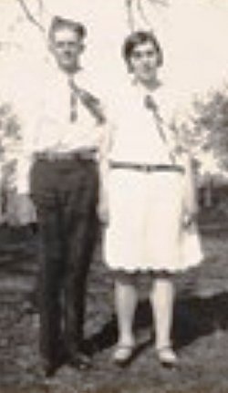
| Description | : | JESSIE MARY MITCHELL was born 06 Jul 1911 in Randolph County, Arkansas, to Bedford Forrest and Martha Missouri 'Zue' Brewer Mitchell. Jessie married CHARLES RAYMOND DUNKIN 20 Aug 1925 in Alton, Oregon County, Missouri, son of JESSE DUNKIN and NAOMI GOINS. He was born 28 Aug 1908 in Myrtle, Oregon County, Missouri. Child from this union: LINDA JAN DUNKIN, born 31 Jan 1947, Missouri. Linda married GENE RHINESS in Liberal, Seward County, Kansas. Linda went to her rest 23 Aug 1974 in Valley Center, Sedgwick County, Kansas. |
frequently asked questions (FAQ):
-
Where is Jessie Mary Mitchell Dunkin - Ellis's memorial?
Jessie Mary Mitchell Dunkin - Ellis's memorial is located at: Myrtle Cemetery, Myrtle, Oregon County, USA.
-
When did Jessie Mary Mitchell Dunkin - Ellis death?
Jessie Mary Mitchell Dunkin - Ellis death on 23 Nov 1987 in Willow Springs, Howell County, Missouri, USA
-
Where are the coordinates of the Jessie Mary Mitchell Dunkin - Ellis's memorial?
Latitude: 36.5133900
Longitude: -91.2664300
Family Members:
Parent
Spouse
Siblings
Children


Nearby Cemetories:
1. Myrtle Cemetery
Myrtle, Oregon County, USA
Coordinate: 36.5133900, -91.2664300
2. Church of God Cemetery
Oregon County, USA
Coordinate: 36.5023500, -91.2580200
3. Byrd Cemetery
Myrtle, Oregon County, USA
Coordinate: 36.5186005, -91.3143997
4. Crass Homestead
Myrtle, Oregon County, USA
Coordinate: 36.5359695, -91.3084671
5. Old Elmore Thomas field
Billmore, Oregon County, USA
Coordinate: 36.5237770, -91.1980250
6. Spring Valley Cemetery
Billmore, Oregon County, USA
Coordinate: 36.5324670, -91.2003420
7. Guiteau-Risner Cemetery
Guiteau, Oregon County, USA
Coordinate: 36.5588074, -91.3156128
8. Walnut Grove Cemetery
Elm Store, Randolph County, USA
Coordinate: 36.4914017, -91.1967010
9. O'Neal
Billmore, Oregon County, USA
Coordinate: 36.5712170, -91.2415410
10. Cotton Creek Cemetery
Jobe, Oregon County, USA
Coordinate: 36.5844002, -91.2652969
11. John Brown Cemetery
Jobe, Oregon County, USA
Coordinate: 36.5812111, -91.2953568
12. James Cemetery
Randolph County, USA
Coordinate: 36.4660988, -91.3435974
13. Old Jobe Cemetery
Jobe, Oregon County, USA
Coordinate: 36.5917015, -91.2517014
14. Mount Carmel Cemetery
Calm, Oregon County, USA
Coordinate: 36.5106010, -91.1643982
15. Taylor Cemetery
Ravenden Springs, Randolph County, USA
Coordinate: 36.4468994, -91.3293991
16. Garfield Cemetery
Garfield, Oregon County, USA
Coordinate: 36.5844400, -91.3253400
17. Mosely Cemetery
Randolph County, USA
Coordinate: 36.4460983, -91.1975021
18. Davis Cemetery
Sharp County, USA
Coordinate: 36.4606018, -91.3574982
19. Reynolds Cemetery
Elm Store, Randolph County, USA
Coordinate: 36.4491997, -91.1860962
20. Pigman Mound Archeological Site
Calm, Oregon County, USA
Coordinate: 36.5717100, -91.1784800
21. Stubblefield Cemetery
Dalton, Randolph County, USA
Coordinate: 36.4597015, -91.1718979
22. Bellah Cemetery
Ravenden Springs, Randolph County, USA
Coordinate: 36.4207993, -91.2825012
23. Arytown Cemetery
Arytown, Oregon County, USA
Coordinate: 36.5539513, -91.3795776
24. Liberty Cemetery
Calm, Oregon County, USA
Coordinate: 36.5586500, -91.1549600