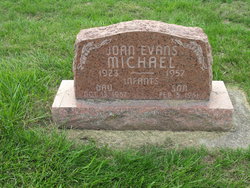
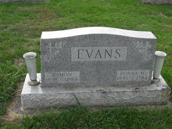
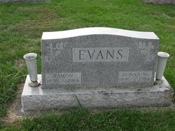
Joan Evans Michael
| Birth | : | 12 Aug 1923 Lima, Allen County, Ohio, USA |
| Death | : | 14 Oct 1957 Lima, Allen County, Ohio, USA |
| Burial | : | Holy Cross Cemetery, Douglas, Ward County, USA |
| Coordinate | : | 47.8622730, -101.4986600 |
| Plot | : | Section H, Row 1 |
frequently asked questions (FAQ):
-
Where is Joan Evans Michael's memorial?
Joan Evans Michael's memorial is located at: Holy Cross Cemetery, Douglas, Ward County, USA.
-
When did Joan Evans Michael death?
Joan Evans Michael death on 14 Oct 1957 in Lima, Allen County, Ohio, USA
-
Where are the coordinates of the Joan Evans Michael's memorial?
Latitude: 47.8622730
Longitude: -101.4986600
Family Members:
Parent
Spouse
Children
Flowers:
Nearby Cemetories:
1. Trinity Lutheran Cemetery
Douglas, Ward County, USA
Coordinate: 47.8626200, -101.4973700
2. Douglas City Cemetery
Douglas, Ward County, USA
Coordinate: 47.8610600, -101.4975100
3. Spring Lake Cemetery
Douglas, Ward County, USA
Coordinate: 47.9283610, -101.4225830
4. Saint Pauls Lutheran Cemetery
Douglas Township, McLean County, USA
Coordinate: 47.7476349, -101.4856491
5. Rosehill Cemetery
Ryder, Ward County, USA
Coordinate: 47.9266600, -101.6706500
6. First Baptist Cemetery
Ward County, USA
Coordinate: 47.8484612, -101.2989349
7. Max City Cemetery Old
Max, McLean County, USA
Coordinate: 47.8268088, -101.3014727
8. Evangelical Lutheran Cemetery
Max, McLean County, USA
Coordinate: 47.8268000, -101.3000000
9. Max City Cemetery
Max, McLean County, USA
Coordinate: 47.8127100, -101.2935300
10. Clifton Cemetery
McLean County, USA
Coordinate: 47.7317009, -101.6235962
11. Early Settlers Cemetery
Ward County, USA
Coordinate: 48.0229301, -101.5136490
12. Immaculate Conception Cemetery
Max, McLean County, USA
Coordinate: 47.8177986, -101.2613983
13. Zion Lutheran Cemetery
Max, McLean County, USA
Coordinate: 47.7653999, -101.2937622
14. Anna Township Cemetery
Makoti, Ward County, USA
Coordinate: 48.0199410, -101.6152740
15. Gasman Township Cemetery
South Prairie, Ward County, USA
Coordinate: 47.9795227, -101.2927475
16. Hiddenwood Cemetery
McLean County, USA
Coordinate: 47.8330994, -101.7743988
17. Zion Lutheran Cemetery
South Prairie, Ward County, USA
Coordinate: 48.0524107, -101.5223840
18. Garrison Cemetery
Garrison, McLean County, USA
Coordinate: 47.6650000, -101.4201000
19. Witham Farm Cemetery
Freedom Township, Ward County, USA
Coordinate: 48.0525950, -101.3623800
20. Fron Lutheran Cemetery
South Prairie, Ward County, USA
Coordinate: 48.0660638, -101.4143014
21. Rose Valley Cemetery
South Prairie, Ward County, USA
Coordinate: 48.0527000, -101.3554993
22. Saint Peter Cemetery
Emmet, McLean County, USA
Coordinate: 47.6742020, -101.6510010
23. Kloestitz German Cemetery
McLean County, USA
Coordinate: 47.6739490, -101.3461250
24. Hope Lutheran Cemetery
Makoti, Ward County, USA
Coordinate: 47.9637070, -101.7867420


