John Amsden II
| Birth | : | Nov 1686 Deerfield, Franklin County, Massachusetts, USA |
| Death | : | 3 Jul 1742 Cheapside, Franklin County, Massachusetts, USA |
| Burial | : | Jasper Workman Cemetery, Bald Knob, Boone County, USA |
| Coordinate | : | 37.8659400, -81.6395300 |
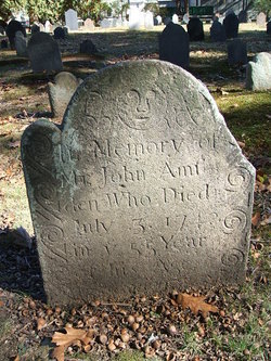
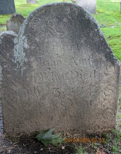
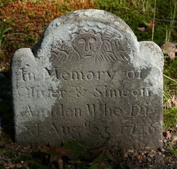
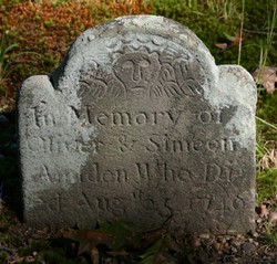
| Inscription | : | "In memory of/ Mr. John Amsden/ who died/ July 2, 1742/ in the 55th year/ of his age." |
| Description | : | John Amsden (II) was the son of John Amsden and Elizabeth ?. He was the husband of Mary Cowles and the father of 12: John (III), Isaac, Elizabeth, Violet (who married Cap't Jonathan Bardwell), Oliver, Eunice [died young], Elisha, Mary, Simeon, Eunice and Asahel. John Amsden II died of drowning. |
frequently asked questions (FAQ):
-
Where is John Amsden II's memorial?
John Amsden II's memorial is located at: Jasper Workman Cemetery, Bald Knob, Boone County, USA.
-
When did John Amsden II death?
John Amsden II death on 3 Jul 1742 in Cheapside, Franklin County, Massachusetts, USA
-
Where are the coordinates of the John Amsden II's memorial?
Latitude: 37.8659400
Longitude: -81.6395300
Family Members:
Spouse
Children
Flowers:
Nearby Cemetories:
1. Jasper Workman Cemetery
Bald Knob, Boone County, USA
Coordinate: 37.8659400, -81.6395300
2. Old Workman Cemetery
Bald Knob, Boone County, USA
Coordinate: 37.8656777, -81.6383830
3. Jarrells Branch Cemetery
Bald Knob, Boone County, USA
Coordinate: 37.8763870, -81.6420740
4. Hatfield Cemetery
Barrett, Boone County, USA
Coordinate: 37.8866200, -81.6640900
5. Cook Mountain Cemetery
Lindytown, Boone County, USA
Coordinate: 37.8961200, -81.6144100
6. Lewis Jarrell Cemetery
Boone County, USA
Coordinate: 37.9077988, -81.5942001
7. Bailey Cemetery
Boone County, USA
Coordinate: 37.8830986, -81.5633011
8. Daniels Cemetery
Logan County, USA
Coordinate: 37.7974450, -81.6295810
9. Asbury Cemetery
Boone County, USA
Coordinate: 37.8967018, -81.5597000
10. Green Cemetery
Bandytown, Boone County, USA
Coordinate: 37.9414810, -81.6420470
11. Noah White Cemetery
Bim, Boone County, USA
Coordinate: 37.9296430, -81.6978040
12. Harvey-Toler Cemetery
Boone County, USA
Coordinate: 37.8043840, -81.5716680
13. Edwight Cemetery
Raleigh County, USA
Coordinate: 37.8820350, -81.5361500
14. Mid Ferrell Cemetery
Bandytown, Boone County, USA
Coordinate: 37.9491997, -81.6530991
15. Absolom Pettry Cemetery
Edwight, Raleigh County, USA
Coordinate: 37.8832200, -81.5345200
16. Jarrells Cemetery
Raleigh County, USA
Coordinate: 37.9272003, -81.5500031
17. Stark Cemetery
Clothier, Boone County, USA
Coordinate: 37.9120130, -81.7435540
18. Asbury Cemetery
Boone County, USA
Coordinate: 37.9144096, -81.5370941
19. Toler Family Cemetery
Cyclone, Wyoming County, USA
Coordinate: 37.7648300, -81.6885000
20. Brown Cemetery
Cyclone, Wyoming County, USA
Coordinate: 37.7518670, -81.6488260
21. Whites Branch Cemetery
Gordon, Boone County, USA
Coordinate: 37.9769630, -81.7006530
22. Bias-Pauley Family Cemetery
Clothier, Boone County, USA
Coordinate: 37.9319000, -81.7728000
23. Peach Tree Road Family Cemetery
Dry Creek, Raleigh County, USA
Coordinate: 37.8550700, -81.4777200
24. Jarrell Cemetery
Raleigh County, USA
Coordinate: 37.8863983, -81.4772034

