
| Birth | : | 24 Nov 1876 Aurora, Cloud County, Kansas, USA |
| Death | : | 8 Jan 1962 Concordia, Cloud County, Kansas, USA |
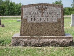
| Burial | : | Saint Peters Cemetery, Aurora, Cloud County, USA |
| Coordinate | : | 39.4763985, -97.5180969 |
| Plot | : | Row 37 South Side |
| Description | : | The Kansan – Jan. 11, 1962 John B. A. Hebert, lifetime resident of Cloud County, died at St. Joseph's hospital early Monday morning, where he had been a patient for the past nine days. He was 85 years old. Mr. Hebert was born November 24, 1876 at Aurora, Kansas, the son of Mr. and Mrs. Delphin Hebert. He lived and farmed in the Aurora community until 1939, when he retired and moved to Concordia. For the past three years, he had made his home at St. Ann's Home. He was a member of Our Lady of Perpetual Help Catholic... Read More |
frequently asked questions (FAQ):
-
Where is John Baptist Alfred Hebert's memorial?
John Baptist Alfred Hebert's memorial is located at: Saint Peters Cemetery, Aurora, Cloud County, USA.
-
When did John Baptist Alfred Hebert death?
John Baptist Alfred Hebert death on 8 Jan 1962 in Concordia, Cloud County, Kansas, USA
-
Where are the coordinates of the John Baptist Alfred Hebert's memorial?
Latitude: 39.4763985
Longitude: -97.5180969
Family Members:
Parent

Spouse
Siblings
Children
Flowers:


Nearby Cemetories:
1. Saint Peters Cemetery
Aurora, Cloud County, USA
Coordinate: 39.4763985, -97.5180969
2. Princeville Cemetery
Aurora, Cloud County, USA
Coordinate: 39.4672012, -97.5010986
3. Green Mound Cemetery
Rice, Cloud County, USA
Coordinate: 39.5248450, -97.5081630
4. Nelson Cemetery
Rice, Cloud County, USA
Coordinate: 39.5257988, -97.5410995
5. Sulphur Springs Cemetery
Aurora, Cloud County, USA
Coordinate: 39.4086610, -97.4986840
6. Pleasant View Cemetery
Ames, Cloud County, USA
Coordinate: 39.5346985, -97.4431000
7. French Presbyterian Church Cemetery
Cloud County, USA
Coordinate: 39.4395200, -97.4148290
8. Enterprise Cemetery
Cloud County, USA
Coordinate: 39.4230995, -97.6106033
9. Rice Cemetery
Rice, Cloud County, USA
Coordinate: 39.5614014, -97.5552979
10. Pleasant Hill Cemetery
Huscher, Cloud County, USA
Coordinate: 39.5093994, -97.6292038
11. Saint Joseph Cemetery
Saint Joseph, Cloud County, USA
Coordinate: 39.5074941, -97.4022328
12. Walnut Grove Cemetery
Cloud County, USA
Coordinate: 39.5699997, -97.4993973
13. Kindel Cemetery
Center Township, Cloud County, USA
Coordinate: 39.4519005, -97.6464005
14. Cedar Grove Cemetery
Clyde, Cloud County, USA
Coordinate: 39.5494003, -97.4056015
15. Oakland Union Cemetery
Miltonvale, Cloud County, USA
Coordinate: 39.3647003, -97.5824966
16. Smith Grave
Miltonvale, Cloud County, USA
Coordinate: 39.3645300, -97.4308700
17. Iwacura Cemetery
Morganville, Clay County, USA
Coordinate: 39.4550000, -97.3510000
18. Saint Concordia Cemetery
Concordia, Cloud County, USA
Coordinate: 39.5593800, -97.6503100
19. Pleasant Hill Cemetery
Concordia, Cloud County, USA
Coordinate: 39.5583000, -97.6639023
20. Nazareth Convent Cemetery
Concordia, Cloud County, USA
Coordinate: 39.5614000, -97.6612000
21. Mount Calvary Cemetery
Clyde, Cloud County, USA
Coordinate: 39.5917015, -97.4143982
22. Mount Hope Cemetery
Clyde, Cloud County, USA
Coordinate: 39.5969009, -97.4116974
23. Hall Cemetery
Cloud County, USA
Coordinate: 39.4455986, -97.7033005
24. Saint Peters Cemetery
Miltonvale, Cloud County, USA
Coordinate: 39.3652350, -97.6483570