
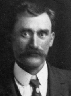

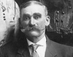
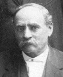
John Bluford Graves
| Birth | : | 25 Oct 1861 Schuyler County, Missouri, USA |
| Death | : | 23 Aug 1961 Lancaster, Schuyler County, Missouri, USA |
| Burial | : | Calvary Cemetery, Winchendon, Worcester County, USA |
| Coordinate | : | 42.6805992, -72.0318985 |
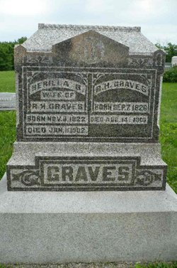
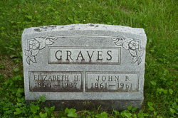
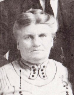
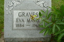
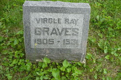
| Description | : | widowed, son of Richard Hardin Graves and Berrilla Burton d. cert 61-031538 ------------ Missouri, Marriage Records, 1805-2002 Name: John B Graves Marriage Date: 23 Apr 1882 Marriage Place: Schuyler, Missouri Registration Place: Schuyler, Missouri Spouse: Lizzie Evans Father: R H Graves Spouse Father: A G Evans Children: Berilla M. (1883 - 1967) Eva Marie (1884 - 1968) Loral (1886 - 1977) Guy Andrew (1888 - 1953) Richard Otis (1891 - 1952) John Ernest (1897 - 1966) Glen (1902 - 1963) Virgle Ray (1905 - 1931) ------------ 1900 Missouri census, Schuyler County John B Graves Head M 39 Missouri Lizzie H Graves Wife F 35 Iowa Eva Graves Daughter F 16... Read More |
frequently asked questions (FAQ):
-
Where is John Bluford Graves's memorial?
John Bluford Graves's memorial is located at: Calvary Cemetery, Winchendon, Worcester County, USA.
-
When did John Bluford Graves death?
John Bluford Graves death on 23 Aug 1961 in Lancaster, Schuyler County, Missouri, USA
-
Where are the coordinates of the John Bluford Graves's memorial?
Latitude: 42.6805992
Longitude: -72.0318985
Family Members:
Parent

Spouse
Siblings
Children
Flowers:


Nearby Cemetories:
1. Riverside Cemetery
Winchendon, Worcester County, USA
Coordinate: 42.6805992, -72.0263977
2. Massachusetts Veterans Memorial Cemetery
Winchendon, Worcester County, USA
Coordinate: 42.6851300, -72.0185200
3. Old Centre Burial Ground
Winchendon, Worcester County, USA
Coordinate: 42.6617012, -72.0366974
4. Robbins Cemetery
Rindge, Cheshire County, USA
Coordinate: 42.7266670, -72.0638890
5. Robbins Burial Ground
Rindge, Cheshire County, USA
Coordinate: 42.7268982, -72.0658035
6. Rand Cemetery
Rindge, Cheshire County, USA
Coordinate: 42.7350006, -72.0582962
7. New Boston Cemetery
Winchendon, Worcester County, USA
Coordinate: 42.6306000, -72.0860977
8. Hillside Cemetery
Rindge, Cheshire County, USA
Coordinate: 42.7463000, -72.0063900
9. Meeting House Cemetery
Rindge, Cheshire County, USA
Coordinate: 42.7501200, -72.0096700
10. Wood Family Cemetery
Rindge, Cheshire County, USA
Coordinate: 42.7457040, -71.9859410
11. Greenlawn Cemetery
Templeton, Worcester County, USA
Coordinate: 42.6124992, -72.0708008
12. Saint Josephs Cemetery
Gardner, Worcester County, USA
Coordinate: 42.5922012, -72.0391998
13. Wilder Cemetery
Rindge, Cheshire County, USA
Coordinate: 42.7395400, -71.9404900
14. Wildwood Cemetery
Gardner, Worcester County, USA
Coordinate: 42.5896988, -72.0306015
15. Fairbanks Cemetery
Ashburnham, Worcester County, USA
Coordinate: 42.6355220, -71.9236710
16. Meetinghouse Hill Cemetery
Ashburnham, Worcester County, USA
Coordinate: 42.6436900, -71.9176100
17. Saint Johns Cemetery
Gardner, Worcester County, USA
Coordinate: 42.5875015, -72.0207977
18. Notre Dame Cemetery
Gardner, Worcester County, USA
Coordinate: 42.5849991, -72.0222015
19. Riverside Cemetery
Royalston, Worcester County, USA
Coordinate: 42.6302986, -72.1453018
20. Jonas Alliene Cemetery
Royalston, Worcester County, USA
Coordinate: 42.6748790, -72.1656520
21. Cathedral of the Pines Cemetery
Rindge, Cheshire County, USA
Coordinate: 42.7749900, -71.9901800
22. New Cemetery
Ashburnham, Worcester County, USA
Coordinate: 42.6318400, -71.9137400
23. Crystal Lake Cemetery
Gardner, Worcester County, USA
Coordinate: 42.5833015, -71.9957962
24. Lawrence Brook Cemetery
Royalston, Worcester County, USA
Coordinate: 42.6693993, -72.1707993