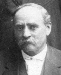
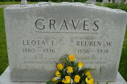
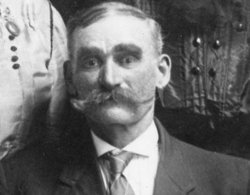
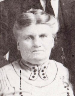
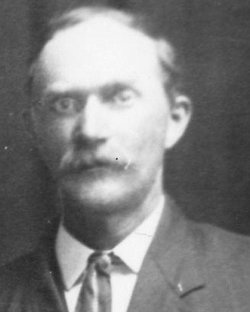
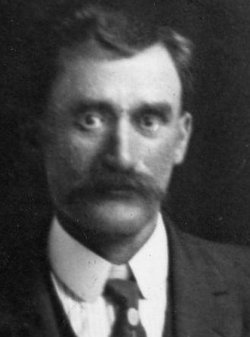
Reuben Walker “Rube” Graves
| Birth | : | 26 Feb 1856 Schuyler County, Missouri, USA |
| Death | : | 19 May 1938 Kirksville, Adair County, Missouri, USA |
| Burial | : | Calvary Cemetery, Winchendon, Worcester County, USA |
| Coordinate | : | 42.6805992, -72.0318985 |
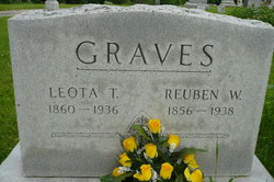
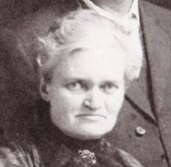
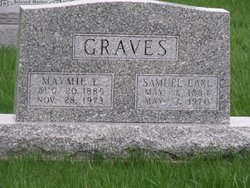
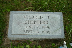
| Description | : | widowed, son of Hardin Graves and Brilla Myrtle, husband of Leota Graves d. cert 17554 ------------ Reuben W. Graves, son of Hardin and Berilla Graves, was born on his father's farm, north of Lancaster, Missouri, on February 26, 1856. He died on May 19, 1938, aged 82 years, 2 months, 23 days. On January 20, 1878, he was married to Leota Temple Sizemore. To this union three children were born, viz: Mrs. Mildred Temple Shepherd of Lancaster, Missouri and Samuel E. Graves and Reuben H. Graves, both of Kansas City, Missouri. All survive him. In his early married life, he lived for a short time... Read More |
frequently asked questions (FAQ):
-
Where is Reuben Walker “Rube” Graves's memorial?
Reuben Walker “Rube” Graves's memorial is located at: Calvary Cemetery, Winchendon, Worcester County, USA.
-
When did Reuben Walker “Rube” Graves death?
Reuben Walker “Rube” Graves death on 19 May 1938 in Kirksville, Adair County, Missouri, USA
-
Where are the coordinates of the Reuben Walker “Rube” Graves's memorial?
Latitude: 42.6805992
Longitude: -72.0318985
Family Members:
Parent
Spouse
Siblings
Children
Flowers:
Nearby Cemetories:
1. Riverside Cemetery
Winchendon, Worcester County, USA
Coordinate: 42.6805992, -72.0263977
2. Massachusetts Veterans Memorial Cemetery
Winchendon, Worcester County, USA
Coordinate: 42.6851300, -72.0185200
3. Old Centre Burial Ground
Winchendon, Worcester County, USA
Coordinate: 42.6617012, -72.0366974
4. Robbins Cemetery
Rindge, Cheshire County, USA
Coordinate: 42.7266670, -72.0638890
5. Robbins Burial Ground
Rindge, Cheshire County, USA
Coordinate: 42.7268982, -72.0658035
6. Rand Cemetery
Rindge, Cheshire County, USA
Coordinate: 42.7350006, -72.0582962
7. New Boston Cemetery
Winchendon, Worcester County, USA
Coordinate: 42.6306000, -72.0860977
8. Hillside Cemetery
Rindge, Cheshire County, USA
Coordinate: 42.7463000, -72.0063900
9. Meeting House Cemetery
Rindge, Cheshire County, USA
Coordinate: 42.7501200, -72.0096700
10. Wood Family Cemetery
Rindge, Cheshire County, USA
Coordinate: 42.7457040, -71.9859410
11. Greenlawn Cemetery
Templeton, Worcester County, USA
Coordinate: 42.6124992, -72.0708008
12. Saint Josephs Cemetery
Gardner, Worcester County, USA
Coordinate: 42.5922012, -72.0391998
13. Wilder Cemetery
Rindge, Cheshire County, USA
Coordinate: 42.7395400, -71.9404900
14. Wildwood Cemetery
Gardner, Worcester County, USA
Coordinate: 42.5896988, -72.0306015
15. Fairbanks Cemetery
Ashburnham, Worcester County, USA
Coordinate: 42.6355220, -71.9236710
16. Meetinghouse Hill Cemetery
Ashburnham, Worcester County, USA
Coordinate: 42.6436900, -71.9176100
17. Saint Johns Cemetery
Gardner, Worcester County, USA
Coordinate: 42.5875015, -72.0207977
18. Notre Dame Cemetery
Gardner, Worcester County, USA
Coordinate: 42.5849991, -72.0222015
19. Riverside Cemetery
Royalston, Worcester County, USA
Coordinate: 42.6302986, -72.1453018
20. Jonas Alliene Cemetery
Royalston, Worcester County, USA
Coordinate: 42.6748790, -72.1656520
21. Cathedral of the Pines Cemetery
Rindge, Cheshire County, USA
Coordinate: 42.7749900, -71.9901800
22. New Cemetery
Ashburnham, Worcester County, USA
Coordinate: 42.6318400, -71.9137400
23. Crystal Lake Cemetery
Gardner, Worcester County, USA
Coordinate: 42.5833015, -71.9957962
24. Lawrence Brook Cemetery
Royalston, Worcester County, USA
Coordinate: 42.6693993, -72.1707993

