
| Birth | : | 1 May 1887 |
| Death | : | 31 Jan 1975 |
| Burial | : | Montcalm Cemetery, Enfield Center, Grafton County, USA |
| Coordinate | : | 43.6019600, -72.1247600 |
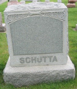
| Inscription | : | Schutta John C. 1887-1975 |
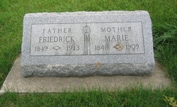
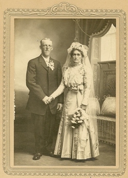
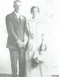
| Description | : | Funeral services were held Monday, February 3, 1975, at 10:30 a.m. at St. Paul Lutheran Church, Postville, for John Schutta, who died January 31, 1975 at Community Memorial Hospital in Postville. The Rev. Norman Ullestad officiated. Interment was in the Frankville Cemetery. Named John Carl Schutta, he was born on a farm near Gunder on May 1, 1887, the son of Frederich and Marie Hoth Schutta. He was baptized into St. Paul Lutheran Church, Monona on June 19, 1887 and was confirmed into St. Paul Lutheran Church, Postville on March 23, 1902 where he remained a member. On October 7, 1915 he... Read More |
frequently asked questions (FAQ):
-
Where is John C Schutta's memorial?
John C Schutta's memorial is located at: Montcalm Cemetery, Enfield Center, Grafton County, USA.
-
When did John C Schutta death?
John C Schutta death on 31 Jan 1975 in
-
Where are the coordinates of the John C Schutta's memorial?
Latitude: 43.6019600
Longitude: -72.1247600
Family Members:
Parent
Spouse

Siblings
Children
Flowers:


Nearby Cemetories:
1. Montcalm Cemetery
Enfield Center, Grafton County, USA
Coordinate: 43.6019600, -72.1247600
2. Shaker Cemetery
Enfield, Grafton County, USA
Coordinate: 43.6093310, -72.1349760
3. Enfield Center Cemetery
Enfield Center, Grafton County, USA
Coordinate: 43.5918700, -72.1101700
4. Countryside Cemetery
Grafton County, USA
Coordinate: 43.6131927, -72.1065096
5. Country Side Cemetery
Enfield, Grafton County, USA
Coordinate: 43.6147400, -72.1060990
6. Lockehaven Cemetery
Enfield, Grafton County, USA
Coordinate: 43.6119440, -72.0977780
7. Town Cemetery
Enfield, Grafton County, USA
Coordinate: 43.6119170, -72.0972360
8. Old Cemetery
Enfield, Grafton County, USA
Coordinate: 43.6238890, -72.1186110
9. Shaker Cemetery
Enfield, Grafton County, USA
Coordinate: 43.6216540, -72.1468630
10. La Salette Cemetery
Enfield, Grafton County, USA
Coordinate: 43.6213700, -72.1479100
11. George Hill Cemetery
Enfield Center, Grafton County, USA
Coordinate: 43.5801400, -72.0906600
12. Butman Cemetery
Enfield, Grafton County, USA
Coordinate: 43.5952400, -72.0795610
13. Purmort Cemetery
Enfield, Grafton County, USA
Coordinate: 43.5942000, -72.1750400
14. Follensbee Cemetery
Enfield, Grafton County, USA
Coordinate: 43.6173100, -72.1802600
15. Oak Grove Cemetery
Enfield, Grafton County, USA
Coordinate: 43.6408860, -72.1501450
16. Paddleford Cemetery
Enfield, Grafton County, USA
Coordinate: 43.6418500, -72.1500710
17. Lakeview Cemetery
Enfield, Grafton County, USA
Coordinate: 43.6419144, -72.1524734
18. East Lebanon Cemetery
Lebanon, Grafton County, USA
Coordinate: 43.6419920, -72.1534820
19. Scofield Cemetery
Canaan, Grafton County, USA
Coordinate: 43.6319440, -72.0777780
20. Choate Cemetery
Enfield Center, Grafton County, USA
Coordinate: 43.5665700, -72.0763900
21. West Canaan Cemetery
West Canaan, Grafton County, USA
Coordinate: 43.6455700, -72.0911800
22. Morse Cemetery
Enfield, Grafton County, USA
Coordinate: 43.6060400, -72.0539100
23. Leavitt Hill Cemetery
Grantham, Sullivan County, USA
Coordinate: 43.5574130, -72.1654530
24. Leavitt Hill Cemetery
North Grantham, Sullivan County, USA
Coordinate: 43.5547200, -72.1638900