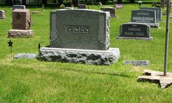
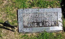
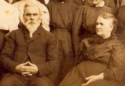
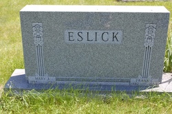
John Danforth Eslick
| Birth | : | 9 Feb 1842 Forsyth, Taney County, Missouri, USA |
| Death | : | 6 Aug 1925 Iowa, USA |
| Burial | : | McGuire Bend Cemetery, Dayton, Webster County, USA |
| Coordinate | : | 42.3410000, -93.9880000 |
| Description | : | U.S., Civil War Soldier Records and Profiles, 1861-1865 about John D Eslick Name: John D Eslick Residence: Iowa Age at enlistment: 20 Enlistment Date: 4 Jan 1862 Rank at enlistment: Private State Served: Iowa Survived the War?: Yes Service Record: Enlisted in Company D, Iowa 16th Infantry Regiment on 15 Jan 1864.Mustered out on 19 Jul 1865 at Louisville, KY. Birth Date: abt 1842 Sources: Roster & Record of Iowa Soldiers in the War of Rebellion Sixteenth Regiment Iowa Volunteers: Roster |
frequently asked questions (FAQ):
-
Where is John Danforth Eslick's memorial?
John Danforth Eslick's memorial is located at: McGuire Bend Cemetery, Dayton, Webster County, USA.
-
When did John Danforth Eslick death?
John Danforth Eslick death on 6 Aug 1925 in Iowa, USA
-
Where are the coordinates of the John Danforth Eslick's memorial?
Latitude: 42.3410000
Longitude: -93.9880000
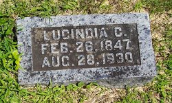
Family Members:
Parent
Spouse
Siblings
Children
Flowers:
Nearby Cemetories:
1. McGuire Bend Cemetery
Dayton, Webster County, USA
Coordinate: 42.3410000, -93.9880000
2. Hartman Cemetery
Lehigh, Webster County, USA
Coordinate: 42.3666397, -93.9835627
3. Vegors Cemetery
Webster County, USA
Coordinate: 42.3177986, -93.9421997
4. Ober and Scott Cemetery
Duncombe, Webster County, USA
Coordinate: 42.3841390, -93.9982856
5. Oak Grove Cemetery
Lehigh, Webster County, USA
Coordinate: 42.3438988, -94.0475006
6. Bass Cemetery
Dayton, Webster County, USA
Coordinate: 42.2966995, -94.0149994
7. Blanchard Cemetery
Webster County, USA
Coordinate: 42.4021988, -93.9997025
8. West Lawn Cemetery
Lehigh, Webster County, USA
Coordinate: 42.3616982, -94.0678024
9. Homer Cemetery
Homer, Hamilton County, USA
Coordinate: 42.3680992, -93.9088974
10. Border Plains Cemetery
Border Plains, Webster County, USA
Coordinate: 42.3917000, -94.0448000
11. Hooks Point Cemetery
Hamilton County, USA
Coordinate: 42.2944530, -93.9199090
12. Oakwood Cemetery
Stratford, Hamilton County, USA
Coordinate: 42.2942009, -93.9182968
13. Neese Cemetery
Homer, Hamilton County, USA
Coordinate: 42.3250000, -93.8935000
14. Nesse Cemetery
Hamilton County, USA
Coordinate: 42.3250008, -93.8933029
15. Washington Cemetery
Duncombe, Webster County, USA
Coordinate: 42.4277992, -93.9916992
16. Dayton Cemetery
Dayton, Webster County, USA
Coordinate: 42.2675000, -94.0755000
17. Hardin Township Cemetery
Hardin Township, Webster County, USA
Coordinate: 42.2411003, -93.9708023
18. Christ the King Catholic Cemetery
Dayton, Webster County, USA
Coordinate: 42.2601929, -94.0727539
19. Otho Cemetery
Otho, Webster County, USA
Coordinate: 42.4025002, -94.1153030
20. Saratoga Cemetery
Stanhope, Hamilton County, USA
Coordinate: 42.3539009, -93.8167038
21. Holaday Creek Cemetery
Webster County, USA
Coordinate: 42.4472008, -94.0886002
22. Washington Township Cemetery
Duncombe, Webster County, USA
Coordinate: 42.4707900, -94.0002000
23. Linn Cemetery
Pilot Mound, Boone County, USA
Coordinate: 42.2045330, -93.9970230
24. South Marion Cemetery
Stratford, Hamilton County, USA
Coordinate: 42.2327995, -93.8735962

