| Birth | : | 24 Apr 1947 Cedar Rapids, Linn County, Iowa, USA |
| Death | : | 1 Jan 2021 Coralville, Johnson County, Iowa, USA |
| Burial | : | Sharon Cemetery, Johnson County, USA |
| Coordinate | : | 41.5402000, -91.6370000 |
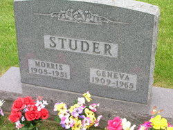
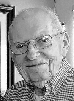
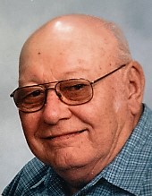
| Description | : | John “Darrel” Studer, 73, of Iowa City, died peacefully on Friday, January 1, 2021 at Windmill Manor in Coralville, IA. At Darrel’s request there will be no services at this time. Burial will be held at a later date at Grout Cemetery in Sharon Center, IA. In lieu of flowers, memorials may be directed to Iowa City Hospice or the American Cancer Society. Darrel was born on April 24, 1947 in Cedar Rapids, Iowa, the son of Morris and Geneva (McCormick) Studer. He married Karen Pewitt on April 28, 1968 in Kalona, IA. Darrel and Karen... Read More |
frequently asked questions (FAQ):
-
Where is John “Darrell” Studer's memorial?
John “Darrell” Studer's memorial is located at: Sharon Cemetery, Johnson County, USA.
-
When did John “Darrell” Studer death?
John “Darrell” Studer death on 1 Jan 2021 in Coralville, Johnson County, Iowa, USA
-
Where are the coordinates of the John “Darrell” Studer's memorial?
Latitude: 41.5402000
Longitude: -91.6370000
Family Members:
Parent
Siblings
Flowers:
Nearby Cemetories:
1. Sharon Cemetery
Johnson County, USA
Coordinate: 41.5402000, -91.6370000
2. Sharon Center Cemetery
Johnson County, USA
Coordinate: 41.5543000, -91.6555000
3. Saint John Lutheran Cemetery
Sharon Center, Johnson County, USA
Coordinate: 41.5542000, -91.6678000
4. Yoder Family Cemetery
Sharon Center, Johnson County, USA
Coordinate: 41.5666832, -91.6460017
5. Fairview Mennonite Cemetery
Johnson County, USA
Coordinate: 41.5396000, -91.6751000
6. Saint Stanislaus Cemetery
Iowa City, Johnson County, USA
Coordinate: 41.5377000, -91.5960000
7. John Helmuth Cemetery
Sharon Center, Johnson County, USA
Coordinate: 41.5583870, -91.6764660
8. Peter Miller Cemetery
Johnson County, USA
Coordinate: 41.5214005, -91.6813965
9. Mentzer Cemetery
Johnson County, USA
Coordinate: 41.5574989, -91.5888977
10. Eash Cemetery
Johnson County, USA
Coordinate: 41.5800018, -91.6519012
11. North Gingerich Sharon Cemetery
Johnson County, USA
Coordinate: 41.5553017, -91.7024994
12. Middleburg Cemetery
Kalona, Washington County, USA
Coordinate: 41.4907990, -91.6613998
13. East Union Mennonite Cemetery
Sharon Center, Johnson County, USA
Coordinate: 41.5258179, -91.7049484
14. Saint Vincent Cemetery
Riverside, Washington County, USA
Coordinate: 41.4874992, -91.6188965
15. Sharon Bethel Cemetery
Williamstown, Johnson County, USA
Coordinate: 41.5558000, -91.7086000
16. Moses P Miller Cemetery
Kalona, Washington County, USA
Coordinate: 41.4929610, -91.6960140
17. Mount Olivet Cemetery
Riverside, Washington County, USA
Coordinate: 41.4864006, -91.5802994
18. Riverside Cemetery
Riverside, Washington County, USA
Coordinate: 41.4869003, -91.5785980
19. Sharon Hill Cemetery
Kalona, Washington County, USA
Coordinate: 41.4928017, -91.7071991
20. Hummer Cemetery
Johnson County, USA
Coordinate: 41.5974998, -91.6941986
21. South Gingerich Mennonite Cemetery
Kalona, Washington County, USA
Coordinate: 41.5076294, -91.7227936
22. Earhart Cemetery
Hills, Johnson County, USA
Coordinate: 41.5547300, -91.5424800
23. Haven Cemetery
Johnson County, USA
Coordinate: 41.5558080, -91.7320500
24. Snider Cemetery
Kalona, Washington County, USA
Coordinate: 41.4997386, -91.7196131


