
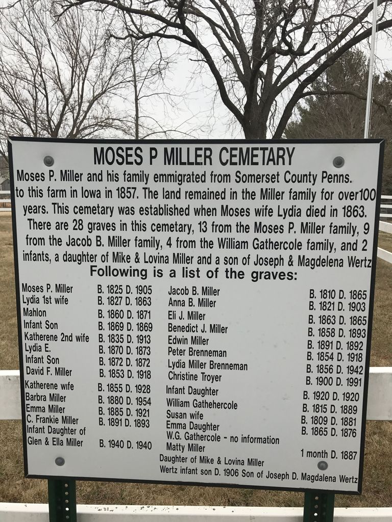
| Memorials | : | 5 |
| Location | : | Kalona, Washington County, USA |
| Coordinate | : | 41.4929610, -91.6960140 |
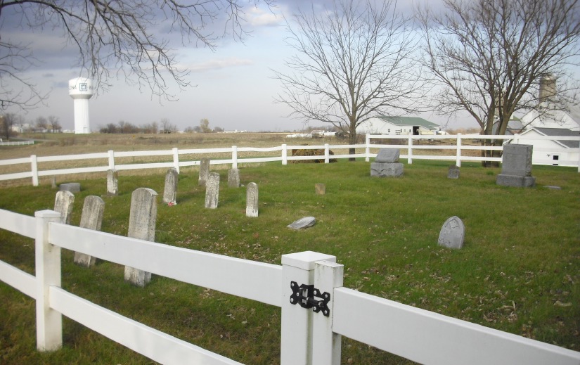
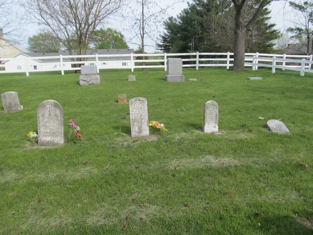
| Description | : | Cemetery is in the town of Kalona, on land that was formerly the Moses P. Miller family farm. Cemetery access easement is on the east side of 1215 12th Place, Kalona, IA. Not to be confused with the Peter Miller Cemetery three miles northeast of Kalona IA, or the Miller Cemetery (Memorial Miller Cemetery) eight miles southwest of Washington, IA. |
frequently asked questions (FAQ):
-
Where is Moses P Miller Cemetery?
Moses P Miller Cemetery is located at Kalona, Washington County ,Iowa ,USA.
-
Moses P Miller Cemetery cemetery's updated grave count on graveviews.com?
5 memorials
-
Where are the coordinates of the Moses P Miller Cemetery?
Latitude: 41.4929610
Longitude: -91.6960140
Nearby Cemetories:
1. Sharon Hill Cemetery
Kalona, Washington County, USA
Coordinate: 41.4928017, -91.7071991
2. Snider Cemetery
Kalona, Washington County, USA
Coordinate: 41.4997386, -91.7196131
3. South Gingerich Mennonite Cemetery
Kalona, Washington County, USA
Coordinate: 41.5076294, -91.7227936
4. Middleburg Cemetery
Kalona, Washington County, USA
Coordinate: 41.4907990, -91.6613998
5. Peter Miller Cemetery
Johnson County, USA
Coordinate: 41.5214005, -91.6813965
6. East Union Mennonite Cemetery
Sharon Center, Johnson County, USA
Coordinate: 41.5258179, -91.7049484
7. Shiloh Nutmeg Cemetery
Kalona, Washington County, USA
Coordinate: 41.4581300, -91.7020800
8. Holy Trinity Cemetery
Richmond, Washington County, USA
Coordinate: 41.4524994, -91.6755981
9. Richmond Cemetery
Kalona, Washington County, USA
Coordinate: 41.4491997, -91.6931000
10. Coffman Cemetery
English River Township, Washington County, USA
Coordinate: 41.4889045, -91.7585030
11. Fairview Mennonite Cemetery
Johnson County, USA
Coordinate: 41.5396000, -91.6751000
12. Brenneman Cemetery
Amish, Johnson County, USA
Coordinate: 41.5166702, -91.7611084
13. Cooper Cemetery
Riverside, Washington County, USA
Coordinate: 41.4623500, -91.6336500
14. Saint Vincent Cemetery
Riverside, Washington County, USA
Coordinate: 41.4874992, -91.6188965
15. North Gingerich Sharon Cemetery
Johnson County, USA
Coordinate: 41.5553017, -91.7024994
16. Sharon Bethel Cemetery
Williamstown, Johnson County, USA
Coordinate: 41.5558000, -91.7086000
17. Sharon Cemetery
Johnson County, USA
Coordinate: 41.5402000, -91.6370000
18. Saint John Lutheran Cemetery
Sharon Center, Johnson County, USA
Coordinate: 41.5542000, -91.6678000
19. John Helmuth Cemetery
Sharon Center, Johnson County, USA
Coordinate: 41.5583870, -91.6764660
20. Haven Cemetery
Johnson County, USA
Coordinate: 41.5558080, -91.7320500
21. Sharon Center Cemetery
Johnson County, USA
Coordinate: 41.5543000, -91.6555000
22. Pleasant Hill Cemetery
Johnson County, USA
Coordinate: 41.5346170, -91.7884060
23. Yoder Family Cemetery
Sharon Center, Johnson County, USA
Coordinate: 41.5666832, -91.6460017
24. Frytown Cemetery
Johnson County, USA
Coordinate: 41.5718000, -91.7355000