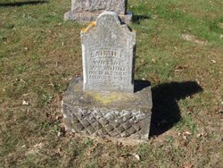
| Birth | : | 13 May 1858 Downing, Schuyler County, Missouri, USA |
| Death | : | 15 May 1935 Larned, Pawnee County, Kansas, USA |
| Burial | : | Larned Cemetery, Larned, Pawnee County, USA |
| Coordinate | : | 38.1861000, -99.1333008 |
| Plot | : | NC 543 |
| Description | : | Husband of Ida E. Huntington and Anna Odell Turner. Son of Rhoda Joseph "Rhody" Peak and Emily Jane Peak ******************************* John F. peak, 77, died yesterday afternoon at 5 o'clock at his home at 123 Toles. He suffered a heart attack Monday, his birthday anniversary, while on his way to his work as janitor of the third ward school. He is survived by his widow; one daughter, Mrs. Eva Copeland of Kansas Ciry, Mo; and four sons, Leonard Peak of Kansas City, Mo, William peak of Portland, OR, Raymond Peak of Salt Lake City, UT and Raleigh Peak of Girard,... Read More |
frequently asked questions (FAQ):
-
Where is John Francis Peak's memorial?
John Francis Peak's memorial is located at: Larned Cemetery, Larned, Pawnee County, USA.
-
When did John Francis Peak death?
John Francis Peak death on 15 May 1935 in Larned, Pawnee County, Kansas, USA
-
Where are the coordinates of the John Francis Peak's memorial?
Latitude: 38.1861000
Longitude: -99.1333008
Family Members:
Parent
Spouse
Siblings
Children
Flowers:
Nearby Cemetories:
1. Larned Cemetery
Larned, Pawnee County, USA
Coordinate: 38.1861000, -99.1333008
2. Larned State Hospital Cemetery
Larned, Pawnee County, USA
Coordinate: 38.1722800, -99.1566200
3. Fort Larned Cemetery
Larned, Pawnee County, USA
Coordinate: 38.1839100, -99.2163200
4. Pleasant Valley Cemetery
Larned, Pawnee County, USA
Coordinate: 38.0718994, -99.0955963
5. Ash Valley Cemetery
Pawnee County, USA
Coordinate: 38.2905998, -99.2174988
6. Pawnee Rock State Historic Site
Pawnee Rock, Barton County, USA
Coordinate: 38.2721800, -98.9815300
7. Pawnee Rock Cemetery
Pawnee Rock, Barton County, USA
Coordinate: 38.2771988, -98.9858017
8. Fertig Cemetery
Pawnee County, USA
Coordinate: 38.1458015, -98.9492035
9. Garfield Cemetery
Garfield, Pawnee County, USA
Coordinate: 38.0738983, -99.2667007
10. Bergthal Mennonite Cemetery
Pawnee Rock, Barton County, USA
Coordinate: 38.3053017, -98.9772034
11. Point View Cemetery
Pawnee County, USA
Coordinate: 38.1306000, -98.9131012
12. Pleasant Ridge Cemetery
Radium, Stafford County, USA
Coordinate: 38.2475014, -98.8758011
13. Peace Lutheran Cemetery
Timken, Rush County, USA
Coordinate: 38.3837600, -99.0330750
14. Rozel Cemetery
Rozel, Pawnee County, USA
Coordinate: 38.2042007, -99.4052963
15. Saint Pauls Lutheran Cemetery
Albert, Barton County, USA
Coordinate: 38.3770000, -99.0005900
16. Belpre Cemetery
Belpre, Edwards County, USA
Coordinate: 37.9528950, -99.1017510
17. Dundee Valley Cemetery
Great Bend, Barton County, USA
Coordinate: 38.3125130, -98.8778980
18. Fitch Family Cemetery
Nettleton, Edwards County, USA
Coordinate: 38.0007540, -99.3256550
19. Wayne Cemetery
Lewis, Edwards County, USA
Coordinate: 37.9550018, -99.2144012
20. Patterson Cemetery
Barton County, USA
Coordinate: 38.4019012, -98.9963989
21. Saint Francis Xavier Cemetery
Seward, Stafford County, USA
Coordinate: 38.2038994, -98.8193970
22. Albert Cemetery
Rush County, USA
Coordinate: 38.4213982, -99.0342026
23. Everett Cemetery
Barton County, USA
Coordinate: 38.3767014, -98.9092026
24. Bohemian Cemetery
Timken, Rush County, USA
Coordinate: 38.4441986, -99.1967010


