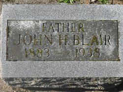
John Henry Blair
| Birth | : | 8 Jul 1883 Kansas, USA |
| Death | : | 13 Nov 1938 Kelso, Cowlitz County, Washington, USA |
| Burial | : | Davids Cemetery, Kettering, Montgomery County, USA |
| Coordinate | : | 39.6789017, -84.1697006 |
| Plot | : | Mt. Brynion Blk 1, Section 99, Space 4 |
| Inscription | : | "Father" |
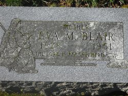
| Description | : | Ostrander Farmer Dies Of Sudden Heart Attack Sunday John Blair, 58, a farmer living near Ostrander, died of a heart attack yesterday as he and a neighbor were gathering wood along Goble Creek, it was reported today. He had been a resident of Ostrander for nearly 20 years. Survivors include the widow, Eva; a son, Dewey of Ostrander; five step-daughters, Mrs. Lissie Holcomb, Mrs. T. C. Russell, Mrs. William Foley, and June, all of Ostrander, and Mrs. Richard Van Ness, Castle Rock; and four step-sons, Leo Marks of Stella,James and Harold Marks and Frank Blair of AOstrander. Funeral services will be held... Read More |
frequently asked questions (FAQ):
-
Where is John Henry Blair's memorial?
John Henry Blair's memorial is located at: Davids Cemetery, Kettering, Montgomery County, USA.
-
When did John Henry Blair death?
John Henry Blair death on 13 Nov 1938 in Kelso, Cowlitz County, Washington, USA
-
Where are the coordinates of the John Henry Blair's memorial?
Latitude: 39.6789017
Longitude: -84.1697006
Family Members:
Flowers:
Nearby Cemetories:
1. Saint Georges Episcopal Church Memorial Garden
Dayton, Montgomery County, USA
Coordinate: 39.6672760, -84.1608950
2. Woodbourne Cemetery
Montgomery County, USA
Coordinate: 39.6588783, -84.1727676
3. Epiphanys Lutheran Memorial Garden
Dayton, Montgomery County, USA
Coordinate: 39.6510760, -84.1548340
4. Zion Cemetery
Moraine, Montgomery County, USA
Coordinate: 39.6931877, -84.2118378
5. Munger Road Cemetery
Centerville, Montgomery County, USA
Coordinate: 39.6556220, -84.2048980
6. Beavertown Cemetery
Beavertown, Montgomery County, USA
Coordinate: 39.6981010, -84.1288986
7. Sugar Creek Baptist Church Cemetery
Centerville, Montgomery County, USA
Coordinate: 39.6367493, -84.1579666
8. Saint Paul's Episcopal Church Columbarium
Oakwood, Montgomery County, USA
Coordinate: 39.7249780, -84.1747480
9. Centerville Cemetery
Centerville, Montgomery County, USA
Coordinate: 39.6307983, -84.1539001
10. Calvary Cemetery
Dayton, Montgomery County, USA
Coordinate: 39.7248993, -84.1979980
11. McLane Cemetery
Beavercreek, Greene County, USA
Coordinate: 39.6735916, -84.1019592
12. Beth Abraham Cemetery
Oakwood, Montgomery County, USA
Coordinate: 39.7291985, -84.1919022
13. Washington Cemetery
Montgomery County, USA
Coordinate: 39.6332000, -84.2060300
14. Riverview Cemetery
Dayton, Montgomery County, USA
Coordinate: 39.7299995, -84.1908035
15. Morgan Cemetery
Kettering, Montgomery County, USA
Coordinate: 39.7033830, -84.1067830
16. Marianist Brothers Cemetery
Dayton, Montgomery County, USA
Coordinate: 39.7385700, -84.1733500
17. Sugar Creek Friends Cemetery
Centerville, Montgomery County, USA
Coordinate: 39.6204681, -84.1393509
18. Woodland Cemetery and Arboretum
Dayton, Montgomery County, USA
Coordinate: 39.7428840, -84.1773210
19. Queen of Heaven Cemetery
Beavercreek, Greene County, USA
Coordinate: 39.7176730, -84.0992720
20. Fallis Pioneer Cemetery
Bellbrook, Greene County, USA
Coordinate: 39.6553690, -84.0881860
21. Old Greencastle Cemetery
Dayton, Montgomery County, USA
Coordinate: 39.7370000, -84.2143900
22. Saint Henrys Cemetery
Dayton, Montgomery County, USA
Coordinate: 39.7450150, -84.1887630
23. Evergreen Cemetery
West Carrollton City, Montgomery County, USA
Coordinate: 39.6744003, -84.2585983
24. New Greencastle Cemetery
Dayton, Montgomery County, USA
Coordinate: 39.7346992, -84.2272034


