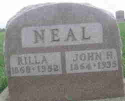
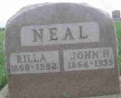
John Henry Neal
| Birth | : | 10 Jun 1864 Maryville, Nodaway County, Missouri, USA |
| Death | : | 7 Jun 1935 Maryville, Nodaway County, Missouri, USA |
| Burial | : | Fairview Cemetery, Digby, Digby County, Canada |
| Coordinate | : | 44.6243600, -65.7622600 |
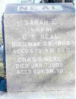
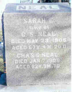
| Description | : | Son of Charles Smith Neal and Sarah Elizabeth Hawkins Neal. Missouri D/C #20552 Maryville Daily Forum, June 7, 1935 Dies of Injuries Inflicted by Bull John Henry Neal, a farmer living northeast of Maryville who was badly trampled by a bull the night of May 6, died at 2 o'clock this morning at the St. Francis hospital where he had been confined since the accident. The accident happened when Mr. Neal was attempting to lock an ill-tempered bull in a stall in the barn at his farm. The animal turned on him, knocked him down and trampled him, bruising him and rendering him unconscious.... Read More |
frequently asked questions (FAQ):
-
Where is John Henry Neal's memorial?
John Henry Neal's memorial is located at: Fairview Cemetery, Digby, Digby County, Canada.
-
When did John Henry Neal death?
John Henry Neal death on 7 Jun 1935 in Maryville, Nodaway County, Missouri, USA
-
Where are the coordinates of the John Henry Neal's memorial?
Latitude: 44.6243600
Longitude: -65.7622600
Family Members:
Parent
Spouse
Siblings
Children
Flowers:
Nearby Cemetories:
1. Fairview Cemetery
Digby, Digby County, Canada
Coordinate: 44.6243600, -65.7622600
2. St. Patrick's Cemetery
Digby, Digby County, Canada
Coordinate: 44.6251730, -65.7607530
3. Trinity Anglican Church Cemetery
Digby, Digby County, Canada
Coordinate: 44.6201283, -65.7576467
4. Woodlawn Baptist Cemetery
Digby, Digby County, Canada
Coordinate: 44.6133850, -65.7630060
5. Forest Hill Anglican Cemetery
Digby, Digby County, Canada
Coordinate: 44.6129190, -65.7641090
6. Roop's Point Cemetery
Lansdowne, Digby County, Canada
Coordinate: 44.5975700, -65.7466200
7. Thomas Cemetery
Smiths Cove, Digby County, Canada
Coordinate: 44.6128800, -65.7193800
8. Nichols Burial Ground
Lansdowne, Digby County, Canada
Coordinate: 44.5900700, -65.7483800
9. Hillgrove United Baptist Cemetery
Hillgrove, Digby County, Canada
Coordinate: 44.5871331, -65.7575940
10. Jordantown Burials
Jordantown, Digby County, Canada
Coordinate: 44.5883330, -65.7763890
11. Smith-Sulis Cemetery
Smiths Cove, Digby County, Canada
Coordinate: 44.6121000, -65.7071300
12. St. Thomas Cemetery
Smiths Cove, Halifax County, Canada
Coordinate: 44.6120400, -65.7028340
13. Saint Paul's Cemetery
Marshalltown, Digby County, Canada
Coordinate: 44.5830696, -65.7916837
14. Madonna Cemetery
Marshalltown, Digby County, Canada
Coordinate: 44.5816650, -65.8067322
15. Bayview United Church Cemetery
Bay View, Digby County, Canada
Coordinate: 44.6777700, -65.7737700
16. Union Cemetery of Culloden
Culloden, Digby County, Canada
Coordinate: 44.6550920, -65.8335330
17. Pinkney Family Cemetery
Deep Brook, Annapolis County, Canada
Coordinate: 44.6167300, -65.6775900
18. Broad Cove Cemetery
Culloden, Digby County, Canada
Coordinate: 44.6545600, -65.8373900
19. Moore-Spurr Cemetery
Deep Brook, Annapolis County, Canada
Coordinate: 44.6300500, -65.6718700
20. Port Wade Cemetery
Port Wade, Annapolis County, Canada
Coordinate: 44.6783410, -65.7087670
21. Victoria Beach Cemetery - Garden of Peace
Victoria Beach, Annapolis County, Canada
Coordinate: 44.6901770, -65.7545250
22. Mariner's Section Burial Ground
Port Wade, Annapolis County, Canada
Coordinate: 44.6794100, -65.7045100
23. Covert Cemetery
Port Wade, Annapolis County, Canada
Coordinate: 44.6805600, -65.7062600
24. Waldeck West Cemetery
Waldeck West, Annapolis County, Canada
Coordinate: 44.6121940, -65.6399440

