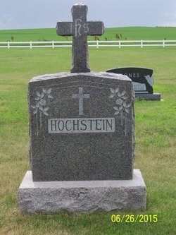
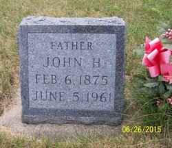
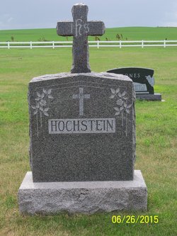
John Herman Hochstein
| Birth | : | 6 Feb 1875 Bow Valley, Cedar County, Nebraska, USA |
| Death | : | 5 Jun 1961 Wynot, Cedar County, Nebraska, USA |
| Burial | : | Green Mound Cemetery, New Madison, Darke County, USA |
| Coordinate | : | 39.9627991, -84.7052994 |
| Description | : | He married Rose Eleanore Schulte on May 28, 1901 in Bow Valley, Cedar, Nebraska. |
frequently asked questions (FAQ):
-
Where is John Herman Hochstein's memorial?
John Herman Hochstein's memorial is located at: Green Mound Cemetery, New Madison, Darke County, USA.
-
When did John Herman Hochstein death?
John Herman Hochstein death on 5 Jun 1961 in Wynot, Cedar County, Nebraska, USA
-
Where are the coordinates of the John Herman Hochstein's memorial?
Latitude: 39.9627991
Longitude: -84.7052994
Family Members:
Parent
Spouse
Siblings
Children
Flowers:
Nearby Cemetories:
1. Green Mound Cemetery
New Madison, Darke County, USA
Coordinate: 39.9627991, -84.7052994
2. First Universalist Church Cemetery
New Madison, Darke County, USA
Coordinate: 39.9667280, -84.7058340
3. Harter Cemetery
New Madison, Darke County, USA
Coordinate: 39.9747009, -84.6949997
4. Wilt Cemetery
Darke County, USA
Coordinate: 39.9486008, -84.6992035
5. Yankeetown Cemetery
Yankeetown, Darke County, USA
Coordinate: 39.9356003, -84.7230988
6. Otterbein Cemetery
Otterbein, Darke County, USA
Coordinate: 39.9453270, -84.6705110
7. Mills Cemetery
New Madison, Darke County, USA
Coordinate: 39.9947014, -84.6797028
8. Providence Cemetery
Darke County, USA
Coordinate: 39.9347750, -84.7575290
9. Spencer Cemetery
New Madison, Darke County, USA
Coordinate: 39.9939600, -84.7616140
10. Clark Station Cemetery
Clark, Darke County, USA
Coordinate: 40.0147250, -84.7209360
11. Downing Cemetery
New Madison, Darke County, USA
Coordinate: 39.9915330, -84.7639610
12. Friendship Cemetery
Hollansburg, Darke County, USA
Coordinate: 39.9466667, -84.7783356
13. Cedar Grove Cemetery
Hollansburg, Darke County, USA
Coordinate: 39.9538879, -84.7874985
14. Wayne Lakes Cemetery
Fort Jefferson, Darke County, USA
Coordinate: 40.0156040, -84.6580110
15. Miller Homestead Gardens Cemetery
Hollansburg, Darke County, USA
Coordinate: 39.9524600, -84.7883640
16. Beech Grove Cemetery
Hollansburg, Darke County, USA
Coordinate: 40.0157000, -84.7570700
17. Old Castine Cemetery
Castine, Darke County, USA
Coordinate: 39.9383011, -84.6250000
18. Castine Cemetery
Castine, Darke County, USA
Coordinate: 39.9306050, -84.6210650
19. Beech Grove Cemetery
Arcanum, Darke County, USA
Coordinate: 39.9907800, -84.6180000
20. Oak Grove Cemetery
Fort Jefferson, Darke County, USA
Coordinate: 40.0233002, -84.6528015
21. Pioneer Cemetery
Fort Jefferson, Darke County, USA
Coordinate: 40.0272700, -84.6569000
22. Hollansburg Cemetery
Hollansburg, Darke County, USA
Coordinate: 39.9998398, -84.7895432
23. Railroad Cemetery
Castine, Darke County, USA
Coordinate: 39.9183410, -84.6244710
24. Saint John's Cemetery
Palestine, Darke County, USA
Coordinate: 40.0350000, -84.7447000

