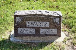
John Hill Swartz
| Birth | : | 30 Nov 1838 White Pigeon, St. Joseph County, Michigan, USA |
| Death | : | 1927 Osceola, Clarke County, Iowa, USA |
| Burial | : | Fairhall Cemetery, Blenheim, Marlborough District, New Zealand |
| Coordinate | : | -41.5294100, 173.8677800 |
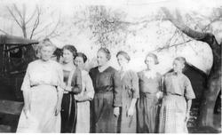
| Description | : | John was the oldest of nine children born to Solomon and Catherine (Hill) Swartz. His siblings were: Mary Anna, b. 2 April 1841 Benjamin Andrew, b. 28 Nov 1842 Catherine Jane, b. 7 Jan 1845 Solomon Henry, b. 27 June 1847 Leah Elizabeth, b. 24 July 1851 Samuel Edmund, b. 4 Sept 1853 Lydia Belle, b. 15 Nov. 1857 Sarah Ellen, b. 4 June 1860 John married Elizabeth Mary West on 25 Oct 1866 in Jefferson County, Iowa. They were the parents of nine children......all daughters!! Mary Elizabeth Swartz, b. ca 1868 Emma Swartz, b. ca 1869 Hettie Swartz, b. ca 1871 Mrs. Katherine Bell Swartz Inabnet, b. 1873 Ella... Read More |
frequently asked questions (FAQ):
-
Where is John Hill Swartz's memorial?
John Hill Swartz's memorial is located at: Fairhall Cemetery, Blenheim, Marlborough District, New Zealand.
-
When did John Hill Swartz death?
John Hill Swartz death on 1927 in Osceola, Clarke County, Iowa, USA
-
Where are the coordinates of the John Hill Swartz's memorial?
Latitude: -41.5294100
Longitude: 173.8677800
Family Members:
Parent
Spouse
Siblings
Children
Flowers:
Nearby Cemetories:
1. Fairhall Cemetery
Blenheim, Marlborough District, New Zealand
Coordinate: -41.5294100, 173.8677800
2. Pioneers Church Cemetery
Renwick, Marlborough District, New Zealand
Coordinate: -41.5091139, 173.8364765
3. Old Renwick Cemetery
Marlborough District, New Zealand
Coordinate: -41.5014030, 173.8909900
4. Upper Wairau Valley Cemetery
Blenheim, Marlborough District, New Zealand
Coordinate: -41.5171130, 173.7974110
5. Omaka Cemetery
Blenheim, Marlborough District, New Zealand
Coordinate: -41.5381800, 173.9401100
6. Rapaura Community Churchyard
Rapaura, Marlborough District, New Zealand
Coordinate: -41.4724800, 173.8995800
7. Rapaura Anglican Cemetery
Rapaura, Marlborough District, New Zealand
Coordinate: -41.4719700, 173.9014700
8. Kaituna Cemetery
Kaituna, Marlborough District, New Zealand
Coordinate: -41.4694650, 173.8036590
9. Maher Family Cemetery
Kaituna, Marlborough District, New Zealand
Coordinate: -41.4682494, 173.7958289
10. Ruakanakana Urupā
Kaituna, Marlborough District, New Zealand
Coordinate: -41.4463616, 173.8779400
11. Māori Island Urupā Otamawahu
Grovetown, Marlborough District, New Zealand
Coordinate: -41.4729310, 173.9778908
12. Wairau Affray Graves
Tuamarina, Marlborough District, New Zealand
Coordinate: -41.4285146, 173.9597007
13. Tuamarina Cemetery
Tuamarina, Marlborough District, New Zealand
Coordinate: -41.4280969, 173.9623665
14. Langley Dale Cemetery
Marlborough District, New Zealand
Coordinate: -41.5076952, 173.7025647
15. Wairau Bar Pilot House Graves
Spring Creek, Marlborough District, New Zealand
Coordinate: -41.4970923, 174.0582651
16. Te Pokohiwi Urupā
Marlborough District, New Zealand
Coordinate: -41.5068950, 174.0612846
17. Taylor Pass Cemetery
Seddon, Marlborough District, New Zealand
Coordinate: -41.6706624, 173.9871644
18. Bartlett's Creek Cemetery
Onamalutu, Marlborough District, New Zealand
Coordinate: -41.5136730, 173.5891660
19. Altimarlock Station
Altimarlock, Marlborough District, New Zealand
Coordinate: -41.7387595, 173.8579141
20. Seddon Cemetery
Seddon, Marlborough District, New Zealand
Coordinate: -41.6831810, 174.0582210
21. Robin Hood Bay Urupā
Marlborough District, New Zealand
Coordinate: -41.3541665, 174.0768701
22. Mahakipawa
Linkwater, Marlborough District, New Zealand
Coordinate: -41.2892290, 173.8474970
23. Wairau Valley Community Churchyard
Wairau Valley, Marlborough District, New Zealand
Coordinate: -41.5604349, 173.5424065
24. Lansdowne Cemetery
Hillersden, Marlborough District, New Zealand
Coordinate: -41.5709846, 173.5434728


