
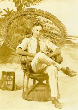
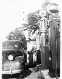
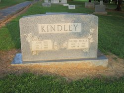
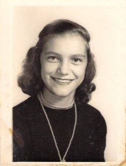
John Ray Kindley
| Birth | : | 3 Nov 1906 |
| Death | : | 1 Feb 1965 |
| Burial | : | Good Hope Cemetery, Pleasant Valley, Jo Daviess County, USA |
| Coordinate | : | 42.2087631, -90.0623093 |
frequently asked questions (FAQ):
-
Where is John Ray Kindley's memorial?
John Ray Kindley's memorial is located at: Good Hope Cemetery, Pleasant Valley, Jo Daviess County, USA.
-
When did John Ray Kindley death?
John Ray Kindley death on 1 Feb 1965 in
-
Where are the coordinates of the John Ray Kindley's memorial?
Latitude: 42.2087631
Longitude: -90.0623093
Family Members:
Parent
Spouse
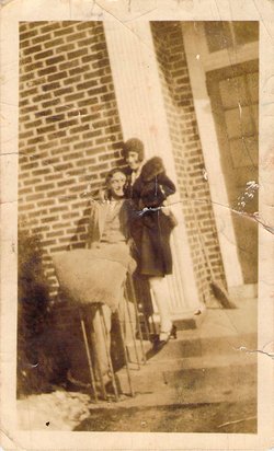
Siblings
Children

Flowers:


Nearby Cemetories:
1. Good Hope Cemetery
Pleasant Valley, Jo Daviess County, USA
Coordinate: 42.2087631, -90.0623093
2. Deeds Cemetery
Pleasant Valley, Jo Daviess County, USA
Coordinate: 42.2148819, -90.0296936
3. Zion Cemetery
Mount Carroll, Carroll County, USA
Coordinate: 42.1841698, -90.0847168
4. Massbach Cemetery
Massbach, Jo Daviess County, USA
Coordinate: 42.2303009, -90.1352997
5. Albrecht Cemetery
Massbach, Jo Daviess County, USA
Coordinate: 42.2228012, -90.1455994
6. Yankee Hollow Cemetery
Pleasant Valley, Jo Daviess County, USA
Coordinate: 42.2761800, -90.0329220
7. Saint Peters Lutheran Cemetery
Savanna, Carroll County, USA
Coordinate: 42.1758900, -90.1486210
8. Plum River Cemetery
Jo Daviess County, USA
Coordinate: 42.2806015, -90.0475006
9. Morrison Cemetery
Hanover, Jo Daviess County, USA
Coordinate: 42.2397003, -90.1596985
10. Union Cemetery
Pleasant Valley, Jo Daviess County, USA
Coordinate: 42.2183450, -89.9538060
11. Derinda Center-Trinity Lutheran Cemetery
Elizabeth, Jo Daviess County, USA
Coordinate: 42.2505989, -90.1748352
12. Flack-Bethel-Rush Creek Cemetery
Woodbine, Jo Daviess County, USA
Coordinate: 42.2934990, -90.1261230
13. Woodland Brethren Cemetery
Mount Carroll, Carroll County, USA
Coordinate: 42.1277809, -89.9877777
14. Old Barrett School Burial Site
Elizabeth, Jo Daviess County, USA
Coordinate: 42.2839720, -90.1758350
15. Clay Cemetery
Berreman Township, Jo Daviess County, USA
Coordinate: 42.2531013, -89.9216995
16. Renner Family Cemetery
Carroll County, USA
Coordinate: 42.1891708, -89.9102783
17. Morseville Cemetery
Morseville, Jo Daviess County, USA
Coordinate: 42.3055458, -89.9788742
18. Arnolds Grove Dunkard Cemetery
Mount Carroll, Carroll County, USA
Coordinate: 42.1338610, -89.9436900
19. Free Family Cemetery
Mount Carroll Township, Carroll County, USA
Coordinate: 42.0907590, -90.0767000
20. Arnolds Grove Cemetery
Carroll County, USA
Coordinate: 42.1283302, -89.9436111
21. Oak Hill Cemetery
Mount Carroll, Carroll County, USA
Coordinate: 42.1033287, -89.9861069
22. Loran Methodist Cemetery
Stephenson County, USA
Coordinate: 42.2402900, -89.9060900
23. Salem United Church of Christ Loran Cemetery
Loran, Stephenson County, USA
Coordinate: 42.2405900, -89.9051500
24. Center Hill Cemetery
Center Hill, Carroll County, USA
Coordinate: 42.0813904, -90.0425034