
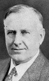

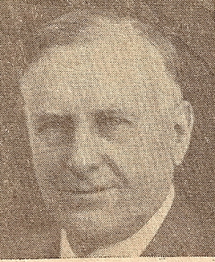
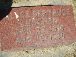
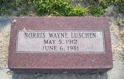
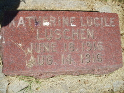
John Rudolph Luschen
| Birth | : | 8 Nov 1873 Colfax County, Nebraska, USA |
| Death | : | 25 Feb 1953 Columbus, Platte County, Nebraska, USA |
| Burial | : | Old Cemetery, Rochester, Strafford County, USA |
| Coordinate | : | 43.2997210, -70.9683750 |
| Description | : | (John Rudolph (Lutjeluschen) Luschen change the name when he started the grocery store. Father: Johann H. Lutjeluschen, Mother Anna Maria Borchers Lutjeluschen) From the web site: http://rootsweb.ancestry.com/~neplatte/vitals/vitals1953.html John R. Luschen, 79, prominent Columbus businessman, died at 10:45 p.m. Wednesday at his home. Mr. Luschen suffered a cerebral hemorrhage Sunday, and did not regain consciousness. Funeral services will be held at 2:30 p.m. Sunday at the Federated church, with the Rev. Franklin E. Wales, pastor, officiating. Burial will be made in the Columbus cemetery, with Masonic grave side services. The body will lie in... Read More |
frequently asked questions (FAQ):
-
Where is John Rudolph Luschen's memorial?
John Rudolph Luschen's memorial is located at: Old Cemetery, Rochester, Strafford County, USA.
-
When did John Rudolph Luschen death?
John Rudolph Luschen death on 25 Feb 1953 in Columbus, Platte County, Nebraska, USA
-
Where are the coordinates of the John Rudolph Luschen's memorial?
Latitude: 43.2997210
Longitude: -70.9683750
Family Members:
Parent

Spouse
Siblings
Children
Flowers:


Nearby Cemetories:
1. Rochester Cemetery
Rochester, Strafford County, USA
Coordinate: 43.3022003, -70.9630966
2. Saint Marys Cemetery
Rochester, Strafford County, USA
Coordinate: 43.2885160, -70.9666660
3. Holy Rosary Cemetery
Rochester, Strafford County, USA
Coordinate: 43.2933250, -70.9856770
4. Brewster Farm Cemetery
Rochester, Strafford County, USA
Coordinate: 43.2958330, -70.9908330
5. French-Hussey Family Burial Ground
Rochester, Strafford County, USA
Coordinate: 43.2979400, -70.9918980
6. Old Town Cemetery
Rochester, Strafford County, USA
Coordinate: 43.3095200, -70.9913500
7. Jenness cemetery
Rochester, Strafford County, USA
Coordinate: 43.2889088, -70.9450590
8. Gonic Village Cemetery
Gonic, Strafford County, USA
Coordinate: 43.2780420, -70.9797880
9. Haven Hill Cemetery
Rochester, Strafford County, USA
Coordinate: 43.2841988, -70.9385986
10. Clark Cemetery
Rochester, Strafford County, USA
Coordinate: 43.3009850, -71.0074390
11. Furber Cemetery
Rochester, Strafford County, USA
Coordinate: 43.3026000, -71.0077000
12. Wingate Homestead Burial Ground
Rochester, Strafford County, USA
Coordinate: 43.3027780, -70.9244440
13. McDuffee Family Cemetery
Rochester, Strafford County, USA
Coordinate: 43.3241670, -70.9994440
14. Ham-Clark Cemetery
Gonic, Strafford County, USA
Coordinate: 43.2721260, -70.9952230
15. Otis Family Cemetery
Gonic, Strafford County, USA
Coordinate: 43.2692012, -70.9901888
16. Foss Cemetery
Rochester, Strafford County, USA
Coordinate: 43.2844800, -71.0113800
17. Roberts Burying Ground
Rochester, Strafford County, USA
Coordinate: 43.2969440, -70.9205560
18. Hurd Cemetery
Gonic, Strafford County, USA
Coordinate: 43.2698590, -70.9938210
19. New Cold Spring Cemetery
East Rochester, Strafford County, USA
Coordinate: 43.3276520, -70.9355500
20. Ramsbottom Family Cemetery
Rochester, Strafford County, USA
Coordinate: 43.2669440, -70.9411110
21. Old Cold Spring Cemetery
East Rochester, Strafford County, USA
Coordinate: 43.3318430, -70.9342360
22. Garland Cemetery
Gonic, Strafford County, USA
Coordinate: 43.2599400, -70.9801000
23. Foss Family Cemetery
Rochester, Strafford County, USA
Coordinate: 43.2760360, -71.0156300
24. Rogers Page Cemetery
Rochester, Strafford County, USA
Coordinate: 43.3321800, -71.0067150