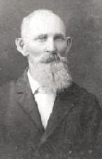
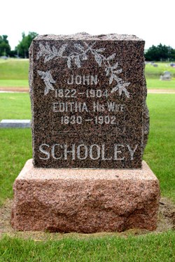
John Schooley
| Birth | : | 12 Oct 1821 Kent County, Delaware, USA |
| Death | : | 11 Feb 1904 Kingman County, Kansas, USA |
| Burial | : | Woolgoolga Monumental & Lawn Cemetery, Woolgoolga, Coffs Harbour City, Australia |
| Coordinate | : | -30.1006600, 153.1946500 |
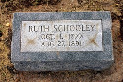
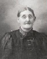
| Description | : | Son of James Schooley & Ruth Hobson Husband of Editha O'Neal John Schooley was born in Kent county, Delaware, October 12, 1821. After migrating to Indiana and Iowa he came to Kansas in 1879, settling on a farm in White township, Kingman Co. He was married in 1845 to Edith O'Neal, and to this union, nine children were born, one of whom, with his faithful wife, have preceeded him to a better land. At the age of 23 he became a member of the M. E. church, and so remained until his death, which occurred on the 11th of this month, at... Read More |
frequently asked questions (FAQ):
-
Where is John Schooley's memorial?
John Schooley's memorial is located at: Woolgoolga Monumental & Lawn Cemetery, Woolgoolga, Coffs Harbour City, Australia.
-
When did John Schooley death?
John Schooley death on 11 Feb 1904 in Kingman County, Kansas, USA
-
Where are the coordinates of the John Schooley's memorial?
Latitude: -30.1006600
Longitude: 153.1946500
Family Members:
Parent
Spouse
Children
Flowers:
Nearby Cemetories:
1. Woolgoolga Monumental & Lawn Cemetery
Woolgoolga, Coffs Harbour City, Australia
Coordinate: -30.1006600, 153.1946500
2. Corindi Cemetery
Corindi, Coffs Harbour City, Australia
Coordinate: -30.0299590, 153.1761930
3. Bucca Cemetery
Bucca, Coffs Harbour City, Australia
Coordinate: -30.1563310, 153.0905443
4. Glenreagh Cemetery
Glenreagh, Clarence Valley Council, Australia
Coordinate: -30.0686470, 152.9795610
5. Coramba Cemetery
Coramba, Coffs Harbour City, Australia
Coordinate: -30.2166670, 153.0166670
6. Coffs Harbour Lawn Cemetery
Karangi, Coffs Harbour City, Australia
Coordinate: -30.2547550, 153.0513360
7. Coffs Harbour Historic Cemetery
Coffs Harbour, Coffs Harbour City, Australia
Coordinate: -30.2984638, 153.1229401
8. Hogbin Drive Crematorium & Memorial Gardens
Coffs Harbour, Coffs Harbour City, Australia
Coordinate: -30.3238230, 153.0926100
9. Coutts Crossing Cemetery
Coutts Crossing, Clarence Valley Council, Australia
Coordinate: -29.8312440, 152.8871770
10. Clarence Lawn Cemetery
South Grafton, Clarence Valley Council, Australia
Coordinate: -29.7673420, 152.9293470
11. Bellingen General Cemetery
Bellingen, Bellingen Shire, Australia
Coordinate: -30.4393310, 152.9006330
12. Urunga Museum - Thrower Headstone
Urunga, Bellingen Shire, Australia
Coordinate: -30.4969460, 153.0219490
13. Nymboida Cemetery
Nymboida, Clarence Valley Council, Australia
Coordinate: -29.9700150, 152.7278440
14. Fernmount Cemetery
Fernmount, Bellingen Shire, Australia
Coordinate: -30.4729595, 152.9407959
15. Urunga Cemetery
Urunga, Bellingen Shire, Australia
Coordinate: -30.5107589, 153.0196292
16. St. Matthews Church Columbarium
South Grafton, Clarence Valley Council, Australia
Coordinate: -29.7181690, 152.9350340
17. South Grafton General Cemetery
South Grafton, Clarence Valley Council, Australia
Coordinate: -29.7169130, 152.9341400
18. Ulmarra General Cemetery
Ulmarra, Clarence Valley Council, Australia
Coordinate: -29.6521510, 153.0688990
19. Grafton General Cemetery
Grafton, Clarence Valley Council, Australia
Coordinate: -29.6774440, 152.9488920
20. Dorrigo General Cemetery
Dorrigo, Bellingen Shire, Australia
Coordinate: -30.3484990, 152.7178950
21. Nambucca Heads Cemetery
Nambucca Heads, Nambucca Shire, Australia
Coordinate: -30.6330660, 153.0111240
22. Mylneford-Eatonsville Cemetery
Eatonsville, Clarence Valley Council, Australia
Coordinate: -29.6330180, 152.8391270
23. Parkes Street Cemetery
Nambucca Heads, Nambucca Shire, Australia
Coordinate: -30.6451620, 153.0158080
24. Ramornie Cemetery
Ramornie Works, Clarence Valley Council, Australia
Coordinate: -29.6465110, 152.8021110

