
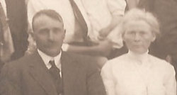

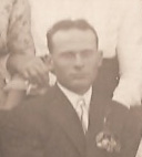
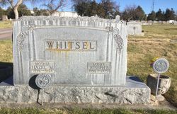
John William “Bill” Whitsel
| Birth | : | Jul 1868 Mahaska County, Iowa, USA |
| Death | : | 1941 Dawes County, Nebraska, USA |
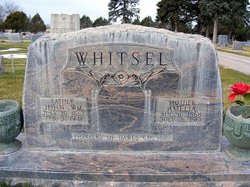
| Burial | : | Tabernacle United Methodist Church Cemetery, Robbins, Moore County, USA |
| Coordinate | : | 35.4306200, -79.5850470 |
frequently asked questions (FAQ):
-
Where is John William “Bill” Whitsel's memorial?
John William “Bill” Whitsel's memorial is located at: Tabernacle United Methodist Church Cemetery, Robbins, Moore County, USA.
-
When did John William “Bill” Whitsel death?
John William “Bill” Whitsel death on 1941 in Dawes County, Nebraska, USA
-
Where are the coordinates of the John William “Bill” Whitsel's memorial?
Latitude: 35.4306200
Longitude: -79.5850470
Family Members:
Parent

Spouse
Siblings
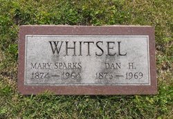
Children
Flowers:


Nearby Cemetories:
1. Tabernacle United Methodist Church Cemetery
Robbins, Moore County, USA
Coordinate: 35.4306200, -79.5850470
2. Pine Rest Cemetery
Robbins, Moore County, USA
Coordinate: 35.4356003, -79.5738983
3. George Davis Cemetery
Robbins, Moore County, USA
Coordinate: 35.4159672, -79.5941860
4. Matthew Williams Cemetery
Robbins, Moore County, USA
Coordinate: 35.4098309, -79.5773649
5. Crossroads Baptist Church Cemetery
Robbins, Moore County, USA
Coordinate: 35.4094700, -79.5763900
6. Emsley Wallace Home Cemetery
Robbins, Moore County, USA
Coordinate: 35.4109047, -79.5710886
7. Sowell Family Cemetery
Robbins, Moore County, USA
Coordinate: 35.4062360, -79.5947134
8. Bellview AME Zion Church Cemetery
Robbins, Moore County, USA
Coordinate: 35.4397130, -79.5546770
9. New Testament Baptist Church Cemetery
Robbins, Moore County, USA
Coordinate: 35.4564730, -79.5728570
10. Thomas J. Williams Cemetery
Robbins, Moore County, USA
Coordinate: 35.4233030, -79.5486440
11. Wallace Family Cemetery
Robbins, Moore County, USA
Coordinate: 35.4038400, -79.5637800
12. Pleasant View Friends Church Cemetery
Eagle Springs, Moore County, USA
Coordinate: 35.4003400, -79.6049900
13. Flint Hill Baptist Church Cemetery
Robbins, Moore County, USA
Coordinate: 35.4053500, -79.5564300
14. Acorn Ridge Baptist Church Cemetery
Robbins, Moore County, USA
Coordinate: 35.4623750, -79.6120810
15. Pleasant Hill Methodist Church
Robbins, Moore County, USA
Coordinate: 35.4655685, -79.5528336
16. Cockman Cemetery
Robbins, Moore County, USA
Coordinate: 35.4133060, -79.5326550
17. New Zion Hill Cemetery
Moore County, USA
Coordinate: 35.4743996, -79.6031036
18. Williams-Morgan Cemetery
Eagle Springs, Moore County, USA
Coordinate: 35.3872530, -79.6047342
19. Rock Hill Friends Meeting Cemetery
Eagle Springs, Moore County, USA
Coordinate: 35.3815650, -79.5936600
20. Sampson Delaney Wallace Gravesite
Robbins, Moore County, USA
Coordinate: 35.3908535, -79.5469594
21. Unity Grove Baptist Church Cemetery
Carthage, Moore County, USA
Coordinate: 35.3850610, -79.5550270
22. Browns Chapel Christian Church Cemetery
Robbins, Moore County, USA
Coordinate: 35.4284520, -79.6502140
23. Hardy Sanders Gravesite
Robbins, Moore County, USA
Coordinate: 35.4015758, -79.6445489
24. Melton-Muse Family Cemetery
Robbins, Moore County, USA
Coordinate: 35.3974497, -79.5280123