| Birth | : | 26 Mar 1874 Fayette County, Iowa, USA |
| Death | : | 14 Jun 1932 Jamestown, Stutsman County, North Dakota, USA |
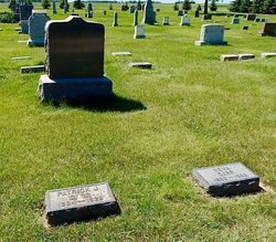
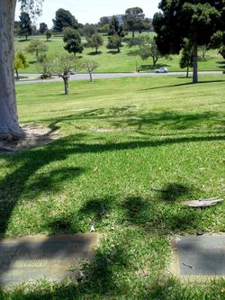
| Burial | : | Mount Vernon Cemetery, West Boylston, Worcester County, USA |
| Coordinate | : | 42.3634650, -71.7804030 |
| Plot | : | Division C - Section E - Block 13 |
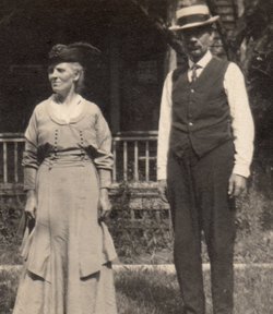
| Description | : | The Jamestown Sun Jamestown, North Dakota, Thursday, June 16, 1932 John W. Carr, Lieutenant Governor of North Dakota, Dies Tuesday After Long Illness; Funeral This Afternoon Gov. Shafer and State Officials Here For Rites John William Carr, one of James¬town's most prominent citizens and Lieutenant Governor of the state of North Dakota, succumbed Tuesday afternoon to a lingering illness, which has confined him to his home for the past year, and which refused to respond to medical science. While friends knew for several months that it was only a matter of time until Mr.... Read More |
frequently asked questions (FAQ):
-
Where is John William Carr's memorial?
John William Carr's memorial is located at: Mount Vernon Cemetery, West Boylston, Worcester County, USA.
-
When did John William Carr death?
John William Carr death on 14 Jun 1932 in Jamestown, Stutsman County, North Dakota, USA
-
Where are the coordinates of the John William Carr's memorial?
Latitude: 42.3634650
Longitude: -71.7804030
Family Members:
Parent
Spouse
Siblings
Children
Flowers:
Nearby Cemetories:
1. Mount Vernon Cemetery
West Boylston, Worcester County, USA
Coordinate: 42.3634650, -71.7804030
2. Beaman Cemetery
West Boylston, Worcester County, USA
Coordinate: 42.3649590, -71.7803600
3. Saint Lukes Cemetery
West Boylston, Worcester County, USA
Coordinate: 42.3833008, -71.7568970
4. Pine Grove Cemetery
Boylston, Worcester County, USA
Coordinate: 42.3582993, -71.7431030
5. High Plains Cemetery
West Boylston, Worcester County, USA
Coordinate: 42.3889008, -71.7972031
6. Old Burial Ground
Boylston, Worcester County, USA
Coordinate: 42.3515700, -71.7355300
7. Legg Cemetery
Sterling, Worcester County, USA
Coordinate: 42.4070020, -71.7986150
8. Cookshire Cemetery
Sterling, Worcester County, USA
Coordinate: 42.4108500, -71.7734800
9. Saint Francis Episcopal Church Memorial Garden
Holden, Worcester County, USA
Coordinate: 42.3522800, -71.8588700
10. Old Burying Ground
Holden, Worcester County, USA
Coordinate: 42.3505800, -71.8626000
11. Fairbank Burial Ground
Sterling, Worcester County, USA
Coordinate: 42.4152600, -71.7320000
12. Park Avenue Cemetery
Holden, Worcester County, USA
Coordinate: 42.3514200, -71.8656900
13. Grove Cemetery
Holden, Worcester County, USA
Coordinate: 42.3520400, -71.8672700
14. Saint Mary Cemetery
Holden, Worcester County, USA
Coordinate: 42.3522400, -71.8684200
15. Reservoir Pines Cemetery
Clinton, Worcester County, USA
Coordinate: 42.4084900, -71.7109700
16. Notre Dame du Lac Cemetery
Worcester, Worcester County, USA
Coordinate: 42.2910170, -71.7681030
17. Chocksett Burial Ground
Sterling, Worcester County, USA
Coordinate: 42.4377000, -71.7555400
18. West Main Street Cemetery
Shrewsbury, Worcester County, USA
Coordinate: 42.2912600, -71.7420000
19. Mountain View Cemetery
Shrewsbury, Worcester County, USA
Coordinate: 42.2999306, -71.7147598
20. Hillside Cemetery
Sterling, Worcester County, USA
Coordinate: 42.4410000, -71.7492570
21. Oak Hill Cemetery
Sterling, Worcester County, USA
Coordinate: 42.4417000, -71.7493973
22. Worcester Rural Cemetery
Worcester, Worcester County, USA
Coordinate: 42.2803001, -71.8035965
23. Woodlawn Cemetery
Clinton, Worcester County, USA
Coordinate: 42.4185982, -71.6889038
24. West Cemetery
Sterling, Worcester County, USA
Coordinate: 42.4514100, -71.7651400


