
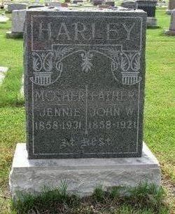
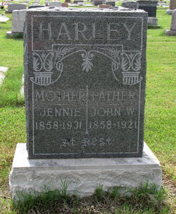
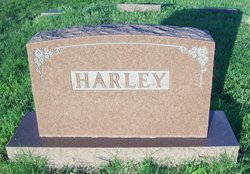
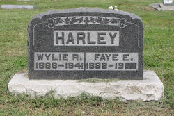
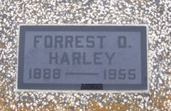
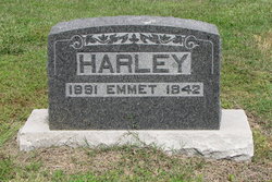
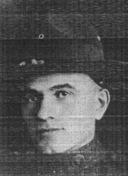
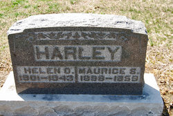
John William Harley
| Birth | : | 27 Oct 1858 Illinois, USA |
| Death | : | 27 Dec 1921 Kansas, USA |
| Burial | : | Canadee Cemetery, Broad Cove, Lunenburg County, Canada |
| Coordinate | : | 44.1941320, -64.4806380 |
| Plot | : | Section 7, Row 1, Lot 56 |
| Description | : | Wife of Sarah Jane (Gordon) Harley Son of George and Sarah Ellen (Crouch) Harley |
frequently asked questions (FAQ):
-
Where is John William Harley's memorial?
John William Harley's memorial is located at: Canadee Cemetery, Broad Cove, Lunenburg County, Canada.
-
When did John William Harley death?
John William Harley death on 27 Dec 1921 in Kansas, USA
-
Where are the coordinates of the John William Harley's memorial?
Latitude: 44.1941320
Longitude: -64.4806380
Family Members:
Parent
Spouse
Siblings
Children
Flowers:


Nearby Cemetories:
1. Canadee Cemetery
Broad Cove, Lunenburg County, Canada
Coordinate: 44.1941320, -64.4806380
2. First Settlers Cemetery
Broad Cove, Lunenburg County, Canada
Coordinate: 44.1827780, -64.4802780
3. Forest Hill Cemetery
Broad Cove, Lunenburg County, Canada
Coordinate: 44.1725000, -64.4963890
4. Hillside Cemetery
Broad Cove, Lunenburg County, Canada
Coordinate: 44.1722220, -64.4961110
5. Woodlawn Cemetery
Cherry Hill, Lunenburg County, Canada
Coordinate: 44.1691670, -64.4994440
6. Mayflower Hill Cemetery
Cherry Hill, Lunenburg County, Canada
Coordinate: 44.1688890, -64.5000000
7. Pine Grove Cemetery
Cherry Hill, Lunenburg County, Canada
Coordinate: 44.1680560, -64.5013890
8. Sipu'Ji'Jk / Petite Rivière Cemetery
Petite Rivière Bridge, Lunenburg County, Canada
Coordinate: 44.2259800, -64.4375600
9. Saint Michael's Cemetery
Petite Rivière Bridge, Lunenburg County, Canada
Coordinate: 44.2377780, -64.4655560
10. Old Burial Grounds
Petite Rivière Bridge, Lunenburg County, Canada
Coordinate: 44.2380560, -64.4594440
11. Wesley United Church Cemetery
Petite Rivière Bridge, Lunenburg County, Canada
Coordinate: 44.2383330, -64.4594440
12. Private Cemetery
Petite Rivière Bridge, Lunenburg County, Canada
Coordinate: 44.2346300, -64.4425300
13. Cherry Hill Old Community Cemetery
Cherry Hill, Lunenburg County, Canada
Coordinate: 44.1477356, -64.5022992
14. Anglican Church Cemetery
Crousetown, Lunenburg County, Canada
Coordinate: 44.2519444, -64.4758333
15. Crousetown Community Cemetery
Crousetown, Lunenburg County, Canada
Coordinate: 44.2575000, -64.4875000
16. Croft Dale Cemetery
Crescent Beach, Lunenburg County, Canada
Coordinate: 44.2453190, -64.4183110
17. Romkey Family Cemetery
Crescent Beach, Lunenburg County, Canada
Coordinate: 44.2413559, -64.4052429
18. Publicover Cemetery
Crescent Beach, Lunenburg County, Canada
Coordinate: 44.2433940, -64.4050830
19. Crouse Cemetery
Crousetown, Lunenburg County, Canada
Coordinate: 44.2672222, -64.4897222
20. Italy Cross United Church Cemetery
Italy Cross, Lunenburg County, Canada
Coordinate: 44.2583600, -64.5323810
21. St Mathias Anglican Cemetery
Italy Cross, Lunenburg County, Canada
Coordinate: 44.2594000, -64.5326600
22. Middlewood United Church Cemetery
Middlewood, Lunenburg County, Canada
Coordinate: 44.2251700, -64.5803800
23. Lakeside Cemetery
Mount Pleasant, Lunenburg County, Canada
Coordinate: 44.2663080, -64.4341060
24. Mount Pleasant United Church Cemetery
Mount Pleasant, Lunenburg County, Canada
Coordinate: 44.2734690, -64.4308070