
| Birth | : | 1869 Stokes County, North Carolina, USA |
| Death | : | 25 Sep 1936 Carthage, Moore County, North Carolina, USA |
| Burial | : | Stoney Creek Primitive Baptist Church Cemetery, Holly Springs, Surry County, USA |
| Coordinate | : | 36.4393654, -80.5477219 |
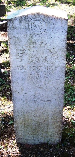
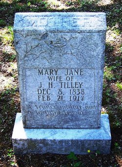
| Description | : | Son of John and Mary Jane Martin Tilley and husband of Nannie Tilley. He was a tenant farmer and was living in rural Carthage at the time of his death. |
frequently asked questions (FAQ):
-
Where is Joseph Alonza “Lonnie” Tilley's memorial?
Joseph Alonza “Lonnie” Tilley's memorial is located at: Stoney Creek Primitive Baptist Church Cemetery, Holly Springs, Surry County, USA.
-
When did Joseph Alonza “Lonnie” Tilley death?
Joseph Alonza “Lonnie” Tilley death on 25 Sep 1936 in Carthage, Moore County, North Carolina, USA
-
Where are the coordinates of the Joseph Alonza “Lonnie” Tilley's memorial?
Latitude: 36.4393654
Longitude: -80.5477219
Family Members:
Parent
Spouse

Siblings
Children
Flowers:


Nearby Cemetories:
1. Simmons Family Cemetery
Mount Airy, Surry County, USA
Coordinate: 36.4452800, -80.5423300
2. Cox Cemetery
Pilot Mountain, Surry County, USA
Coordinate: 36.4306230, -80.5447840
3. Peoples Church Cemetery
Holly Springs, Surry County, USA
Coordinate: 36.4501100, -80.5525000
4. John Anderson Taylor Memorial Cemetery
Pilot Mountain, Surry County, USA
Coordinate: 36.4421600, -80.5238300
5. McGee Cemetery
Mount Airy, Surry County, USA
Coordinate: 36.4550800, -80.5700400
6. Holly Springs Baptist Church Cemetery
Holly Springs, Surry County, USA
Coordinate: 36.4625816, -80.5570297
7. Simmons Grove Baptist Church Cemetery
Pilot Mountain, Surry County, USA
Coordinate: 36.4331180, -80.5175440
8. W.C. Hiatt Cemetery
Mount Airy, Surry County, USA
Coordinate: 36.4484329, -80.5796204
9. Worth Cemetery
Ararat, Surry County, USA
Coordinate: 36.4180130, -80.5205710
10. Watson Cemetery
Ararat, Surry County, USA
Coordinate: 36.4254140, -80.5822060
11. Anchor Baptist Church Cemetery
Ararat, Surry County, USA
Coordinate: 36.4055550, -80.5556050
12. Ararat Cemetery
Ararat, Surry County, USA
Coordinate: 36.4054130, -80.5561350
13. Bryant Chapel Baptist Church Cemetery
Ararat, Surry County, USA
Coordinate: 36.4106840, -80.5728080
14. New Hope Cemetery
Ararat, Surry County, USA
Coordinate: 36.4043890, -80.5428610
15. Lawson and Sawyers Family Cemetery
Ararat, Surry County, USA
Coordinate: 36.4144700, -80.5837500
16. Pine Ridge Presbyterian Church Cemetery
Pilot Mountain, Surry County, USA
Coordinate: 36.4537700, -80.5030000
17. Southside Baptist Church Cemetery
Boones Hill, Surry County, USA
Coordinate: 36.4725280, -80.5729720
18. Simmons Family Cemetery
Pilot Mountain, Surry County, USA
Coordinate: 36.4463110, -80.4982480
19. Charles Beck Family Cemetery
Ararat, Surry County, USA
Coordinate: 36.4147800, -80.5909700
20. Haymore Family Cemetery
Mount Airy, Surry County, USA
Coordinate: 36.4812486, -80.5608610
21. Sulphur Springs Baptist Church Cemetery
Pilot Mountain, Surry County, USA
Coordinate: 36.4074440, -80.5108871
22. Smith Family Cemetery
Mount Airy, Surry County, USA
Coordinate: 36.4773598, -80.5760269
23. Kirkman Family Cemetery
Sheltontown, Surry County, USA
Coordinate: 36.4851110, -80.5421120
24. Skyline Memory Gardens
Mount Airy, Surry County, USA
Coordinate: 36.4745610, -80.5856500