
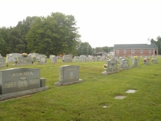
| Memorials | : | 193 |
| Location | : | Pilot Mountain, Surry County, USA |
| Coordinate | : | 36.4074440, -80.5108871 |
| Description | : | From the intersection of Sulphur Springs Church Road and Old US 52 South, travel 0.13 miles on Sulphur Springs Church Road; the church and cemetery will be on the right. |
frequently asked questions (FAQ):
-
Where is Sulphur Springs Baptist Church Cemetery?
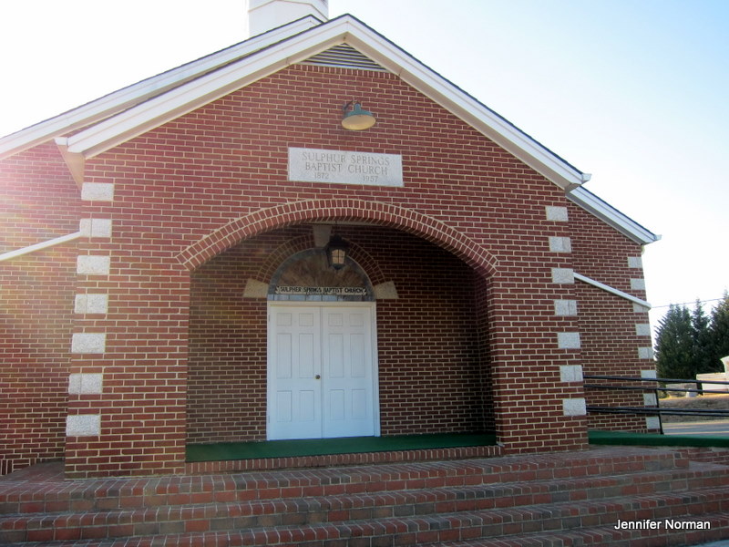
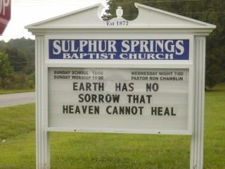
Sulphur Springs Baptist Church Cemetery is located at 164 Sulphur Springs Church Road Pilot Mountain, Surry County ,North Carolina , 27041USA.
-
Sulphur Springs Baptist Church Cemetery cemetery's updated grave count on graveviews.com?
193 memorials
-
Where are the coordinates of the Sulphur Springs Baptist Church Cemetery?
Latitude: 36.4074440
Longitude: -80.5108871
Nearby Cemetories:
1. John Wesley Hill Cemetery
Pilot Mountain, Surry County, USA
Coordinate: 36.4000282, -80.5012817
2. Beulahland Baptist Church Cemetery
Pilot Mountain, Surry County, USA
Coordinate: 36.4037330, -80.4954900
3. Worth Cemetery
Ararat, Surry County, USA
Coordinate: 36.4180130, -80.5205710
4. Bennett Cemetery
Pilot Mountain, Surry County, USA
Coordinate: 36.3988991, -80.4957962
5. Tucker-Stone Cemetery
Surry County, USA
Coordinate: 36.3990000, -80.4954167
6. Green Family Cemetery
Pilot Mountain, Surry County, USA
Coordinate: 36.3956630, -80.4833990
7. New Hope Cemetery
Ararat, Surry County, USA
Coordinate: 36.4043890, -80.5428610
8. Simmons Grove Baptist Church Cemetery
Pilot Mountain, Surry County, USA
Coordinate: 36.4331180, -80.5175440
9. Pilot Mountain City Cemetery
Pilot Mountain, Surry County, USA
Coordinate: 36.3918343, -80.4809418
10. Whitakers Chapel United Methodist Church Cemetery
Pilot Mountain, Surry County, USA
Coordinate: 36.3763008, -80.5105057
11. John Denny Cemetery
Pilot Mountain, Surry County, USA
Coordinate: 36.3755989, -80.4910965
12. Cox Cemetery
Pilot Mountain, Surry County, USA
Coordinate: 36.4306230, -80.5447840
13. Anchor Baptist Church Cemetery
Ararat, Surry County, USA
Coordinate: 36.4055550, -80.5556050
14. John Anderson Taylor Memorial Cemetery
Pilot Mountain, Surry County, USA
Coordinate: 36.4421600, -80.5238300
15. Ararat Cemetery
Ararat, Surry County, USA
Coordinate: 36.4054130, -80.5561350
16. Cox Cemetery
Pilot Mountain, Surry County, USA
Coordinate: 36.3743890, -80.5353890
17. Simmons Family Cemetery
Pilot Mountain, Surry County, USA
Coordinate: 36.4463110, -80.4982480
18. Jessup Grove Baptist Church Cemetery
Pilot Mountain, Surry County, USA
Coordinate: 36.4432780, -80.4865280
19. Lovells Chapel Church Cemetery
Pilot Mountain, Surry County, USA
Coordinate: 36.3879160, -80.4652290
20. Hills Presbyterian Church Cemetery
Hills Grove, Surry County, USA
Coordinate: 36.4234161, -80.4621658
21. Ararat-Cedar Hill Primitive Baptist Church
Cedar Hill, Surry County, USA
Coordinate: 36.3671265, -80.5306778
22. Stoney Creek Primitive Baptist Church Cemetery
Holly Springs, Surry County, USA
Coordinate: 36.4393654, -80.5477219
23. Rescue Baptist Church Cemetery
Pilot Mountain, Surry County, USA
Coordinate: 36.3898080, -80.4613240
24. Simmons Family Cemetery
Mount Airy, Surry County, USA
Coordinate: 36.4452800, -80.5423300