
| Memorials | : | 2 |
| Location | : | Ararat, Surry County, USA |
| Coordinate | : | 36.4055550, -80.5556050 |
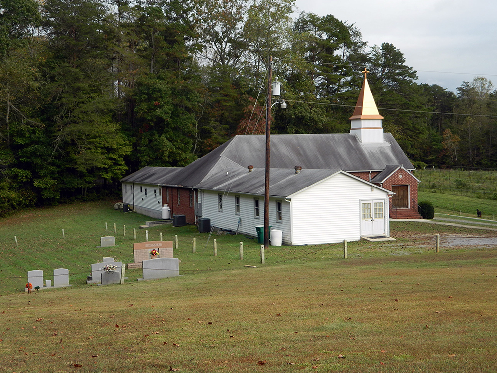
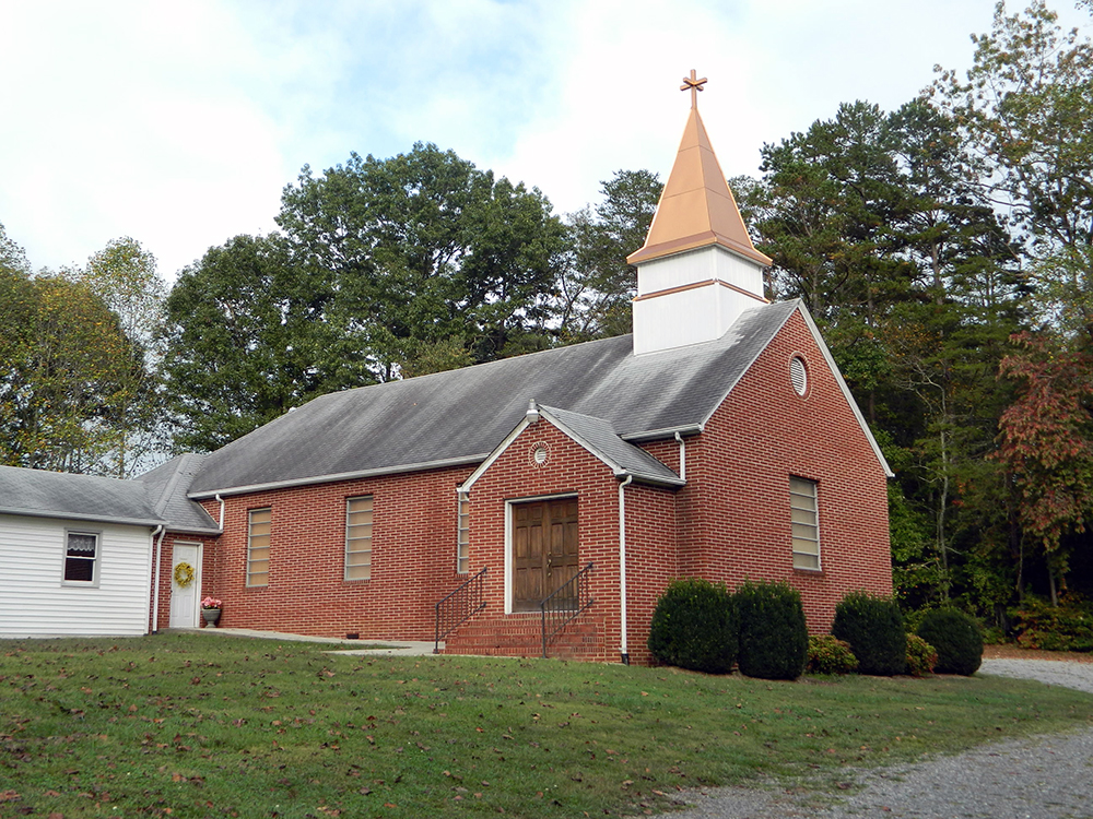
| Description | : | From the intersection of Ararat Road and Old US 52 South, travel approximately 2.38 miles on Ararat Road; the church will be on the right. The cemetery is located behind the church. |
frequently asked questions (FAQ):
-
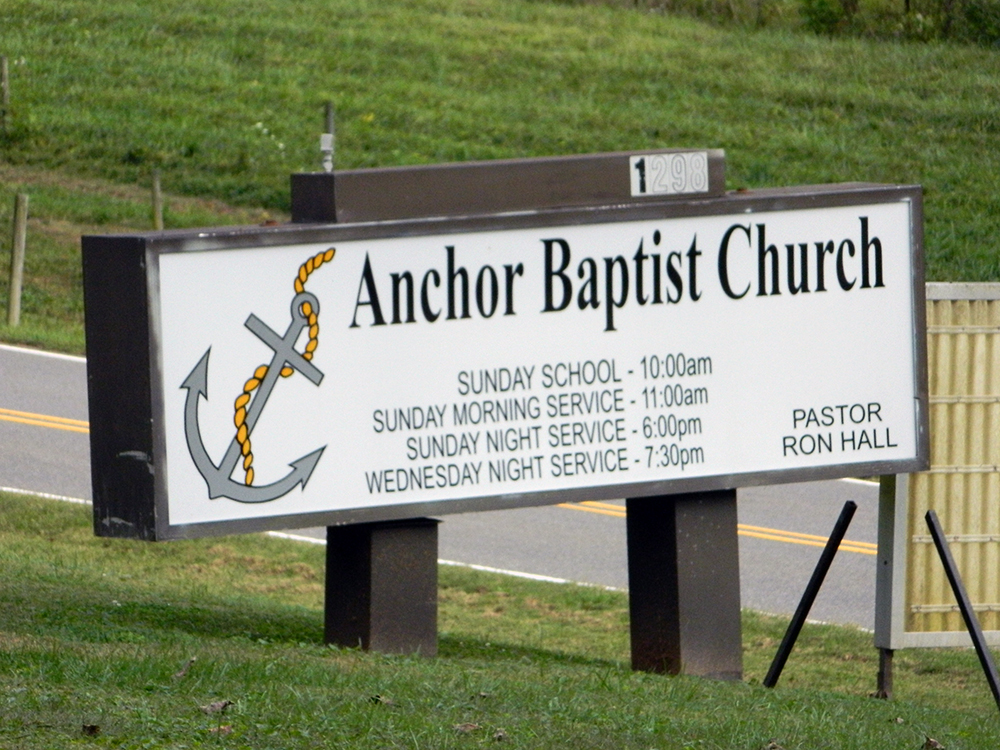
Where is Anchor Baptist Church Cemetery?
Anchor Baptist Church Cemetery is located at 1298 Ararat Road Ararat, Surry County ,North Carolina , 27041USA.
-
Anchor Baptist Church Cemetery cemetery's updated grave count on graveviews.com?
2 memorials
-
Where are the coordinates of the Anchor Baptist Church Cemetery?
Latitude: 36.4055550
Longitude: -80.5556050
Nearby Cemetories:
1. Ararat Cemetery
Ararat, Surry County, USA
Coordinate: 36.4054130, -80.5561350
2. New Hope Cemetery
Ararat, Surry County, USA
Coordinate: 36.4043890, -80.5428610
3. Bryant Chapel Baptist Church Cemetery
Ararat, Surry County, USA
Coordinate: 36.4106840, -80.5728080
4. Mount Zion Baptist Church Cemetery
Ash Hill, Surry County, USA
Coordinate: 36.3949432, -80.5725021
5. Lawson and Sawyers Family Cemetery
Ararat, Surry County, USA
Coordinate: 36.4144700, -80.5837500
6. Bryant-Simpson Cemetery
Eldora Township, Surry County, USA
Coordinate: 36.3991900, -80.5871100
7. Cox Cemetery
Pilot Mountain, Surry County, USA
Coordinate: 36.4306230, -80.5447840
8. Atkinson Family Cemetery
Mount Airy, Surry County, USA
Coordinate: 36.3796940, -80.5682370
9. Watson Cemetery
Ararat, Surry County, USA
Coordinate: 36.4254140, -80.5822060
10. Charles Beck Family Cemetery
Ararat, Surry County, USA
Coordinate: 36.4147800, -80.5909700
11. Johnson Family Cemetery
Ararat, Surry County, USA
Coordinate: 36.4050833, -80.5928333
12. Worth Cemetery
Ararat, Surry County, USA
Coordinate: 36.4180130, -80.5205710
13. Gibbons Family Cemetery
Ararat, Surry County, USA
Coordinate: 36.3747570, -80.5682480
14. Key Cemetery
Ararat, Surry County, USA
Coordinate: 36.3795770, -80.5825170
15. Stoney Creek Primitive Baptist Church Cemetery
Holly Springs, Surry County, USA
Coordinate: 36.4393654, -80.5477219
16. Cox Cemetery
Pilot Mountain, Surry County, USA
Coordinate: 36.3743890, -80.5353890
17. Sulphur Springs Baptist Church Cemetery
Pilot Mountain, Surry County, USA
Coordinate: 36.4074440, -80.5108871
18. Hyatt Family Cemetery
Siloam, Surry County, USA
Coordinate: 36.3644700, -80.5544300
19. Simmons Family Cemetery
Mount Airy, Surry County, USA
Coordinate: 36.4452800, -80.5423300
20. Simmons Grove Baptist Church Cemetery
Pilot Mountain, Surry County, USA
Coordinate: 36.4331180, -80.5175440
21. Ararat-Cedar Hill Primitive Baptist Church
Cedar Hill, Surry County, USA
Coordinate: 36.3671265, -80.5306778
22. Azariah Denny Family Cemetery
Pilot Mountain, Surry County, USA
Coordinate: 36.3647220, -80.5367780
23. John Wesley Hill Cemetery
Pilot Mountain, Surry County, USA
Coordinate: 36.4000282, -80.5012817
24. Peoples Church Cemetery
Holly Springs, Surry County, USA
Coordinate: 36.4501100, -80.5525000