| Birth | : | 24 Aug 1749 Hollis, Hillsborough County, New Hampshire, USA |
| Death | : | Sep 1823 New Hampshire, USA |
| Burial | : | Warren Village Cemetery, Warren, Grafton County, USA |
| Coordinate | : | 43.9326200, -71.8917600 |
| Inscription | : | Joseph Patch | First settler of Warren, | Died Sept. 1823. | Æ. 77 y'rs. |
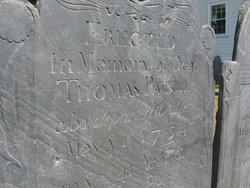
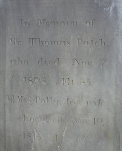
| Description | : | Joseph is the son of Thomas and Anna (Gilson) Patch of Hollis. He married in Warren, on April 19, 1777, Anne Merrill. Joseph, a hunter, built his camp by Hurricane brook, in 1767, and John Mills, James Aiken, Joshua Copp and Ephraim True, with their families, moved into town in 1768. These men, for the first few years, got their supplies from Haverhill and Plymouth, bringing them twenty miles home through the woods on their backs. Wild beasts annoyed them very much, and on winter nights wolves frequently put their noses against the window-pane of John Mills' cabin... Read More |
frequently asked questions (FAQ):
-
Where is Joseph Patch's memorial?
Joseph Patch's memorial is located at: Warren Village Cemetery, Warren, Grafton County, USA.
-
When did Joseph Patch death?
Joseph Patch death on Sep 1823 in New Hampshire, USA
-
Where are the coordinates of the Joseph Patch's memorial?
Latitude: 43.9326200
Longitude: -71.8917600
Family Members:
Parent
Spouse
Siblings
Children
Flowers:
Nearby Cemetories:
1. Warren Village Cemetery
Warren, Grafton County, USA
Coordinate: 43.9326200, -71.8917600
2. Pine Hill Cemetery
Warren, Grafton County, USA
Coordinate: 43.9370003, -71.8929977
3. Clough Cemetery
Warren, Grafton County, USA
Coordinate: 43.9090200, -71.8878800
4. East Side Cemetery
Wentworth, Grafton County, USA
Coordinate: 43.8837000, -71.9002200
5. High Street Cemetery
Glencliff, Grafton County, USA
Coordinate: 43.9851100, -71.8913900
6. East Piermont Cemetery
Piermont, Grafton County, USA
Coordinate: 43.9438890, -71.9689890
7. Foster Cemetery
Wentworth, Grafton County, USA
Coordinate: 43.8708100, -71.9127800
8. Wentworth Village Cemetery
Wentworth, Grafton County, USA
Coordinate: 43.8707280, -71.9128410
9. Oliverian Road Cemetery
Benton, Grafton County, USA
Coordinate: 43.9978145, -71.9209265
10. Lund Cemetery
Warren, Grafton County, USA
Coordinate: 43.9882800, -71.9589200
11. East Orford Cemetery
Orford, Grafton County, USA
Coordinate: 43.9096900, -72.0032600
12. Blake Cemetery
Stinson Lake, Grafton County, USA
Coordinate: 43.8827780, -71.7975000
13. Rodimon-Cross Cemetery
Piermont, Grafton County, USA
Coordinate: 43.9901100, -71.9924500
14. Clay Hollow Cemetery
Piermont, Grafton County, USA
Coordinate: 43.9597220, -72.0333330
15. Number 6 Cemetery
East Haverhill, Grafton County, USA
Coordinate: 44.0326400, -71.9518600
16. Pleasant View Cemetery
Rumney, Grafton County, USA
Coordinate: 43.8194008, -71.8814011
17. Avery Cemetery
Ellsworth, Grafton County, USA
Coordinate: 43.8805600, -71.7511200
18. East Haverhill Cemetery
East Haverhill, Grafton County, USA
Coordinate: 44.0289688, -71.9889297
19. Old Baptist Church Cemetery
Ellsworth, Grafton County, USA
Coordinate: 43.8738890, -71.7430560
20. Pease Cemetery
Ellsworth, Grafton County, USA
Coordinate: 43.8741100, -71.7382000
21. Cheever Cemetery
Dorchester, Grafton County, USA
Coordinate: 43.8015200, -71.9238400
22. South Lawn Cemetery
Piermont, Grafton County, USA
Coordinate: 43.9667600, -72.0812500
23. North Dorchester Cemetery
Dorchester, Grafton County, USA
Coordinate: 43.8033330, -71.9730560
24. Cedar Grove Cemetery
Piermont, Grafton County, USA
Coordinate: 43.9720300, -72.0813400


